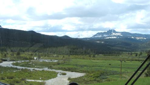
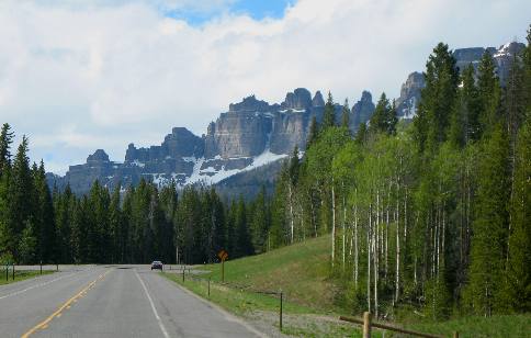
Wind River Range West of Dubois on US-26Wind River as we get close to the Continental Divide
We are near the headwaters of the Wind River as we continue to climb to the continental divide on US-26 between Dubois and Moran Junction, Wyoming As you can see the Wind River is rather small at this elevation and it will get even smaller as we climb to Togwotee Pass. We have been following the Wind River since we left Dubois heading over Togwotee Pass into Moran Junction in Grand Teton National Park. I think we are starting our climb to Togwotee Pass in the Wind River Range but somewhere on the way to Togwotee Pass we transition to the southern Absaroka Mountains that continue northward into Montana. I think that the mountain in the distance is part of the Absaroka Mountains while the Wind River is flowing in the Wind River Range.
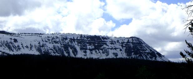
Snow in the Wind River Range west of Dubois, Wyoming on US-26
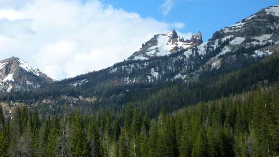
The Wind River Range is a remote hundred-mile range, stretching through Wyoming along the crest of the Continental Divide. This narrow mountain chain includes eight craggy summits over 13,500 feet, rising from the wide open valleys of the west. Three thousand feet below these rugged peaks are small lakes and streams nestling in boulder-strewn alpine meadows. There are large glaciers on some eastern slopes, including the largest glaciers of the US Rocky Mountains on the flanks of Gannett Peak (13,804 ft.). Gannett is the highest and northernmost peak of the range. That is by no means Gannett Peak in this picture. I think some westerners would refer to this as a snow covered mesa.
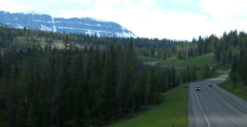
Nearing Continental Divide at Togwotee Pass on US-26 west of Dubois, Wyoming
We are still below the snow line in this picture as we continue our climb on US-26 to the continental divide at Togwotee Pass in the Wind River Range between Dubois and Moran Junction, Wyoming. Since we are still following the Wind River I am assuming the mountains to our south are still the Wind River Range.
Wind River as we get close to the Continental Divide
The Wind River is little more than a large creek at this altitude. We are not far from the headwaters of the Wind River which is near the Continental Divide at Togwotee Pass on US-26 between Dubois, Wyoming and Moran Junction.
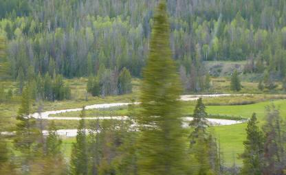
The Wind River is the name applied to the upper reaches of the Bighorn River. The Wind River is 185 miles long. The two rivers (Wind River/Bighorn River) are sometimes referred to as the Wind/Bighorn. The Wind River arises in several forks along the north side of the Wind River Range west of Dubois, Wyoming. It flows southeastward, across the Shoshone Basin and the Wind River Indian Reservation and joins the Little Wind River near Riverton. From there it flows northward, through a gap in the Owl Creek Mountains, where the name of the river becomes the Bighorn River. It is dammed on the south side of the Owl Creek Mountains, forming Boysen Reservoir. The Wind River officially becomes the Bighorn River at the Wedding of the Waters, on the north side of the Wind River Canyon. Almost at the snow line on US-26 between Dubois and Moran Junction with Absaroka Mountains in view
We are certainly climbing in elevation. Snow is visible just above our current elevation. The scenery is so wonderful here in the Southern Absaroka Mountains. US-26 is going to take us up and over Togwotee Pass in a few minutes. From where we are now the Wind River Range would be to the left in this picture while we are looking at one of the peaks in the Absaroka Mountains that stretch north through Yellowstone National Park and into Montana. Snow on the higher peaks of the Wind River Range
We are arriving at the snowline near the northern terminus of the Wind River Range and southern end of the Absaroka Mountains between Dubois and Moran Junction. Click here for more Wyoming travellogsUntil next time remember how good life is. More Wyoming AdventuresSome Utah Adventures ** More 2011 Travel Adventures
Mike & Joyce Hendrix
Mike & Joyce Hendrix who we are We hope you liked this page. If you do you might be interested in some of our other Travel Adventures: Mike & Joyce Hendrix's home page Travel Adventures by Year ** Travel Adventures by State ** Plants ** Marine-Boats ** Geology ** Exciting Drives ** Cute Signs ** RV Subjects ** Miscellaneous Subjects
We would love to hear from you......just put "info" in the place of "FAKE" in this address: FAKE@travellogs.us Until next time remember how good life is.
|
| ||
|
| |||
|
| |||
|
|