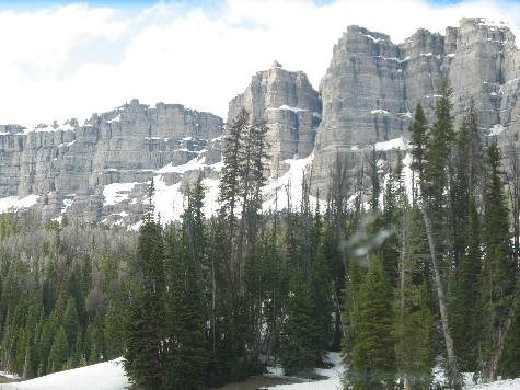
Southern Absaroka MountainsMagnificent exposure of sedimentary rock along US-26 near Togwotee Pass in the Southern Absaroka Mountains of Wyoming
The Absaroka Mountain Range stretches about 150-miles in a north-south direction from Wyoming into Montana, forming the eastern boundary of Yellowstone National Park. The range borders the Beartooth Mountains to the north and the Wind River Range to the south. This picture was taken near the southern end of the Absaroka Mountain Range along the Continental Divide at Togwotee Pass. Only a few miles southeast of here the Wind River Range continues south to South Pass where I-80 crosses the Continental Divide. South Pass is also where Pioneers on the Oregon, Mormon, California and Emigrant Trails used to cross the Continental Divide on their way west.
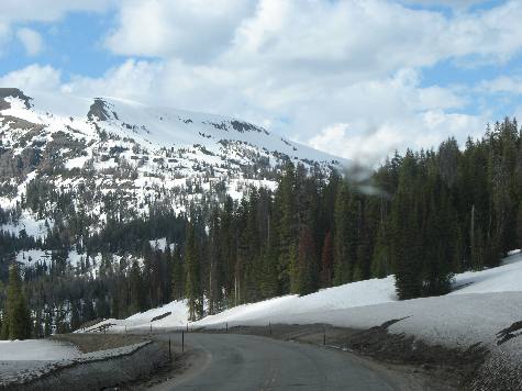
Togwotee Pass on US-26 between Dubois & Moran Junction, Wyoming in the Absaroka Mountains
It is extremely beautiful in the southern Absaroka Mountains along US-26 between Dubois and Moran Junction in Grand Teton National Park.
Togwotee Pass on US-26 between Dubois & Moran Junction, Wyoming in the Absaroka Mountains
Simply breathtaking is the scenery here along US-26 in the southern Absaroka Mountain Range of Wyoming. We are traversing Togwotee Pass between Dubois, Wyoming and Moran Junction, in Grand Teton National Park. Togwotee Pass on US-26 between Dubois & Moran Junction, Wyoming in the Absaroka Mountains
Spectacular views await around every bend in the highway. That is part of the Absaroka Mountain Range you see in this picture taken from US-26 between Dubois, Wyoming and Moran Junction in Grand Teton National Park.
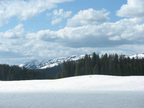
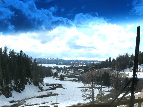
Gros Ventre Mountains on the horizon as seen from US-26 near Togwotee Pass in the Absaroka Mountains
Only occasionally do we get a glimpse of the Gros Ventre Mountains from US-26 as we traverse Togwotee Pass in the Absaroka Mountains of Wyoming. The Gros Ventre Mountains drain the Gros Ventre River that flows into the Snake River near Jackson, Wyoming in Grand Teton National Park.
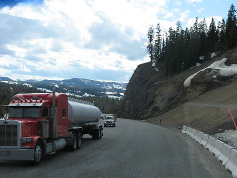
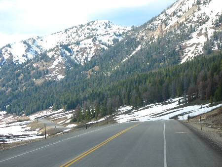
Absaroka Mountains on US-26 from the west side of Togwotee Pass
The Absaroka Range is drained by the Yellowstone River and Bighorn River, both of which flow into the Missouri River and eventually the Mississippi River which empties into the Gulf of Mexico in Louisiana.
If you are still trying to place the Absaroka Mountain Range look at a map. US 14/16/20 follows the Shoshone River from Cody, Wyoming west through the Absaroka Range to the eastern gate of Yellowstone National Park. The Absaroka Range is trending northsouth along the eastern border of Yellowstone National Park. Now look for the Northeast entrance to Yellowstone National Park. Follow US-212 from the northeast east entrance to Yellowstone you will wind your way across the Absaroka Range to Beartooth Pass at 10,947 ft in the neighboring Beartooth Mountains before winding down to Billings, Montana. The Absaroka Range transition into the Beartooth Mountains between the northeast entrance to Yellowstone National Park and Beartooth Pass. There are no signs telling you where this transition occurs. I suppose it is like the confluence of several rivers. It just happens in this area. VBG The above picture was taken at the southern end of the Absaroka Range between Dubois, Wyoming and Moran Junction in Grand Teton National Park. The "official" transition from the Absaroka Range to the Wind River Range takes place at Union Pass which is located a bit south of US-26. Click here for more Wyoming travellogsUntil next time remember how good life is. More Wyoming AdventuresSome Utah Adventures ** More 2011 Travel Adventures
Mike & Joyce Hendrix
Mike & Joyce Hendrix who we are We hope you liked this page. If you do you might be interested in some of our other Travel Adventures: Mike & Joyce Hendrix's home page Travel Adventures by Year ** Travel Adventures by State ** Plants ** Marine-Boats ** Geology ** Exciting Drives ** Cute Signs ** RV Subjects ** Miscellaneous Subjects
We would love to hear from you......just put "info" in the place of "FAKE" in this address: FAKE@travellogs.us Until next time remember how good life is.
|
| ||
|
| |||
|
| |||
|
|