Moab, Utah Scenic DriveThis travel adventure envolves a Scenic Drive east on River Road (SR-128) that runs east following the Colorado River. Then a drive west from Moab on Potash Road (SR-279) along the northern side of the Colorado River to the Potash plant 15-miles west of Moab May 22 & 23, 2007. We were in OK RV-Park & Canyonlands Stables 3310 Spanish Valley Drive 435-259-1400 on May 22. Then we moved the motorhome to Monument RV-Park in Fruita, Colorado on May 23. Since we are in Moab we need to know a little about it. Moab was first settled in 1855 by the Elk Mountain Mission of the Mormon Church. Less than 5-months later, three members of the party were killed by Indians and the settlers fled, abandoning their holdings. The next permanent settlers came in 1878. A Post office was established in 1879, and Moab was given its name, probably from a Biblical source. Finally in 1890 Grand County was created with Moab as the county seat. Cattle and sheep grazing were the main economic activities until the 1940's. Then, occasional mining turned to a boom as Moab became capital of the the western Uranium mining boom which lasted into the 1960's with a revival in the 1970's. Since the 1980's recreational pursuits have come to dominate Moab's economy. Long connected with Colorado River travel and freighting, this historic crossing has become the "Gateway" to some of Utah's most unique scenery with river activities on the Colorado River (rafting, kayaking and sightseeing), mountain biking, jeep and off road vehicle excursions into Canyon Country along with visiting Canyonlands & Arches National Parks attracting tourist to this region. After the obligatory drive through Arches National Park we headed off for scenic drives along SR-128 and Potash Road.
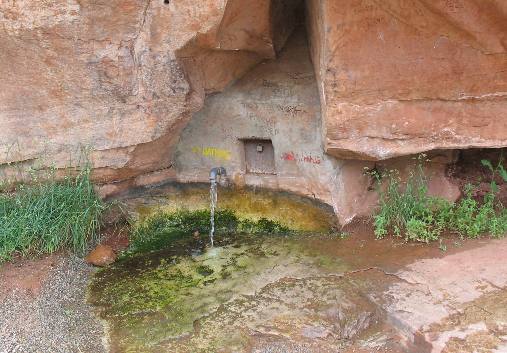
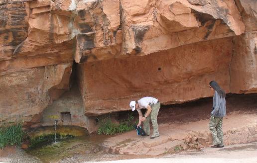
Matrimony Spring Moab, Utah
We always like to stop by this spring when in Moab. It is located on SR-128 about 200-yards east of the junction with US-191. Long ago someone put a pipe into a natural spring and poured cement around the exposed rock. Now it is a watering hole for a wide variety of people. Moab residents even stop by here to get their drinking water. If you are looking for this natural spring that has been modified to accommodate modern needs you can locate it in a pullout on the north side of SR-128.
Matrimony Spring Moab, Utah
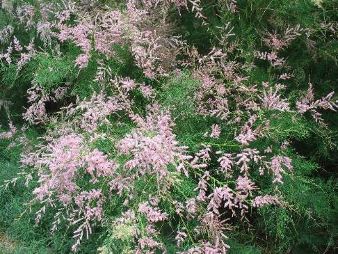
Tamarisk
Tamarisk is that evasive, yet beautiful tree, imported years ago to help control erosion along western rivers. It got out of hand and has now become a major problem. It is still a pretty plant when in bloom.
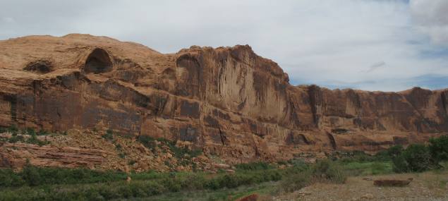
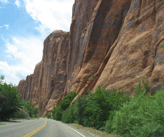
Bluff cut by Colorado River
Steep canyon walls cut by the Colorado River dominate both sides of the river and SR-128 on this drive. Note the desert varnish, (dark colored stain on sandstone wall).
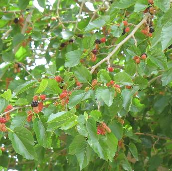
Mulberry tree
This is a mulberry tree we spotted in one of the parks along the Colorado River. I scooped up some berries and will try to grow a mulberry tree in my back yard back in Pensacola.
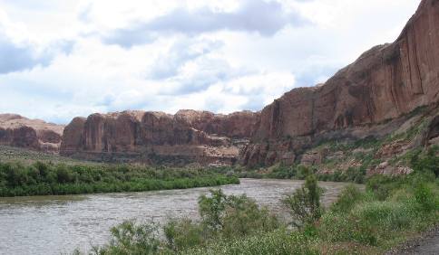
Sandstone bluffs created by the Colorado River east of Moab, Utah
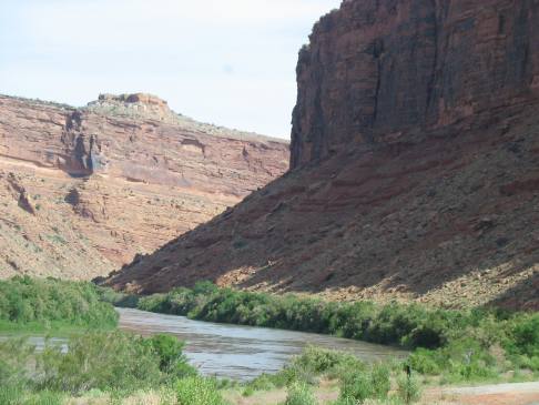
This is a good view of the Colorado River along with the picturesque sandstone cliffs that have resulted from the River relentlessly eroding downward through the rock layers.
Sandstone cliff along the Colorado River east of Moab, Utah
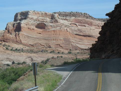
Fin, hoodoo, desert varnish and talus slope all showcased in this sandstone exposure
Occasionally we will spot a thin "fin" such as this usually when the River is making a sharp turn. Note the large amountg of talus at the bottom if this fin.
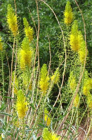
Along SR-128 we spotted this yellow flower that was lighting up the roadside. Does anyone know what it is?
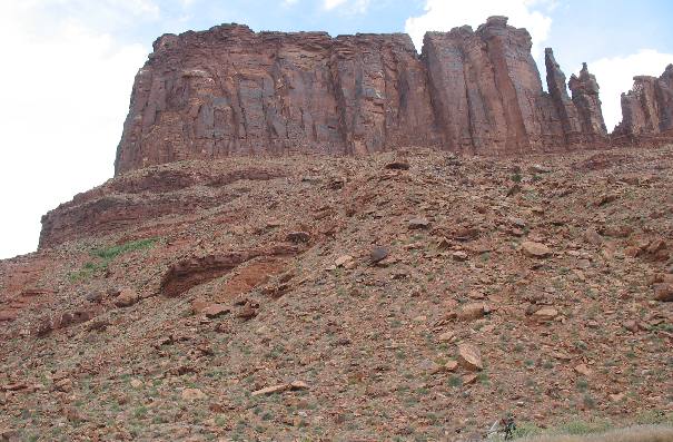
Talus slope with desert varnish on sandstone cliff face
This is a good example of a talus slope - rock debris at the bottom of a cliff.
Desert Varnish & talus slope highlight this Sandstone bluff carved by the Colorado River east of Moab, Utah
Around every bend in the Colorado River along SR-128 east of Moab scenes such as this rock cliff pop into view.
The dark stain on the sandstone cliff wall is desert varnish.
Conglomerate exposed in roadcut
Somewhere along the way sandstone gave way to this conglomerate rock formation. It was so exciting for me to spot this old river bed running through this universe of sandstone. I am getting better at this geology stuff. VBG
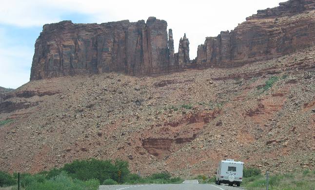
La Sal Mountains in western Colorado
This picture is of the La Sal Mountains that rise to the east of Moab. We are on Potash Road which follows the river west of Moab. If you are visiting Moab one of the things you will have to do is take a 15-mile or so drive west on Potash Road. If you have a jeep or off road vehicle you can continue much further than 15-miles but we stopped after the road became gravel and too rough to comfortably travel on in our Saturn. Potash Road is a Scenic Drive complete with petroglyphs Potash road intersects with US-191 near the entrance to Arches National Park in case you are wondering how to locate it.
Sandstone cliff with Desert Varnish
This is the rock cliff along Potash Road that petroglyphs are drawn in. There are signs along the route that alert you to the petroglyphs Notice the desert varnish on the sandstone cliff wall.
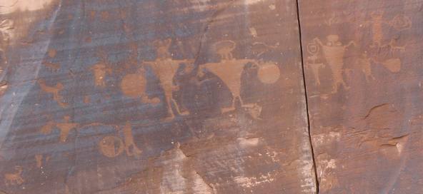
Petroglyphs on sandstone wall (potash road Moab, Utah)
This is an example of some of those petroglyphs We are not into petroglyphs or I would spend more time locating and examining them.
The next day found us heading east on SR-128 again only this time we are in our motorhome and we are heading to Fruita, Colorado (Grand Junction) and the Colorado National Monument.
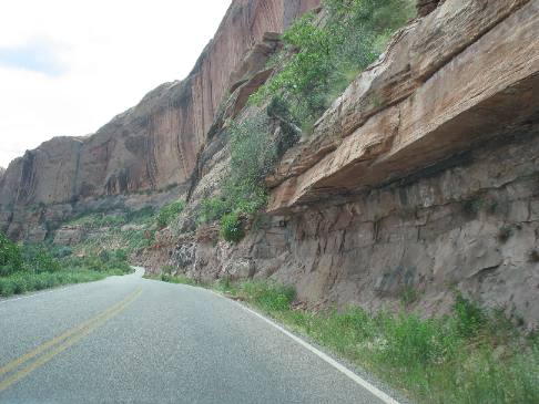
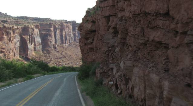
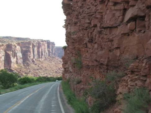
Canyon carved by the Colorado River east of Moab, Utah
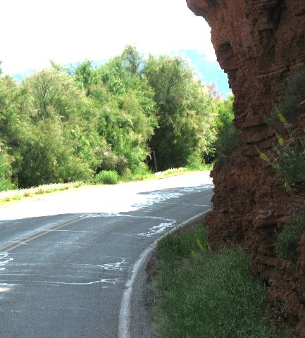
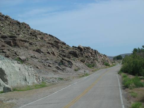
The SR-128 scenic drive east along the Colorado River is exciting in the Saturn but the excitement factor increases when negotiating the myriad curves and roadcuts in our motorhome. This is one of the roadcuts that left me thinking "it would have been nice if engineers had cut a little more rock out of that curve". Amen!
Canyon carved by the Colorado River east of Moab, Utah
This is another place where I think it would have been appropriate to remove more of the rock from that road cut. Thankfully, there wasn't much oncoming traffic and I could cheat on the yellow line.
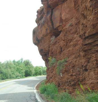
Roadcut along Colorado River east of Moab, Utah
Yes, I cheated on this corner. I really think I would have clipped the rock if I had stayed in my lane.
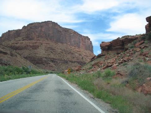
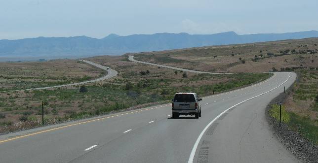
Scenic Route Utah, SR-128 along the Colorado River east of Moab, Utah
This view is pretty typical along SR-128. I suppose that is why it is a designated Scenic Route.
Desert Varnish and Talus slope
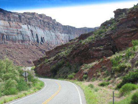
Scenic Route Utah, SR-128 along the Colorado River east of Moab, Utah
More talus slopes and weaving road as we follow the Colorado River. Notice the desert varnish on the cliff face.
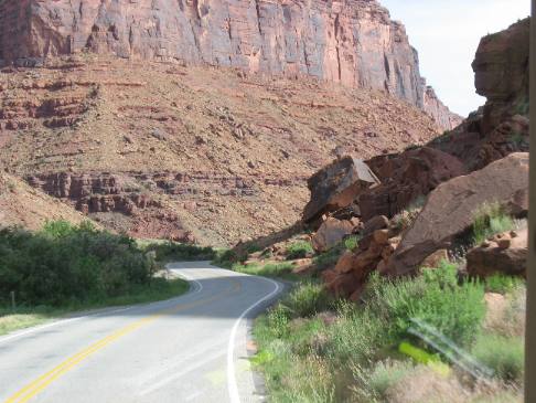
Roadcut east of Moab, Utah
Can you hear Joyce? She is telling me that we are going to hit that rock roadcut. We didn't hit it but it must have been close. When rock is that close to the edge of the road it will make you cheat on the yellow line. VBG
Talus slope
This picture captured the Colorado River in addition to the cliffs and talus slopes.
Layers of sedimentary rock exposed
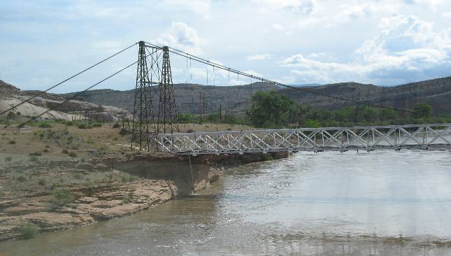
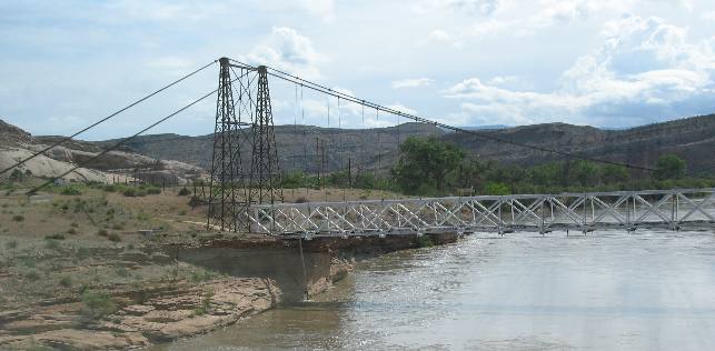
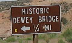
Historic Dewey Bridge over the Colorado River
Historic Dewey Bridge over the Colorado River
Historic Dewey Bridge
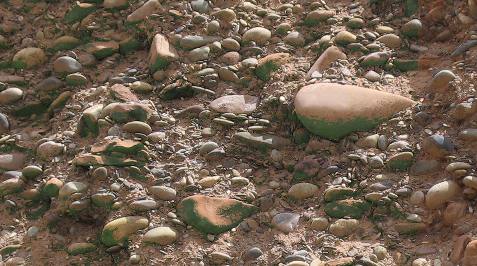
Volcanic Ash
Once we cross over to the north side of the Colorado River we start to climb out of that canyon we had been in since Moab. As you can see the bright red cliffs have given away to younger formations that are more grey in color.
Volcanic Ash
As we start our climb away from the river we came upon this area of volcanic ash. I suppose it is part of the 150-million year old Morrison Formation where of volcanic ash was deposited in the large alkaline lake that covered this area. That would make sense since we are gaining elevation and would naturally be in much younger rock formations than we were seeing downstream.
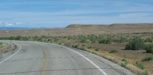
We are miles away from the river now and have climbed up on a high plateau. The topography has certainly changed.
We finally intersected with I-70 at mile marker 212. Joyce snapped this picture as we were headed east toward Colorado and the towns of Fruita and Grand Junction.
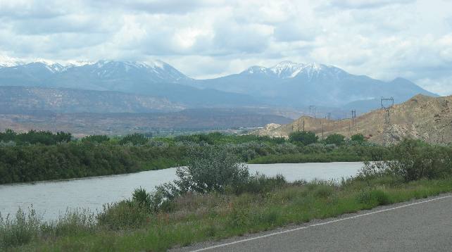
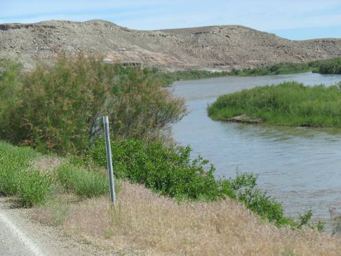
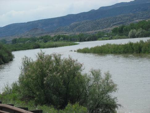
Colorado River in Fruita, Colorado
This is the Colorado River in the Fruita, Colorado area.
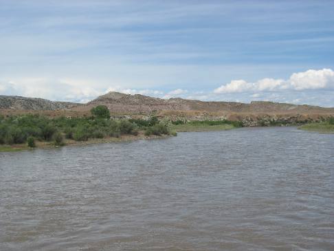
Colorado River in Fruita, Colorado
This is another view of the Colorado River in Fruita, Colorado only this time the view is to the west and Utah.
These are some of our other Travel Logs in this area: The John Wesley Powell Museum in Green River, Utah Arches National Monument in Moab, Utah Driving US-191 from Blanding to Moab, Utah
Until next time remember how good life is. Mike & Joyce Hendrix
|
|
||

|
|||
|
|
|||