Kayenta Formation, Wingate Sandstone, Caprock, fault lineColorado National MonumentMay 22, 2007. There are several campgrounds available in the Fruita / Grand Junction area. We chose Monument RV-Park just because we needed to easily & quickly get into the campground and head out to experience Colorado National Monument. Monument RV-Park is a good clean park but at at $35 price tag. They do have location ---- like, within a mile of the western entrance to Colorado National Monument. The Colorado River State Park is located directly across the street from Monument RV-Park. I think we would probably stay in the State Park on a return trip if for no other reason than cost.
Colorado National Monument
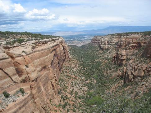
We arrived in Fruita today expressly to tour Colorado National Monument. The Colorado National Monument isn't one of the "top-10" destinations for tourist but it is one of the most spectacular drives you can take. The views and geology exposed in the monument are some of the best available.
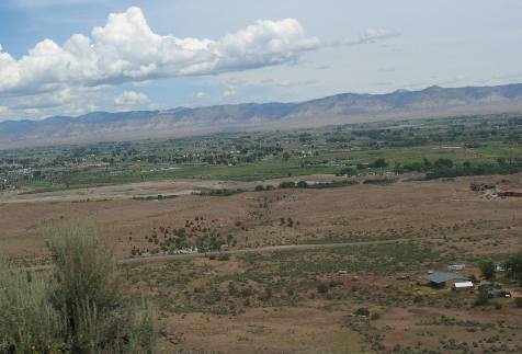
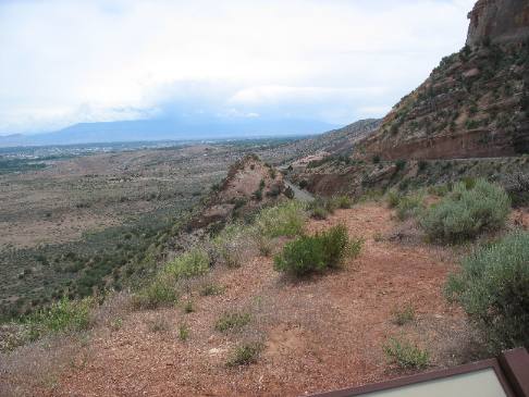
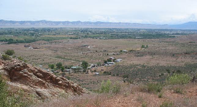
Fruita and Grand Junction Valley from Colorado National Monument
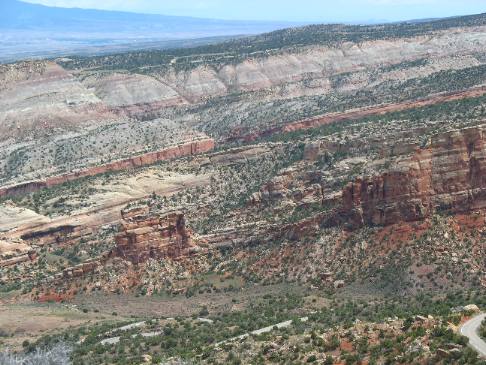
Only moments after entering Colorado National Monument we start our climb up the shear sandstone cliff. Joyce snapped this picture of the Fruita/Grand Junction Valley below Colorado National Monument from midway on that climb.
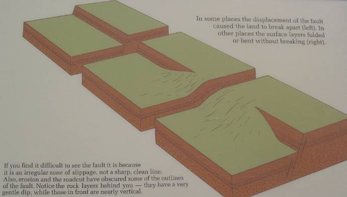
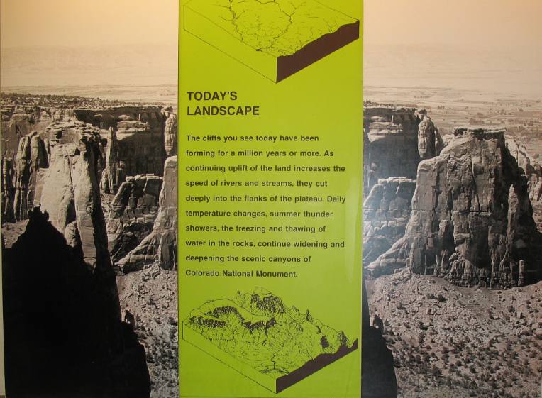
Years ago there wasn't a valley. There was a time when the the valley and the mesa was flat. Forces in the earth's crust made them move to the positions they now occupy. These forces in the earth's crust made the Mesa rise while a fault line developed and the valley fell. The fault runs east and west almost parallel to I-70.
Graphic illustration of showing fault line geology in Colorado National Monument
Pay attention to this graphic. The following pictures in this travelogue I will present pictures where these events are evident.
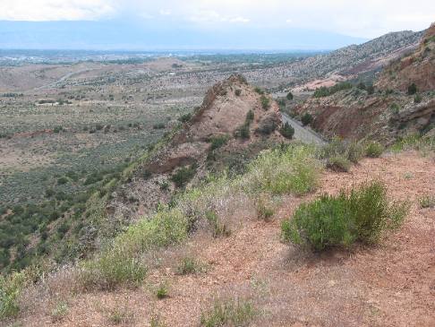
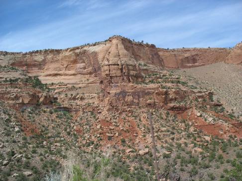
Fault line that created Colorado National Monument
The almost vertical angle of this formation is on the fault. This formation is falling into the Fruita, Grand Junction Valley.
Fault line on northern side of Colorado National Monument
From this angle you can see the fault. On the right side different layers of sediment are virtually flat. While on the left it is easy to see the almost vertical piece falling into the valley.
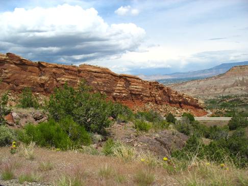
Fault line where it is bending not breaking in Colorado National Monument
Rock formations along the fault "bent" instead of completely breaking.
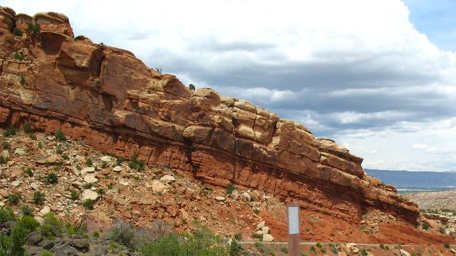
Bending fault line in Colorado National Monument
Picture showing rock formations along the fault bending instead of breaking.
Bending fault line in Colorado National Monument
The road is dropping on about a 7% grade while it is evident this rock formation is dropping at a much steeper rate. In this instance these rocks are being bent by pressures deep within the earth. Sometimes the rock bends along fault lines other times it breaks.
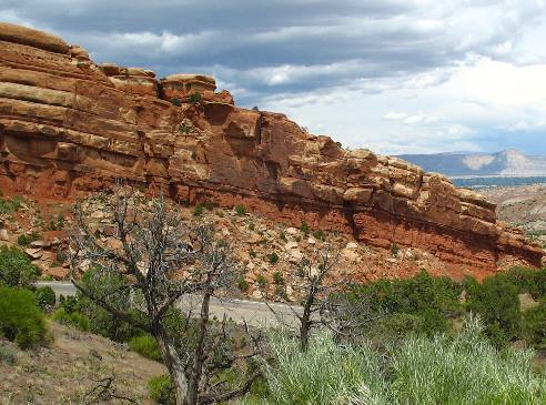
View from fault line in Colorado National Monument
Across the valley you can see the entire block that faulted and fell creating this valley. The sandstone rock in the bottom left corner if this picture is almost vertical. We are standing on the fault line while taking this picture. Rocks did not bend here the block on one side of the fault fell and created a sharp cliff face.
Sandstone clif in Colorado National Monument
This is a picture of the sandstone cliff we are climbing in Colorado National Monument.
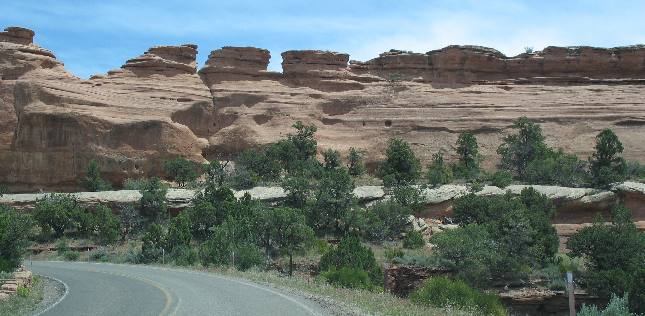
Exposed layers Wingate sandstone sedimentary rock in Colorado National Monument
Kayenta Formation caprock protecting Wingate Sandstone Colorado National Monument
As we climb we are going through layer upon layer of sedimentary rock exposing 100s of millions of years of geology. As we climb remember that the rock layers are becoming younger and younger.
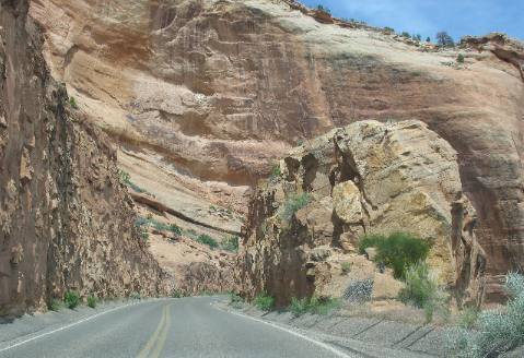
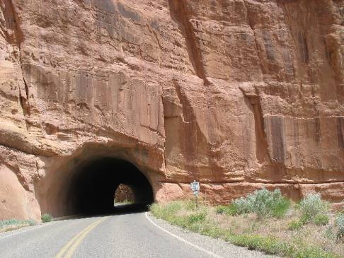
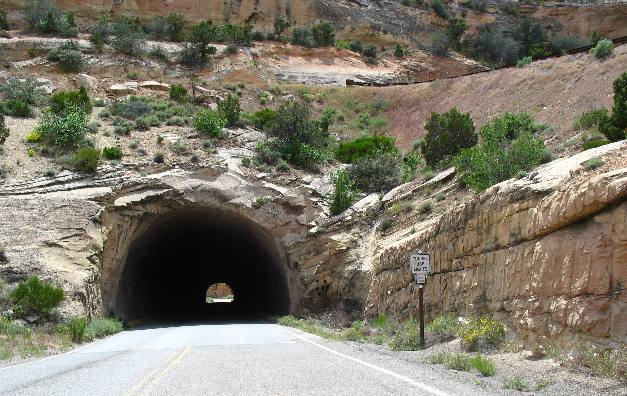
Tunnels in Colorado National Monument through Wingate Sandstone
It isn't easy to construct a highway up these vertical cliffs. On occasion engineers have to employee tunnels like these.
Wingate sandstone and Kenyeta formation with tunnel Colorado National Monument
Colorado National Monument, is not a National Park but most people do not know the difference between a National Park and a National Monument. A national park is established by an act of congress, and usually applies to a site that is nationally-significant in multiple ways. A national monument, on the other hand, is established by presidential proclamation, and usually applies to a site that is nationally significant, but for a singular reason.
Colorado National Monument in western Colorado
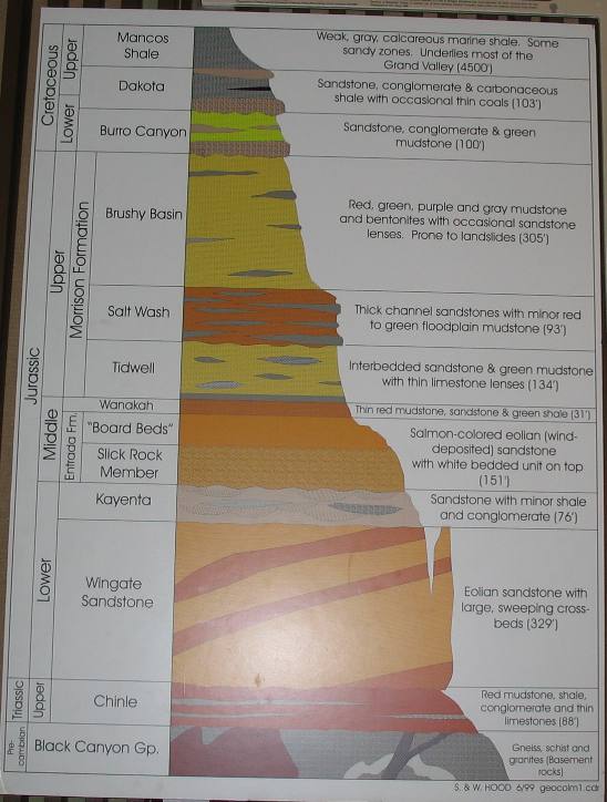
Graphic of sedimentary layers present in Colorado National Monument
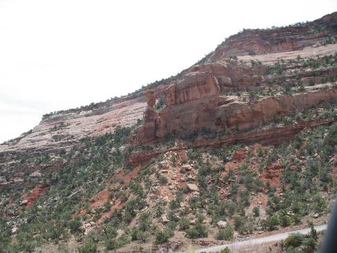
Much of what I recognize in Colorado National Monument is Wingate Sandstone and Kayenta Formation.
Wingate Sandstone and Kayenta Formation in Colorado National Monument
Wingate Sandstone protected by the harder Kayenta Formation acting as a cap rock.
Wingate Sandstone with a cap rock of Kayenta formation
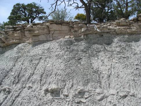
I think the white layers seen in this sandstone are dustings of volcanic ash.
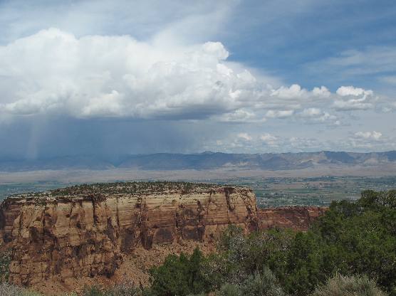
Grand Junction Valley and fault line as seen from Colorado National Monument
Afternoon rainstorm over the Grand Junction valley.
Kayenta Formation is the caprock protecting the softerWingate Sandstone beneath the caprock
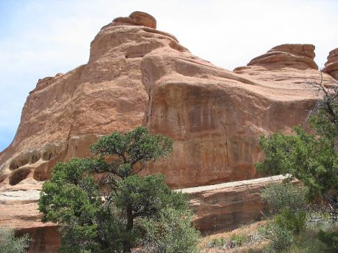
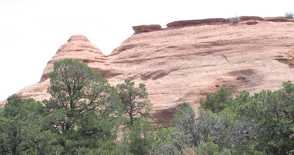
Sandstone weathers into unusual shapes. Here a ridge between two canyons is eroding into a series of domes. The key factor in shaping these adjacent monoliths is the upper layer of harder rock (Kayenta Formation). This caprock layer is breakable, but resistant to erosion. Where the cap layer remains, the softer rock (Wingate Sandstone) beneath is protected; where it has broken away, the underlying formation has rapidly eroded to a rounded form.
Kayenta formation caprock protecting Wingate Sandstone
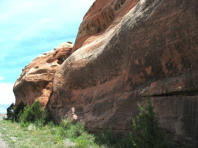
With the relatively resistant Kayenta Formation "caprock" intact, cliffs remain tall and fairly flat-topped. Only minor erosion occurs along vertical cracks.
How Kayenta caprock protects the Wingate Sandstone
When the Kayenta formation camprock is eroded off, underlying Wingate Sandstone begins to erode from the top down, forming more rounded spires and dome shapes.
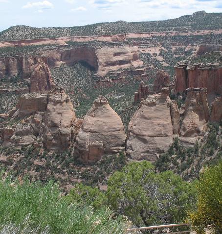
You can certainly see how the hard Kayenta "caprock" protects the Wingate Sandstone in these pictures.
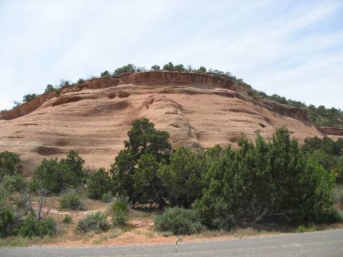
Kayenta formation caprock protecting Wingate Sandstone Colorado National Monument
How many years will it take for these formations to take on the dome shapes of the formations above? But even a novice can see how the harder Kayenta formation caprock protects the softer Wingate Sandstone.
Kayenta formation caprock protecting Wingate Sandstone Colorado National Monument
Much harder caprock of the Kayenta formation protecting the softer Wingate Sandstone under it.
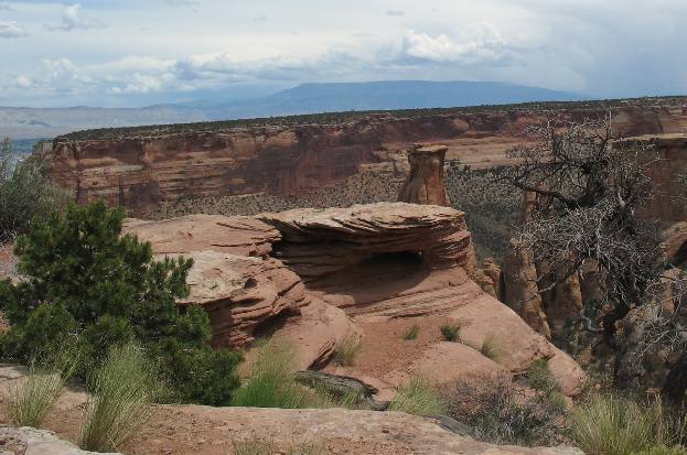
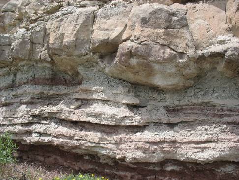
Caprock protecting ash from an ancient volcano
Here a hard caprock is protecting this deep layer of ash from an ancient volcano.
Layers of sedimentary rock exposing volcanic ash deposits
This layer of sedimentary rock is exposing how dustings of volcanic ash occurred many times over thousands of years with intervals in between when the ash would be covered with other sediments then covered with ash again only to have the process repeated time and again.
Volcanic ash and sandstone
Again, volcanic ash is evident in this sandstone formation. It is for the most part wind deposited sand in what is known as the slick rock formation that lies on top of the Kayenta Formation.
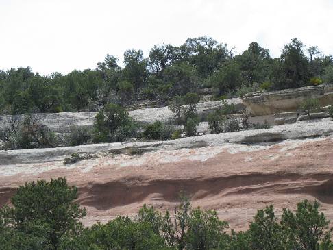
Red Canyon Colorado National Monument exposing Kayenta formation and Wingate Sandstone
This is Red Canyon on the eastern side of Colorado National Monument. This view is looking north into the valley and Grand Junction, Colorado in the distance.
Hundreds of millions of years of geology exposed in sedimentary rocks of the Kayenta Formation and Wingate Sandstone
This picture is showcasing the hundreds of millions of years of sedimentary rock exposed in the cliff face.
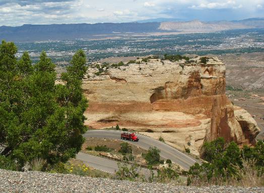
Grand Junction from Colorado National Monument
Joyce took this picture of Grand Junction, in the valley and an awesome switchback visible several hundred feet below as we snake our way down the cliff face on the eastern side of Colorado National Monument.
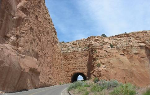
Tunnel through Wingate Sandstone in Colorado National Monument
Like on the western side engineers had to employ a tunnel in order to get automobiles down the steep cliff face.
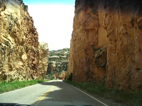
Impressive road cut through Wingate Sandstone in Colorado National Monument
Deep road cuts were employed in some places in the place of tunnels. This is one impressive roadcut.
These are some of our other Travel Logs in this area: The John Wesley Powell Museum in Green River, Utah Arches National Monument in Moab, Utah Driving US-191 from Blanding to Moab, Utah
Click here for more Colorado Travel Logs & Travel Journals
Until next time remember how good life is. Mike & Joyce Hendrix
More Colorado AdventuresSome Exciting Drives** More 2007 Travel Adventures
Mike & Joyce Hendrix
Mike & Joyce Hendrix who we are We hope you liked this page. If you do you might be interested in some of our other Travel Adventures: Mike & Joyce Hendrix's home page Travel Adventures by Year ** Travel Adventures by State ** Plants ** Marine-Boats ** Geology ** Exciting Drives ** Cute Signs ** RV Subjects ** Miscellaneous Subjects
We would love to hear from you......just put "info" in the place of "FAKE" in this address: FAKE@travellogs.us Until next time remember how good life is.
|
| ||

| |||
|
|
|||
|
| |||
|
|