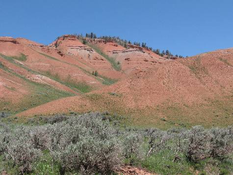
Gros Ventre MountainsThese red cliffs in the Gros Ventre Mountains look like pieces of the Chugwater Formation
This exposure looks like Triassic Chugwater formation to me. The Chugwater formation consists of brick red sandstone, shale, and siltstone. The bright red color of the Chugwater is due to a great amount of oxidized iron between and on the grains of the rock. The Chugwater formation is normally covered with limestones, shales and mudstone formations. I am going to be looking for the limestones, shales and mudstone formations as we continue higher into the Gros Ventre Range. Joyce took these picture of the "Red Hills" area of the Gros Ventre Range about 12-miles east of Kelly, Wyoming on Gros Ventre Road that follows the Gros Ventre River deep into the Gros Ventre Wilderness. The Gros Ventre Mountains of western Wyoming is a fine example of western Wyoming's embarrassment of riches in the natural wonders department. The range is composed of high craggy peaks, glacier scoured valleys, and rolling sagebrush foothills. The Gros Ventre Mountains receives much less visitation than the more well known Grand Teton Range which you can see from much of the Gros Ventre's northern and western flanks. Views from the high country also include views of the Absaroka Mountains, Wind River Mountains, the Snake River Range and the Wyoming Range. Another view of the Chugwater Formation in the Gros Ventre Mountains
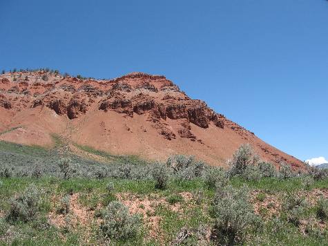
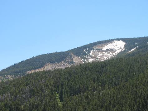
In this view you can see sage brush hills along with the classic Chugwater Formation consisting of brick red sandstone, shale, and siltstone. This picture was taken in the "Red Hills" area of the Gros Ventre Wilderness along the Gros Ventre River east of Kelly, Wyoming on the Gros Ventre Road. At the heart of the Gros Ventre Mountains is the 287,000-acre Gros Ventre Wilderness; it became a part of the National Wilderness Preservation System in 1984. The higher elevations are usually free of snow around mid-July and open until mid-September. Elevations range from 7,000 to over 11,000 feet. This area is best known for Sheep Mountain, also known as the Sleeping Indian due to its resemblance of an Indian chief lying on his back, Jackson Hole's most prominent feature to the east. Much of the wilderness lies above timberline and is home to many peaks over 10,000 feet-with the tallest being Doubletop Peak at 11,682 feet. Mechanized vehicles, including mountain bikes and snowmobiles.
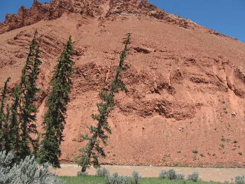
River Cut through the Chugwater Formation along the Gros Ventre River east of Kelly, Wyoming
The Gros Ventre River is cutting through a thick section of the Chugwater Formation east of Kelly, Wyoming in the Gros Ventre Mountains.
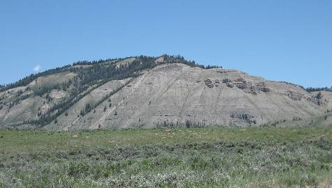
Marine limestone, sandstone, dolomite and siltstone
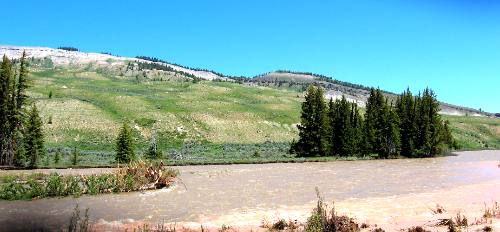
The further we travel into the Gros Ventre Mountains we transition into a deep layer of marine limestone, sandstone dolomite and siltstone that lies on top of the red Chugwater Formation that we saw earlier and at a lower elevation.
Not the sage brush covered landscape here in the Gros Ventre Mountains.
Limestone mountains visible on the northern side of the Gros Ventre River east of Kelly, Wyoming
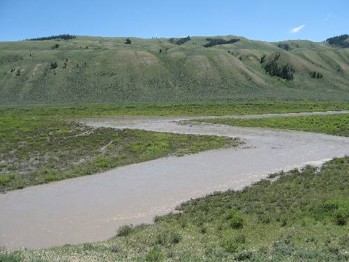
Sloping limestone hills viewed from along the Gros Ventre River deep in the Gros Ventre Mountain Range.
Gros Ventre River flowing through limestone hills deep in the Gros Ventre Mountains
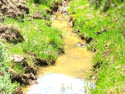
The Gros Ventre Mountains are home to elk, moose, deer, bighorn sheep, black and grizzly bear, wolves, mountain lion and many other species. It is considered critical calving grounds for the Jackson Hole elk herd. The Gros Ventre River Valley doesn't receive much snow so the area doubles as critical winter range for wildlife also, this dynamic provides great wildlife viewing opportunities for the snowmobile tours offered out of Jackson. Blue ribbon trout fishing is to be found throughout the range in its many streams and rivers. The range's many tributaries are spawning areas for the Snake River trout but many stay behind. The regions numerous lakes also provide great fishing. The Gros Ventre Mountain Range has fewer lakes than the nearby Wind River Mountains, but still offers great fishing opportunities for several species of trout. Very large ones can be found in Turquoise Lake, Slide Lake, Brewster Lake, McLeod Lake and Lunch Lake. Snow melt heading down the slopes of the Gros Ventre Mountain Range
The high alpine meadows have prolific wild flower displays in the summer months starting with the balsamroot in early June. Many high mountain meadows contain little grass, but many tall perennials such as cow parsnip, penstemon, lupine, monkshood, and western coneflower. These plants grow so tall that they obscure lightly used trails by mid summer. Gros Ventre Slide in the Gros Ventre Mountains east of Kelly, Wyoming
The landscape is a dynamic one, In 1925 a year of heavy snow and spring rain, a major slump broke off the north side of the Sleeping Indian and resulted in the Gros Ventre Slide. Some 50 million cubic yards of sandstone, limestone, shale and rock, about one mile long, 2000 feet wide and several hundred feet deep in places, plunged down and formed a dam 225 feet high and half a mile wide across the Gros Ventre River. A lake (Slide Lake) was created above this new dam. For almost two years this earth dam held; then on May 18, 1927, part of the dam gave way and a wall of water, mud and rock flowed down the canyon destroying valuable property. Ranch lands were ruined by mud and rubble and the town of Kelly, three and one half miles downstream, was practically wiped out. Six persons drowned in the flood. The slide is still a wonder to look at, giant boulders are strewn willy nilly along the river bottom, natures earthwork dam that still holds back sizable Slide Lake is a marvel and the gapping hole in the mountain still inspires awe. The boulder fields below the dam provide world class kayaking in the spring. In the winter and spring along the south side of the lake in the red cliffs is a good place to view rocky mountain bighorn sheep. Click here for more Wyoming travellogsUntil next time remember how good life is. More Wyoming AdventuresSome Utah Adventures ** More 2011 Travel Adventures
Mike & Joyce Hendrix
Mike & Joyce Hendrix who we are We hope you liked this page. If you do you might be interested in some of our other Travel Adventures: Mike & Joyce Hendrix's home page Travel Adventures by Year ** Travel Adventures by State ** Plants ** Marine-Boats ** Geology ** Exciting Drives ** Cute Signs ** RV Subjects ** Miscellaneous Subjects
We would love to hear from you......just put "info" in the place of "FAKE" in this address: FAKE@travellogs.us Until next time remember how good life is.
|
| ||
|
| |||
|
| |||
|
|