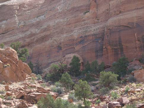
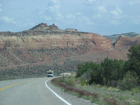
Sandstone formations part twoSandstone formations (part two) on SR-95 west of Blanding, UtahMay 20, 2007. There are two commercial campgrounds in Blanding. We decided to stay in the one with some shade so we picked it but both RV-Parks were OK: $19.80 for FHU, gravel interior roads and sites. It is located on US 191 on the south side of town behind the shell station (hint, it is easy to find since Blanding is very small). Sandstone cliff on the west side of Comb Ridge 11-miles west of Blanding, UT
Joyce took this picture of the west side of Comb Ridge a cliff wall, the result of a surface scar remaining when the ground on one side of the fault moved upward while the side we are on in the picture slid down and under that huge wall of sandstone. While I do not know the formation this sandstone represents it looks very similar to the sandstone layers we saw in Canyon de Chelly, Arizona.
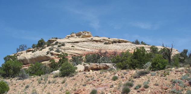
Sandstone of the Cedar Mesa Formation
On the west side of Comb Ridge we start encountering another form of sandstone. This pale sandstone is known as the Cedar Mesa Formation.
Cedar Mesa Formation sandstone was formed from huge sand dunes.
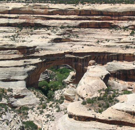
Sandstone in Natural Bridges National Monument
How did all this geology come to be? That is the question posed by everyone who lays eyes on these marvels of nature. Geologist tell us, that 260 million years ago, dazzling white beach sand migrated inland from the shore of a warm sea. Blown by prevailing northwest winds, grain by grain this sand moved up the windward slope of large dunes until the weight at the top sent cascades of sand sailing down the opposite slope. These dunes retreated before ancient winds, forming cross bedded layers. Over long expanses of time, rainwater percolated down through the dunes, dissolving calcium carbonate. Slowly, this natural cement fused the individual grains of sand to form the Cedar Mesa Sandstone. Eons later this area was uplifted and meandering streams cut into the rising earth. Over millions of years the uplifting of the plateau combined with the cutting power of these meandering streams created these canyons we see today.
Is this a better view of that natural bridge of stone? It was still taken from the rim.
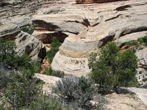
Formation of sandstone in Natural Bridges National Monument
The horizontal layers in this sandstone formation are easy to see.
This formation in, Natural Bridges National Monument, is know as the "Horse Collar". It is fairly easy to see how it got that name. Remember that meandering streams cut through this sandstone over millions of years. In a way this reminds me of the "Great Goosenecks of the San Juan" that we saw earlier on this trip.
Sandstone exposed in Comb Ridge
The "slick" surface on this cliff wall is sandstone while the broken pieces form a talus slope under the exposed sandstone. This is the west side of Comb Ridge that was forced upward when techtonic plates deep within the earth slipped causing the east side to move upward while the side we are on (west side) slipped down and underneath the other plate. This all happened around 65-million years ago.
Closer look at the sandstone exposed in the Comb Ridge fault or surface scar
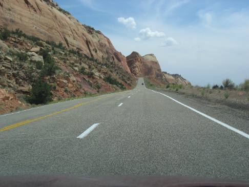
Sandstone exposed on the face of Comb Ridge 11-miles west of Blanding, Utah on SR-95.
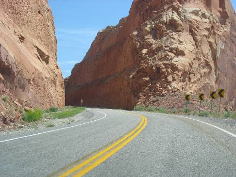
Awesome roadcut passing through sandstone on Comb Ridge
This is an awesome roadcut through a huge formation of sandstone.
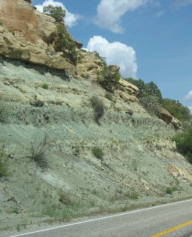
Sandstone and Volcanic ash
This picture shows harder sandstone acting as a caprock and protecting a layer of volcanic ash. Volcanic ash is the greenish colored material under the tan sandstone.
If you liked this Travel Adventure you might like one of these: Goosenecks on the San Juan River southern Utah
Click here for more Utah Travel Adventures
More Utah AdventuresPlants Trees and Flowers ** More 2007 Travel Adventures
Mike & Joyce Hendrix
Mike & Joyce Hendrix who we are We hope you liked this page. If you do you might be interested in some of our other Travel Adventures: Mike & Joyce Hendrix's home page Travel Adventures by Year ** Travel Adventures by State ** Plants ** Marine-Boats ** Geology ** Exciting Drives ** Cute Signs ** RV Subjects ** Miscellaneous Subjects
We would love to hear from you......just put "info" in the place of "FAKE" in this address: FAKE@travellogs.us Until next time remember how good life is.
|
| ||
|
| |||
|
| |||
|
|