Goosenecks of the San Juan & Mulie PointGoosenecks of the San Juan & Mulie PointMay 19, 2007. We stayed in Cottonwood Campground in Bluff, Utah. Several private RV-Parks were available in Bluff. We chose Cottonwood. The others were just as nice. One mile west of town is Sand Island Department of the Interior Campground with no utilites. It was OK as well. Cottonwood was $20 for a FHU site.
We had a list of things we wanted to experience today and all of them were around Mexican Hat, Utah. We covered our ride to Mexican Hat in another travelogue. In this one I am going to cover our visit to the Great Goosenecks of the San Juan River and our ride out to Muley Point. To get to the Goosenecks one has to drive east out of Mexican Hat on US-163 for about 5-miles then turn north on SR-261 for about a mile before turning west on SR-316. Within 4-miles or so you arrive at the parking area where you can view the Great Goosenecks of the San Juan River.
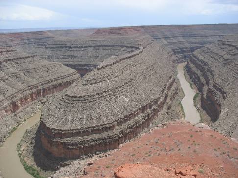
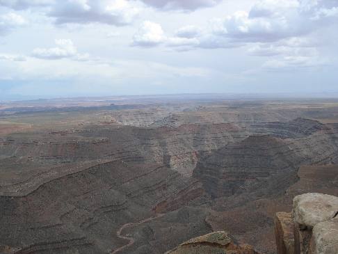
Goosenecks of the San Juan north of Mexican Hat, Utah
Millions of years of geology exposed in this cut by the San Juan River.
Nearly 1,000 feet below the San Juan River winds its way from deep in Colorado to eventually join the Colorado River and Lake Powel west of here. The San Juan has been cutting the deep winding chasm you see here for eons. This section of erosional cuts is called the Great Goosenecks of the San Juan River. One look and you can see why. Geologists consider this part of the river to be one of the finest examples of "entrenched meanders" anywhere in the world. The meandering pattern originated several million years ago when the river was flowing on a relatively flat plain, much as the present-day Mississippi River. The San Juan became entrenched when the entire Colorado Plateau was slowly uplifted. Cutting downward as the plateau uplifted, the river followed its initial pattern and thus created the canyon you now see. The process continues to this day as the San Juan River cuts ever deeper into prehistoric geological formations. The rock formations at the bottom of the canyon are around 310-million years old.
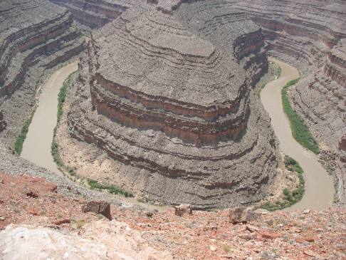
Goosenecks of the San Juan north of Mexican Hat, Utah
This is another spot where 300-million years of geologic history are laid bare before our eyes. Totally awesome.
Just think, when someone is floating down the San Juan River through these Gooseneck meanders they are floating through geology laid down 300-million years ago. It is difficult to even comprehend that number.
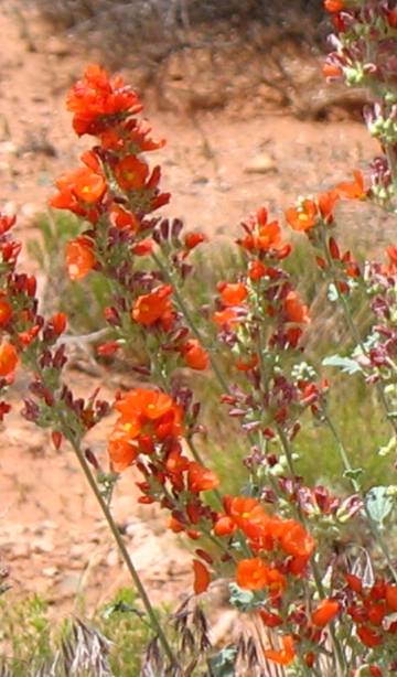
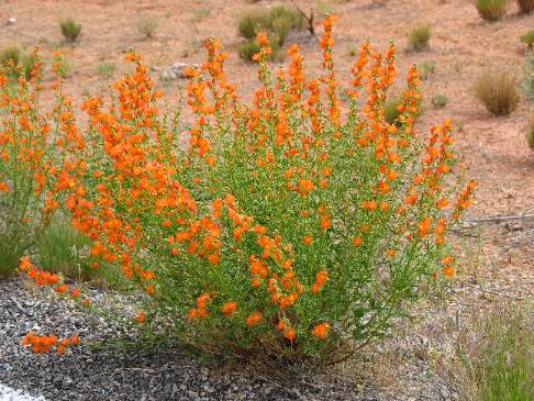
Globemallow
On the drive out to the Great Goosenecks of the San Juan River we are priviledged to see a roadside covered with these globemallow plants.
From the Goosenecks we backtrack the 4-miles or so on SR-316 to SR-261 and head to the famous Moki Dugway and Mulie Point Overlook.
To get to Mulie Point one has to experience climbing the Moki Dugway because you have to turn west off SR-261 at the top of the Moki Dugway.
The climb up the Moki Dugway is covered in the next travelogue. So for now I am going to skip over the Moki Dugway and go directly to where we turned off SR-216 onto Muley Point Road at the top of the Moki Dugway. Don't worry Muley Point is well marked at the top of the Moki Dugway.
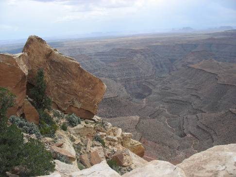
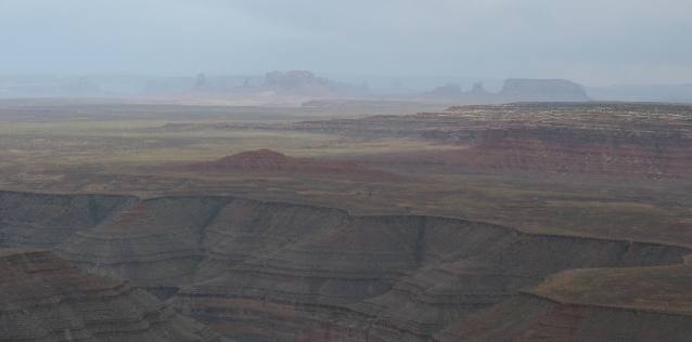
View from Muley Point
And this is the view from Muley Point. It overlooks the meandering San Juan River a few miles downstream from the Goosenecks.
View from Muley Point
The San Juan River is at the bottom of this canyon.
View from Muley Point
Those formation in the distance look so much like Monument Valley but I don't think they are part of the famous Monument Valley.
Globemallow
This is a globemallow and they are prolific along certain stretches of this road. They are so colorful.
If you liked this Travel Adventure you might like one of these: Natural Bridges National Monument in southern Utah
Click here for more Utah Travel Adventures
I can't think of a better ending to a wonderful day. Until next time remember how good life is. Mike & Joyce Hendrix
More Utah AdventuresPlants Trees and Flowers ** More 2007 Travel Adventures
Mike & Joyce Hendrix
Mike & Joyce Hendrix who we are We hope you liked this page. If you do you might be interested in some of our other Travel Adventures: Mike & Joyce Hendrix's home page Travel Adventures by Year ** Travel Adventures by State ** Plants ** Marine-Boats ** Geology ** Exciting Drives ** Cute Signs ** RV Subjects ** Miscellaneous Subjects
We would love to hear from you......just put "info" in the place of "FAKE" in this address: FAKE@travellogs.us Until next time remember how good life is.
|
| ||
|
| |||
|
| |||
|
|