Gates of the MountainsGates of the MountainsJuly 26, 2007. We are staying in Lincoln Road RV-Park Helena, Montana less than a mile west of I-15 at exit 200. Lincoln Road RV-Park is about 10-miles north of downtown Helena but in a very good position access everything in the area. $25.04 with Good Sam discount plus-taxes for FHU in nice gravel pull thru sites with some shade. Free wifi was available but no cable TV.
Today we are taking a scenic and historic boat ride on the Missouri River through what is know as Gates of the Mountains. This is the name given the area by Lewis and Clark when they traversed this area in 1865. Gates of the Mountains is located 19-miles north of Helena and is accessed from exit 209 on I-15.
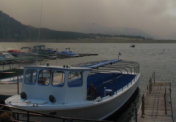
Marina and boat that takes passengers on Gates of the Mountains tour
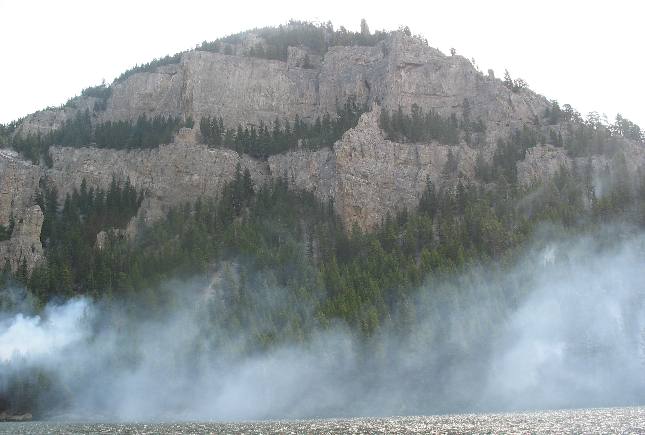
When we arrived at the dock for our boat trip the Meriwether Fire was causing concern. This is the boat we will be riding on.
You can see smoke from the Meriwether Fire in the distance. We are on the banks of the Missouri River about 18-miles north of Helena, Montana.
Missouri River as it heads into Gates of the Mountains north of Helena, Montana
Operators of the boat tour filled the boat with 35 to 40 eager individuals and cast off like there was no fire. We are on the Missouri River and will be heading into that canyon in front of us. The Missouri River flows from the south to the north in this area and we will be heading north (with the current).
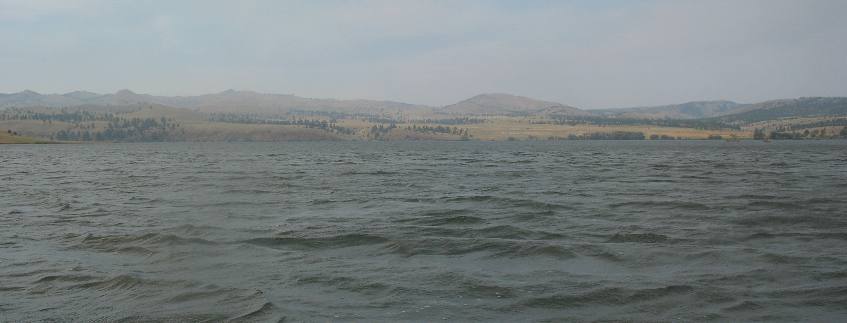
Sieben Ranch and Hilger Hereford Ranch
This picture was taken from the boat dock but facing southeast looking across the valley comprising the Sieben Ranch and Hilger Hereford Ranch.
Gates of the Mountains wilderness area
Gates of the Mountains wilderness area is located on the east side of the Missouri River.
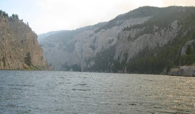
Entering the south end of Gates of the Mountains
At this point we begin entering "The Gates".
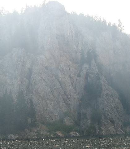
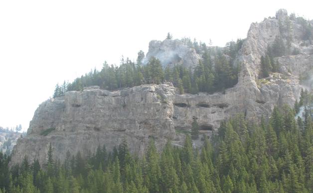
Smoke from the Meriwether Forest Fire is having and effect on visibility.
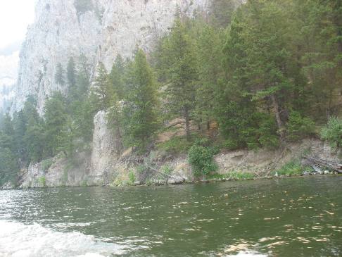
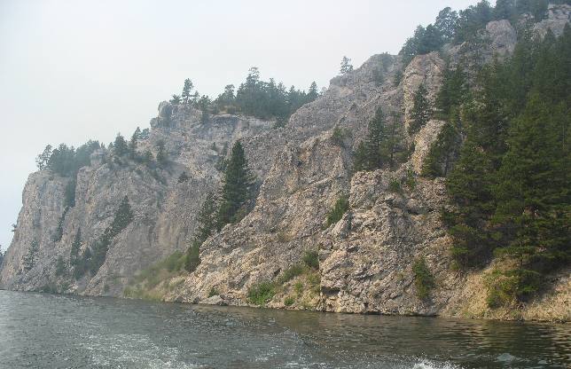
Limestone cliffs line both sides of the Missouri River through Gates of the Mountains
The limestone cliffs take on so many different shapes and so many different appearances.
Limestone cliffs tower above both sides of the river. These cliffs are what prompted Meriwether Lewis to call this area Gates to the Mountains since he knew they were near the Rocky Mountains and the source of the Missouri River.
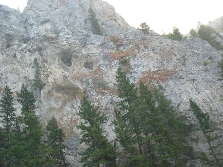
Cavities and caves visible in limestone cliffs
The side of this cliff is peppered with caves and holes all created by water. Limestone is porous and as such allows rain water to percolate through. However, water can and will dissolve limestone especially acid water. In any event water dissolves cavities. When these cavities are exposed in cliffs they become caves.
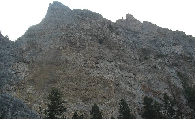
Visible signs of tremendous uplift in the earths crust
This limestone has been contorted and bent until it is now in an almost vertical position. Keep in mind that this limestone was born on the bottom of an ancient sea some 350-million years ago. These limestone deposits are hundreds of feet deep and were in the making over possibly a 100-million years. Then this area was uplifted when molten lava deep in the earth exerted pressure. The sea floor became dry land then the seafloor continued to uplift. The limestone crust cracked and distorted as the pressure kept pushing it up. In the case of this rock it has been thrust up to an almost vertical position. At one time this mass of limestone was below sea level and now finds itself at over 4,000 feet above sea level.
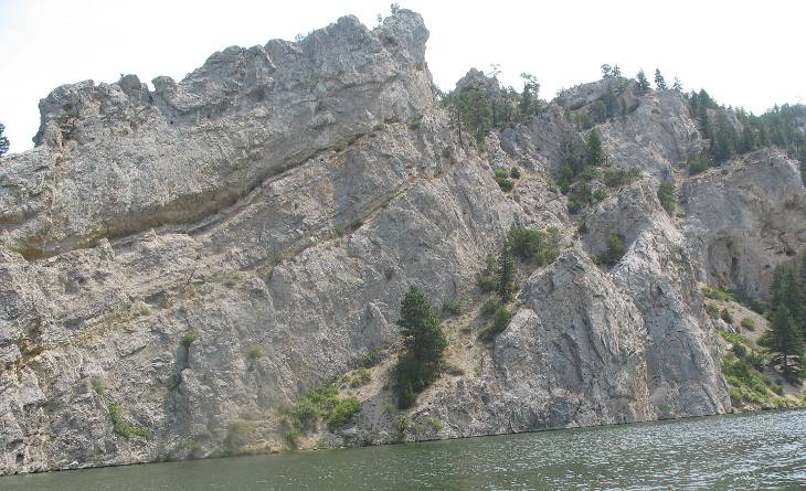
Limestone cliff walls in Gates of the Mountains
The Missouri River has cut a path through this limestone creating these sharp banks.
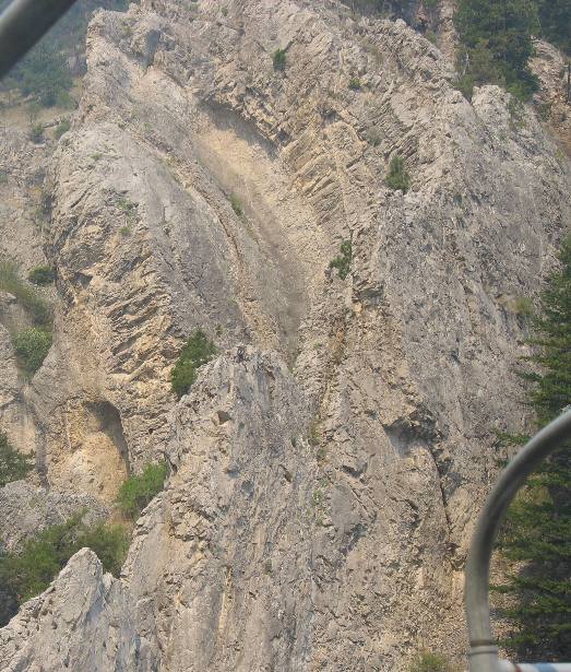
Smoke from the Meriwether Fire is obscuring the view of this anticline
Smoke from the Meriwather Fire is making it difficult to see the geology but here the layers of limestone are nearly vertical instead of laying flat.
Look closely at the curve in that limestone formation in the bottom right hand corner. It is creating what geologist call an anticline.
Horizontally layered limestone bluff visible above smoke from Meriwether Fire
On the opposite side of the river limestone is laying horizontal just as it was formed over 300 million years ago.
Yes, that is the Meriwether fire burning in the understory. I cover the Meriwether fire in the following travel logs in case you are interested: 2007 #129 Fire in Gates to the Mountains 2007 #129aa Meriwether Fire of 2007 2007 #129bb Helicopters Fighting Meriwether Fire 2007 129cc Fire Fighting Helicopters
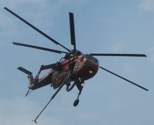
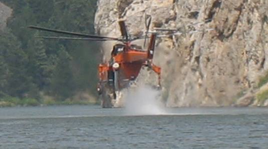
Helicopter that was fighting the Meriwether Fire in Gates of the Mountains Wilderness
This helicopter and others were scooping water out of the Missouri River near our boat and dumping it on the Meriwether Fire. . Here are some links to travel logs covering the helicopters that were fighting the Meriwether Fire as we were slowly making our way through Gates of the Mountains Wilderness. 2007 #129bb Helicopters Fighting Meriwether Fire 2007 129cc Fire Fighting Helicopters
Fire fighting helicopter scooping water in Gates of the Mountains Wilderness
Scooping water out of the Missouri River to fight the Meriwether Forest Fire.
More action pictures of these helicopters of these fire fighting helicopters is here. 2007 #129bb Helicopters Fighting Meriwether Fire 2007 129cc Fire Fighting Helicopters
Honeycone nature of limestone cliffs of Gates of the Mountains
This picture highlights not only the Meriwether fire but the honeycone nature of these limestone cliffs.
Yes that is smoke from the Meriwether fire. It looks like a small fire has started on that cliff.
A geology question
I wonder if those two bands of softer material might have been ash falling from a volcano. Or possibly this area was in a shallow bay with a river emptying into it. A flood or some other event may have carried a foot of silt into the bay causing these two bands.
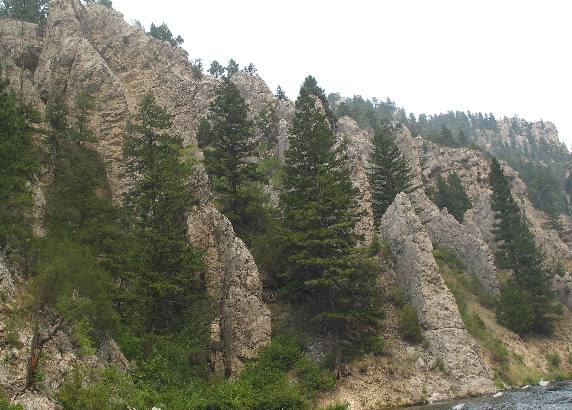
Limestone hoodoos
Note how erosion has carved these cliffs in the limestone. Those formations are called hoodoos.
Look at the way various layers of limestone are laying along this fault
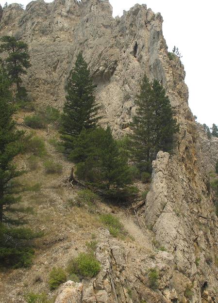
Trees and grasses grow anywhere they can get a start.
Also take note that this picture was taken along a fault boundry. Some of the limestone is almost vertical while some is laying almost flat.
Click here for more Montana Travel AdventuresUntil next time remember how good life is.
More Montana AdventuresSome Exciting Drives** More 2007 Travel Adventures
Mike & Joyce Hendrix
Mike & Joyce Hendrix who we are We hope you liked this page. If you do you might be interested in some of our other Travel Adventures: Mike & Joyce Hendrix's home page Travel Adventures by Year ** Travel Adventures by State ** Plants ** Marine-Boats ** Geology ** Exciting Drives ** Cute Signs ** RV Subjects ** Miscellaneous Subjects
We would love to hear from you......just put "info" in the place of "FAKE" in this address: FAKE@travellogs.us Until next time remember how good life is.
|
| ||

| |||
|
| |||
|
| |||
|
|