Big Horn BasinLooking west over the Big Horn Basin from US-14a on Oh My God Hill west of Lovell, Wyoming
The Big Horn Basin in northwest Wyoming is bound on the west by the Beartooth and Absoroka Mountains. On the south are the Wind River and Owl Creek ranges, on the north the Pryor Mountains and on the east are the Big Horns. The Basin is nearly elliptical in shape, about 140-miles long and 100-miles wide. The Wind River, fed by many tributaries in the Wind River Mountains, becomes the Big Horn River at the "Wedding of the Waters" in Wind River Canyon. It is the principal drainage of the Basin. The river flows into Big Horn Lake 71-miles upstream from Yellowtail Dam. It is the center of a 120,000-acre Bighorn Canyon National Recreation Area administered by the National Park Service. In the Pryor Mountains is the first National Wild Horse Range established by an act of Congress. It provides sanctuary for around 200 wild mustangs. In the Basin, Sheep Mountain reveals classic geologic history were the strata of many eras are exposed in the anticline. Heart Mountain Relocation camp, northeast of Cody, is where more than 11,000 Japanese Americans were confined during World War II from August 1942 until summer 1945. Despite harsh winters and austere living conditions, the Nisei brought water to the bench and successfully irrigated 1,200 acres of farmland. Four counties, Park, Big Horn, Washakie and Hot Springs, comprise the Basin. Their seats are Cody, Basin, Worland and Thermopolis. Cody is home of the world-famous Buffalo Bill Historic Center and Thermopolis hosts the world's largest mineral hot springs. Northeast of the Basin, atop Medicine Mountain at an elevation of 9,642 feet, lies the prehistoric Medicine Wheel, a mysterious circle of stones 80-feet in diameter. It was designated an national Historic Landmark in 1970. Nearby in sharp contrast, is an FAA air traffic control radar station, built in 1962. It is a high-tech facility which monitors air traffic over three states. Beginning in the late 1800's, Mormon pioneers moved into the northern end of the Basin and camped in tents along the "Stinking Water" (Shoshone) River until their log homes could be built. They established the communities of Lovell, Cowley and Byron. Today, the Basin's prime industries are farming, ranching, oil, mining, manufacturing and tourism.
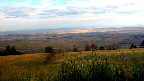
Looking west over the Big Horn Basin from US-14a on Oh My God Hill west of Lovell, Wyoming
Before you lies the Bighorn Basin, which has its southern end in Wyoming and extends north into Montana. Six hundred million years of geologic history have shaped the Basin. Although the basin now receives less than 10-inches of precipitation a year, it was once covered by vast inland seas. When the seas receded, it became a swampy home to dinosaurs. Volcanoes erupting to the west-135 million years ago then buried the basin under huge quantities of ash. Combined with the basin's shallow waters, the mixture became a clay called bentonite. And, when most of the Rockies were covered by seas 100 to 75-million years ago the basin was again under water. About this time, the land began to rise in the process of mountain building that created the Big Horn Mountains. Wind and waters relentless force wore away the deposits of prehistoric seas and volcanoes, leaving the older rocks we see today. Variety of color in the rocks came from the minerals within them. Reds are created by the presence of ferric oxide, and iron. High concentrations of magnesium carbonate often impart a buff color.
View of the Big Horn Basin from US-14a on Oh My God Hill west of Lovell, Wyoming
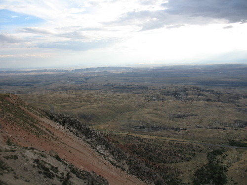
This is a great view overlooking the Big Horn Basin taken from high in the Big Horn Mountains along US-14a and the Oh My God Hill west of Lovell, Wyoming.
Looking west over the Big Horn Basin from US-14a on Oh My God Hill west of Lovell, Wyoming
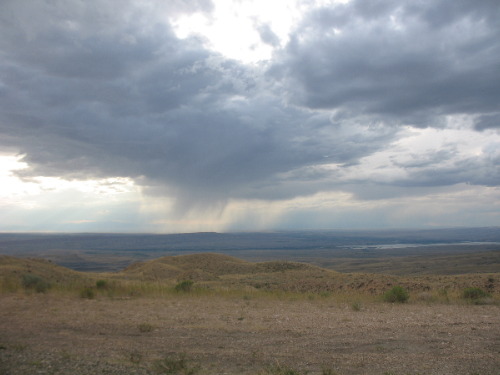
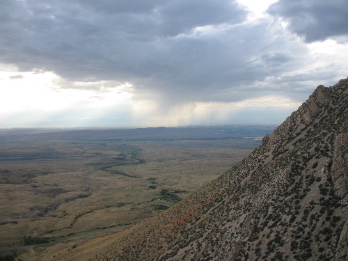
It is late in the afternoon and a small patch of rain can be seen over the Big Horn Basin. Joyce captured this view from along US-14a high on Oh My God Hill west of Lovell, Wyoming in the Big Horn Mountains of northern Wyoming. Good view of the Big Horn Basin from US-14a on Oh My God Hill west of Lovell, Wyoming
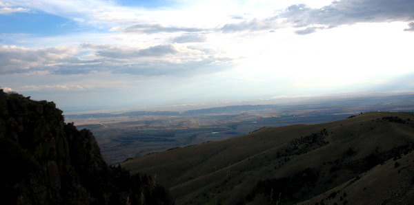
We were at a pretty good altitude when we got this view of the Big Horn Basin from our vantage point along US-14a as we approach Bald mountain in the Big Horn Mountains west of Lovell, Wyoming.
Click here for some Colorado travellogsUntil next time remember how good life is. More Wyoming AdventuresSome Idaho Adventures ** More 2014 Travel Adventures
Mike & Joyce Hendrix
Mike & Joyce Hendrix who we are We hope you liked this page. If you do you might be interested in some of our other Travel Adventures: Mike & Joyce Hendrix's home page Travel Adventures by Year ** Travel Adventures by State ** Plants ** Marine-Boats ** Geology ** Exciting Drives ** Cute Signs ** RV Subjects ** Miscellaneous Subjects
We would love to hear from you......just put "info" in the place of "FAKE" in this address: FAKE@travellogs.us Until next time remember how good life is.
|
| ||
|
| |||
|
| |||
|
|