Burley & Heyburn Idaho
Idaho: Burley, Heyburn,
Snake
River, Rupert, Acequia, Lake Walcott, Paul, Hazelton, Eden,
Mindoka Japanese
Internment Camp used during WWII, Kimberly, Hansen and the
Milner BLM area
with Oregon Trail Ruts
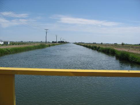
on display. June 1, 2, & 3rd, 2007. We moved the motorhome 120-miles north to Burley/Heyburn, Idaho on the Snake River today. We are staying in Heyburn Riverside City RV-Park 679-8158 full hookups $21 in a very nice RV-Park located on the Snake River next to the Heyburn-Burley Chamber of Commerce Tourist Information Center and a city park (US-30 on the northeast side of the Snake River Bridge.)
Once we settled into the RV-Park we headed out in search of places where traces of the Oregon Trail could still be viewed. West of Burley (10-miles) is Milner BLM property where we went searching for tracks left by the old wagon trains. Getting there required traversing typical southern Idaho landscape on typical southern Idaho roads.
Near Milner BLM property and traces of the Oregon Train
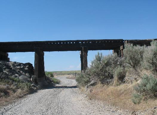
This RR track is following the south side of the Snake River just like we are. Only at this point we need to get between the RR tracks and the Snake River.
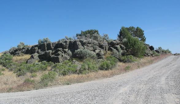
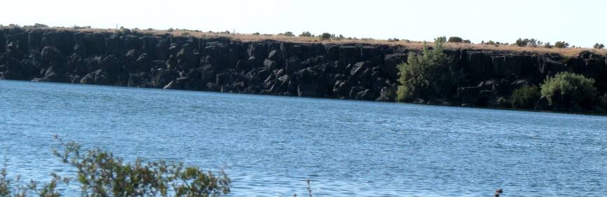
Lava rock near Snake River west of Burley, Idaho
This is the typical landscape. Lava rock litters the landscape like weeds.
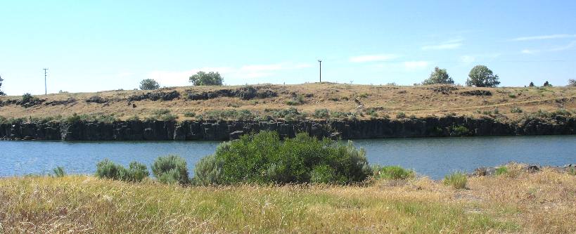
. Snake River cutting through lava rock west of Burley, Idaho
This is the Snake River as it cuts a path through this extremely hard lava rock. The Oregon Trail passed by this very spot on the south side of the Snake River. No doubt pioneers drew water at this site, stayed the night, listened to a fiddle or jew's harp by campfire light, and watched wearily as the sun rose in the east, signaling the start of another long day. The Milner area was a mild but welcome stop, with its mostly flat terrain and readily available water. Behind the pioneers was the "rocky, sagebrush desert," as one journal recorded; ahead lay "a seemingly endless sage plain." But first a little history to orient you to the significance of the Oregon Trail and the part it played in American History and the opening of the West. In the late 1830s, Great Britain was rumbling about its ownership of the Pacific Northwest. American leaders believed that an influx of settlers in the area would cement their claim to it. At the same time, the United States was rocked by a depression. Money was tight, unemployment high, and the prospects for many lower and middle class people were dim. In 1838, a former missionary to Oregon named Jason Lee toured eastern states extolling the virtues of the West. To a struggling people, his words seemed heaven-sent. In 1841, the first wagon train gathered in Independence, Missouri, the last settlement on the western frontier. Poorly organized, lacking leadership and a capable guide, most quickly became discouraged and turned back. Only about 30 of the original 500 eventually reached Oregon. But they continued coming, year after year. Some of those travelers stayed in Idaho, becoming among the first pioneers in this state. Through searing heat and powder-fine dust, walking against the sting of a steady west wind, enduring the horror of cholera, and facing the daily drudgery of walking across most of a continent a step at a time, tens of thousands of pioneers passed this way. They were carried as much by a vision as they were by creaky wagons and weary limbs--the dream of land to call their own and a new life. Oregon Trail marker
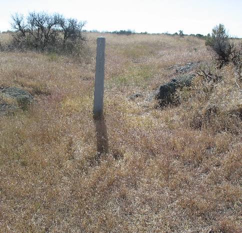
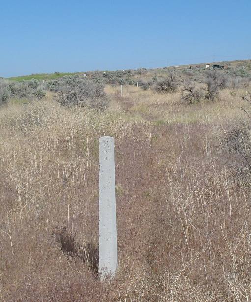
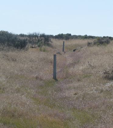
The dusty Oregon Trail was the most famous route to California and Utah; short cuts and alternative pioneer routs webbed their way across southern Idaho. A dozen or more westward trails crisscrossed this area. Only portions of the original trails remain intact. The Bureau of Land Management (BLM), along with many other organizations and citizens, are working to mark and preserve the original trail route through much of southern Idaho. They never want the history and memory of this remarkable chapter in American history to be forgotten. Across this sagebrush flat, tucked close to the Snake River, where two-track trails weave, are the last visible signs of a distinctly American saga. The Oregon Trail was the path that led westward for more than 300,000 emigrants between 1841 and 1869. After the transcontinental RR was completed they continued to come west but by RR. That cement marker is maintained by the BLM so that people today can walk the same Oregon Trail so many pioneers trekked over.
Markers trace the Oregon Trail across this BLM property west of Burley, Idaho
Wagon ruts carved by thousands of wheels into soil and lava are much more than a mere road through the desert. What the West was in yesteryear and is today forever will be linked with the Oregon Trail. Just walking along this trail gives us the feeling that we indeed are on the path of history. How those brave, tough pioneers walked the Oregon Trail from Independence, Missouri to Oregon is beyond my comprehension when we see this terrain. Pay close attention to these pictures where you can see marker post after marker post strung out over this inhospitable terrain as markers of where the old trail used to be. Without these markers one would scarcely pay attention to the slight indention. One hundred and thirty years can heal old wounds it would seem to say. Snake River cutting throug extremely hard lava rock in southern Idaho
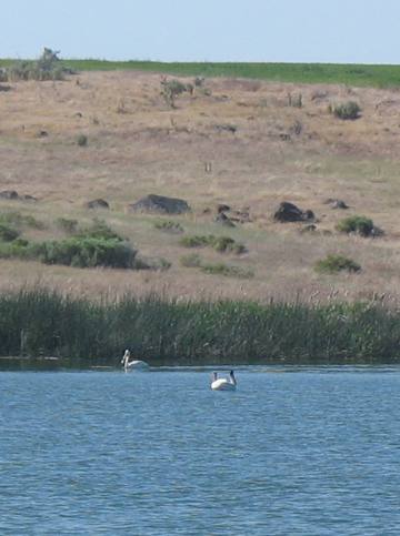
This is a good example of the lava rock that must be 100 feet or more deep in this area. The picture was taken from the south bank of the Snake River in the Milner area where wagon trains on the Oregon Trail would surely have stopped for the night with cool clear water available. White Pelicans in the Snake River
White pelicans doing what pelicans do on the Snake River.
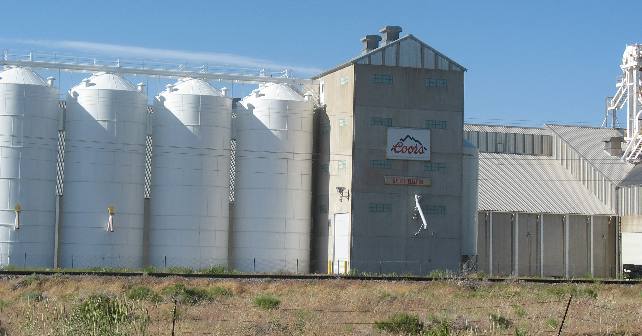
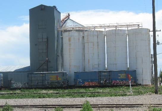
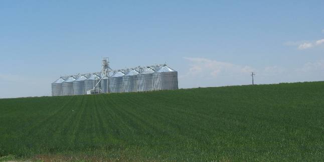
Coors Grain silo's in Southern Idaho west of Burley
Coors has a barley processing facility in Burley as well as this McCain food processor. The Coors barley will be shipped by rail to the Coors brewery in Golden, Colorado.
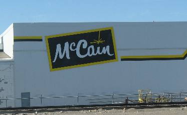
McCain potato processing plant west of Burley, Idaho
We are not familiar with the McCain brand name. Does anyone know what types of food products they specialize in? I received information from LeeAnn, my Canadian friend and proofreader, that McCain was a Canadian company specializing in frozen food products like French fries, potato nuggets and hash browns. Just guessing but they probably produce frozen potato products under "house-brand" names American .
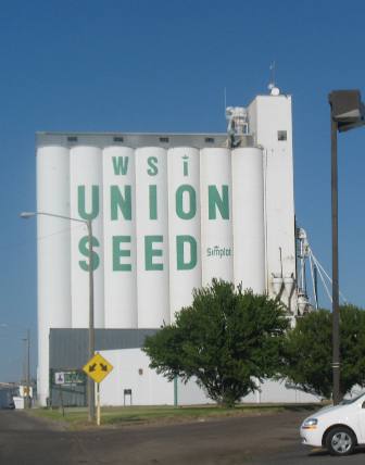
WSI Union Seed silos
Southern Idaho grain/bean storage
This is a familiar site in almost every town in southern Idaho. This is a grain/bean farming area.
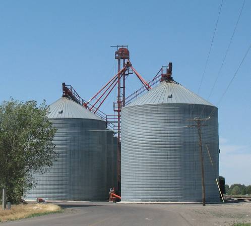
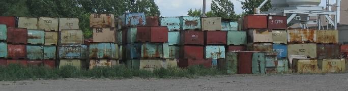
Bean shipping containers
We see these large bins stacked around many silos. Someone told us that beans were transported in them. Now I wonder what kind of beans. Does anyone know what type of bean is grown in southern Idaho? We did not see any beans growing. They may have been being planted and not up yet.
Southern Idaho grain elevators
Every small town in southern Idaho has several of these facilities.
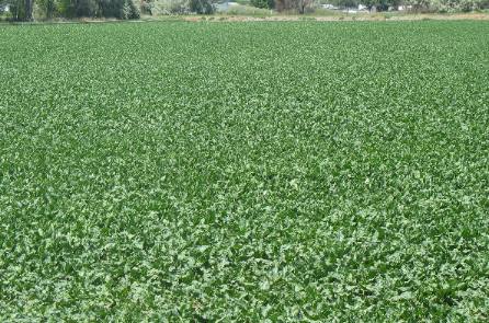
Southern Idaho sugar beets
Southern Idaho sugar beets
While we have not seen any processing plants we are seeing fields of sugar beets. In fact 10% of the farmed land may be planted in sugar beets. I do wonder where the processing plant is.
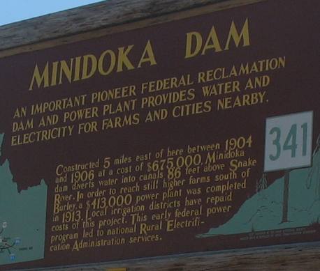
Minidoka Dam on the Snake River in Southern Idaho
As the United States expanded steadily westward, the desert of Idaho beckoned to creative minds. It was dry, dusty, and isolated, but some eager settlers believed the desert could be farmed. Only water and adventuresome farmers were needed to forge the way. In 1902, Congress passed the Reclamation Act, which opened the tap, and a new age of federal irrigation projects began. The U.S. Reclamation Service, the forerunner of the Bureau of Reclamation, helped the dream come true. The Reclamation Act of 1902 enabled the government to develop large reclamation projects, such as the Minidoka Project. Settlers received water for farming and repaid the cost of the project in a series of yearly payments. At the end of their term, the settlers would receive the land title and water right. Irrigation projects were constructed by the Reclamation Service. Minidoka Dam is a zoned earthfill dam 86-feet high creating Lake Walcott with an active storage capacity of 95,200 acre-feet of water. In 1904, the Secretary of the Interior authorized the Minidoka Project and the U.S. Reclamation Service began construction of Minidoka Dam. Within three years, water was delivered to he first irrigated farms. Construction of the dam was challenging. The area was isolated and all the materials were hauled by horse teams from the rail line at Minidoka, about 6-miles away. Difficult working conditions let to frequent labor and management disputes. During construction lived in a contractor's camp located on the north side of the current dam. The Reclamation Service knew that potential energy was locked inside the flowing water. To harness that energy, they built a hydroelectric powerplant at Minidoka Dam. Today, the plant stands as a symbol of early hydroelectric technology and its effect on the development of the region. The Minidoka power plant was featured in brochures that lured settlers to the area. The availability of electricity was the pride of settlers. Rupert was one of the earliest towns to be electrified, and displayed its streetlamps like a badge of honor. The thoroughly modern "Electric High School" was the first public building in the United States to be powered completely by electricity. ------ Now chew on that a small town in rural southern Idaho holds claim to having the "first" public building powered by electricity and it was the high school. Today, much of the electricity generated at the plant is used to pump water to irrigate lands on higher ground. Surplus power is sold to the local power company.
In 1904, prospective homesteaders began to flood into the area. For two and a half years, the rush continued until the good land was claimed. By 1919, there was a local population of 17,000. As homesteaders settled, little town sprung up practically overnight. Rupert, Heyburn, and Acacia were designed and platted by the Reclamation Service for the new settlers. One homesteader remembered: "eight months after, the site of Rupert was nothing but the sagebursh...there was a population of 400. Daylight to dark was filled with the incessant sound of hammering..."
Irrigation canal flowing off Minidoka Dam irrigation project
This is one of the irrigation canals flowing off the Minidoka Dam irrigation project as it looks today. Once the Minidoka Dam was completed, the region underwent a metamorphosis. Land that had been resistant to modern development was opened to settlement. A flood of eager settlers was lured by the availability of irrigated farmland. The early years were filled with hardships, but those sturdy enough to persevere, soon reaped their rewards. By 1915 the Reclamation Service Report boasted that "1915 was the most prosperous one that the farmers of the Project have ever experienced. Nearly all crops yielded a bountiful harvest and the prices have been good and often high...As a result of this prosperity, the banks of the Project were overloaded with money.
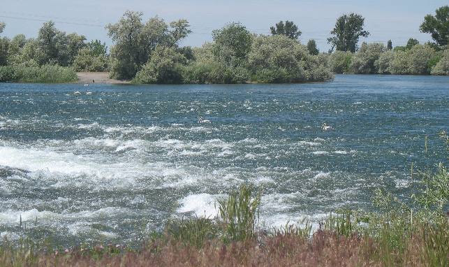
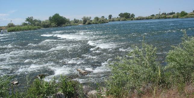
Rapids & Russian Olive trees below the Minidoka Dam on the Snake River
Rapids below Minidoka Dam & Power plant on the Snake River.
Rapids below the Minidoka Dam on the Snake River
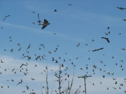
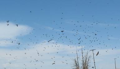
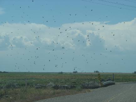
Cliff swallows over Minidoka irrigation canal in southeren Idaho
Cliff Swalows over Minidoka irrigation canal in Southern Idaho.
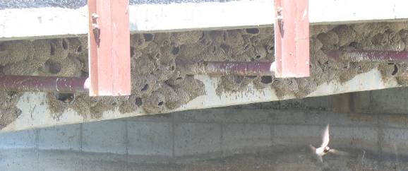
Cliff swallow nest under bridge over Minidoka irrigation canal in southern Idaho
On certain bridges crossing the irrigation canals we see large flocks of cliff swallows. They are building their mud nests under the bridge where they are protected from coyotes, foxes and other animals that would harm their young.
Large colony of cliff swallows
We are totally surprised by the large numbers of these cliff swallows that can be nesting under just one of these small bridges. Each bridge easily had over 100 birds nesting in the colony.
Cliff swallow nests under bridge over Minidoka irrigation canal
Cliff swallows congregated near their nesting site
Cliff swallows filling the sky above one of the bridges over an irrigation canal in southern Idaho.
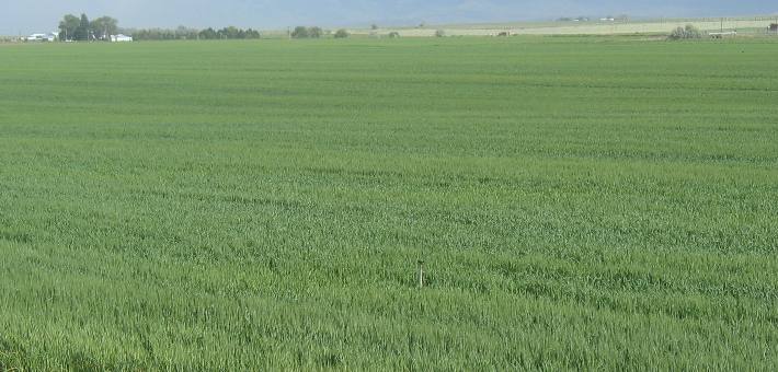
Irrigated grain in Southern Idaho
Grain is the predominant crop all of it made possible by the Minidoka Dam Irrigation Project that was constructed in the early 1900's.
Large grain elevator system in Southern Idaho
This is a familiar site along both sides of the Snake River downstream of the Minidoka Project where water is plentiful and turns the desert green.
Minidoka Internment Camp
This is all that remains of the old Minidoka Internment Camp where American Citizens of Japanese descent were interred during WWII. I had read that this was a "National Monument" but if it is there are no markings to indicate such. From what I have read this is one of the Internment Camps where American Citizens of Japanese descent were held during WWII. One area resident told us that some of them stayed in the area after the war and their relatives are still in the area.
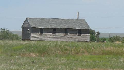
Barracks building from the Japanese Internment Camp
We were told by one area resident that after the War (WWII) that the government was still trying to attract people to this area and were giving away 160-acres of land with one of these buildings on it. That is supposed to be one of the old barracks buildings from the Japanese Internment Camp. The individual that was telling us about this said there was a lottery and those whose names/numbers were drawn received 160-acres with a building like this on it. I wonder if anyone knows anything about this. If one were to Google for information the nearest town is Eden, Idaho and the Internment Camp was Minidoka Internment Camp. If you find additional information please let me know. I would like to add the information to this travelogue.
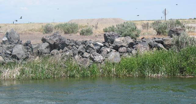
Lava Rocks lining Minidoka irrigation canal
Lava rocks like these line many if not most of the Minidoka irrigation canals in this area.
Sage brush and lava rock
Even if the government gave me 160-acres of this land I would not be confident that I could grow enough on it to feed my family. It looks like sage brush and lava rocks to me. But who am I!
Sage brush and lava rock
It seems to me that winning a lottery and winning 160-acres of this would be like getting a lump of coal in your Christmas stocking.
Where did the lava rocks go?
Land like that shown above can be made to look like this with a LOT of work and plenty of water.
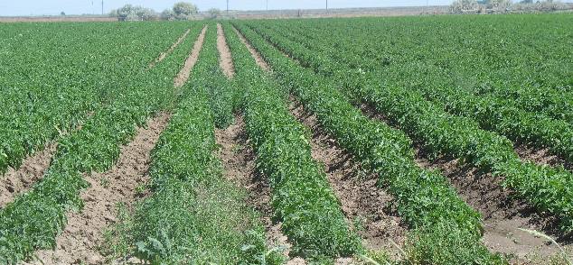
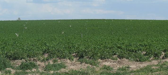
Idaho potatos
Potatos seem to occupy 20% of the available land.
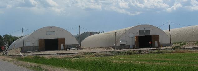
Potato storage barns
Potato storage barns. I think we saw these modern potato barns in Eden.
Potato field and sprinkler heads
More potatoes. Like grain fields they seem to stretch from horizon to horizon.
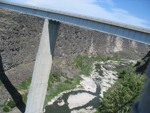
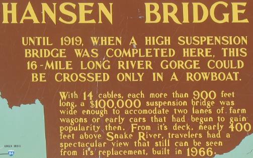
Hansen Bridge over the Snake River in southern Idaho
This is the new Hansen Bridge over the Snake River. And looking downstream from the bridge the gorge continues. Note that the wall of the Snake River Canyon is lava flow.
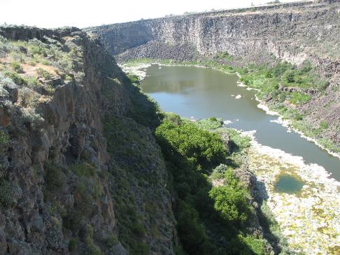
Snake River Gorge as veiewed from Hansen Bridge overlook in southern Idaho
Back in Burley 20-miles or so east of here there is no gorge. Gorges are created when the earth along existing flowing water begins to uplift. As the land uplifts water begins cutting through the hard lava rock. The gorge will get deeper and deeper as the uplift continues.
Do understand that the walls of the Snake River canyon that you see in this picture are lava rock.
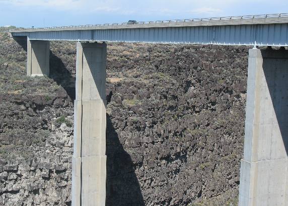
Hansen Bridge over the Snake River in southern Idaho
Hansen Bridge over Snake River Gorge in southern Idaho.
New Hansen Bridge over the Snake River Gorge in southern Idaho
From the viewing point I can not get the entire bridge support system in the picture. However, as the kiosk says it is 400' feet to the bottom of this river gorge.
The Snake River Canyon walls are solid lava rock.
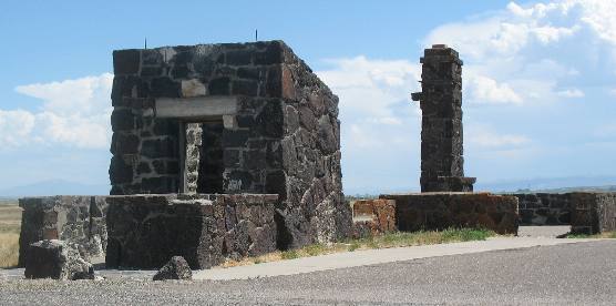
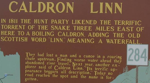
Caldron Linn on the Snake River
Caldron Linn is 10-miles upstream from this bridge on the Snake River and in this same gorge I would suspect.
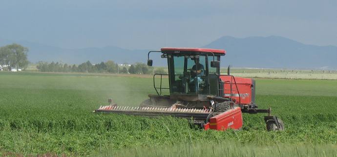
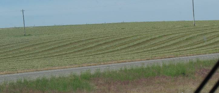
Cutting alfalfa hay
Alfalfa hay is another big crop in this area. This farmer is cutting his alfalfa.
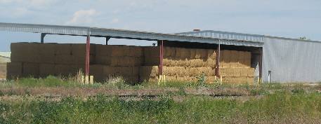
Idaho hay storage
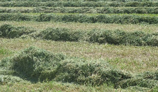
Cut hay drying in rows
This recently mowed alfalfa is drying before the bailing machines move into the field.
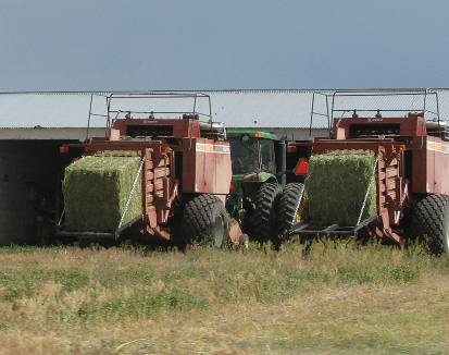
Two hay bailing machines about to "birth" a big bale of hay
Bailing machines about to deliver bales.
Drying rows of hay
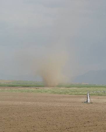
Southern Idaho dust devil
A cold front was coming through and with it the expected winds. We spotted this dust devil or small tornado snaking across some plowed fields. They are interesting to watch but do not seem to represent any real danger.
Click here for more Idaho travellogsUntil next time remember how good life is.
More Idaho AdventuresSome of our Miscellaneous Subjects ** More 2007 Travel Adventures
Mike & Joyce Hendrix
Mike & Joyce Hendrix who we are We hope you liked this page. If you do you might be interested in some of our other Travel Adventures: Mike & Joyce Hendrix's home page Travel Adventures by Year ** Travel Adventures by State ** Plants ** Marine-Boats ** Geology ** Exciting Drives ** Cute Signs ** RV Subjects ** Miscellaneous Subjects
We would love to hear from you......just put "info" in the place of "FAKE" in this address: FAKE@travellogs.us Until next time remember how good life is.
|
|
||

|
|||
|
|
|||
|
|
|||
|
|