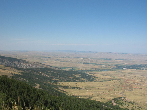
Eastern side of Big Horn Mountains on US-14 Sheridan, Wyoming part-2View from US-14 looking east at the plains from the Big Horn Mountains near Sheridan, Wyoming
We are out sight seeing on US-14 heading east out of Ranchester, Wyoming which is around 14-miles north of Sheridan We are climbing up into the Big Horn Mountains toward Burgess Junction where US-14 and US-14a divide. US-14 goes over Granite Pass and down Shell Canyon to Greybull, Wyoming. US-14a goes over Bald Mountain and down what the locals call "Oh, My God Hill" into Lovell, Wyoming. There is good reason the locals call 14a the "Oh, My God Hill" -- it is 10-miles of 10% grade followed by 4-miles of 8% grade. That should clearly explain the moniker. However, the pictures in this travel log are from the portion of US-14 between Rochester/Sheridan and US-90 west to Burgess Junction as US-14 climbs the eastern slope of the Big Horn Mountains. This section of US-14 consists of 11-miles of 5% to 6% grades and 30 to 40-mph curves. Then a little over 2-miles of grades that change from 6% to 2% then back to 6%. This is followed by 13-miles of 5% to 7% grades and many 25-30-mph curves. US-14 is a good two lane road with some stretches of 3-lanes. I stay off US-14 between I-90 and Greybull and or Lovell (across the Big Horn Mountains) with our motorhome. Folks with the experience and right equipment do take their RV's over the Big Horn Mountains on US-14. Others try and pay the price. You have been warned.
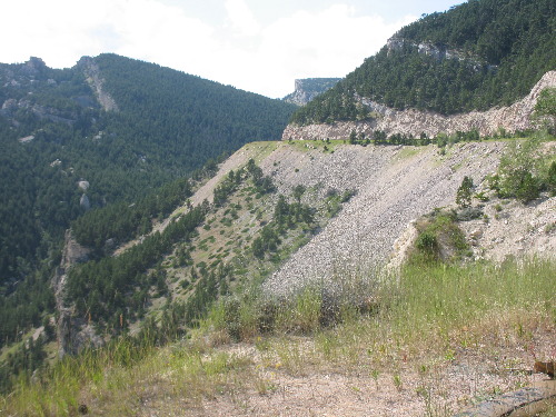
Geology visible from US-14 in the Big Horn Mountains near Sheridan, Wyoming
This is a view of the highly tilted sedimentary rock on the eastern slope of the Big Horn Mountains. I-90 around Ranchester, Wyoming (14-miles north of Sheridan) is around 3,763'. US-14 climbs 6,000' to Burgess Junction in the Big Horn Mountains. When the mountain building process was going on around 70-million years ago the Big Horn Mountains were pushed up around 9,000'. This is a view of the eastern edge of what was uplifted. What was once flat sedimentary rocks are now lying at a steep angle.
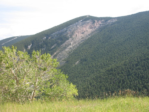
View of US-14 as it climbs the eastern slope of the Big Horn Mountains near Sheridan, Wyoming
This is a view of US-14 west of Sheridan, Wyoming as it climbs the eastern slope of the Big Horn Mountains. Note the steep slope of the sedimentary rocks on the mountain on the left side of this picture. Those are some awesome angles.
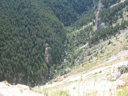
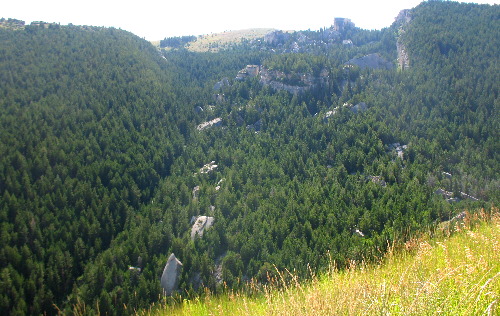
View of stream flowing below US-14 in the Big Horn Mountains near Sheridan, Wyoming
I can not actually see the stream but it is down there. Earlier today we took an awesome scenic drive through Tongue River Canyon near Daton, Wyoming. I thought this was the Tongue River but looking at a map doesn't back up that assumption. My maps say it is just a perennial stream. But back to that Tongue River Canyon, if you are in this are by all means take the time to do the Tongue River Canyon. It is a bucket list item for sure. Interesting geology exposed in US-14 road cut in the Big Horn Mountains west of Sheridan, Wyoming
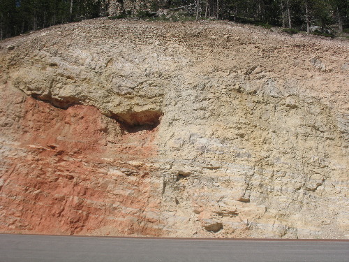
I wonder about sights like this. I can tell this is sedimentary rock. What I do not understand is the red part. It is out of place. I wonder if it might be metamorphic rock changed by perhaps steam or some other process. If you have information on what this picture is showing I sure would like to hear from you. Just put "info" in the place of "FAKE" in this address: FAKE@travellogs.us Awesome road cut on US-14 in the Big Horn Mountains west of Sheridan, Wyoming
This is another example of sedimentary rock that has been "altered" into possibly metamorphic rock. I can clearly see the change in color yet the strata of sedimentary rock continues across the color change. If you have information on what this picture is showing I sure would like to hear from you. Just put "info" in the place of "FAKE" in this address: FAKE@travellogs.us
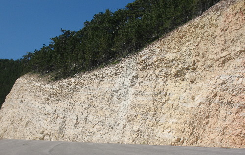
View of sharply tilted sedimentary rocks from US-14 in the Big Horn Mountains west of Sheridan, WY
This is just another view from US-14 in the Big Horn Mountains west of Sheridan, Wyoming.
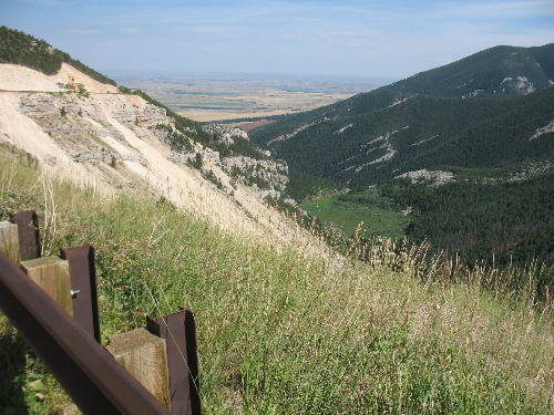
View from US-14 looking east at the plains from the Big Horn Mountains near Sheridan, Wyoming
We have climbed several thousand feet up the eastern slope of the Big Horn Mountains in this picture. This is a view of the eastern Wyoming plains between Sheridan and the Montana Border. I-90 is out there somewhere. Absolutely spectacular eye candy. Joyce took this picture from a pull out viewing area on US-14 between Ranchester, Wyoming on I-90 and Burgess Junction deep in the Big Horn Mountains.
Click here for some Colorado travellogsUntil next time remember how good life is. More Wyoming AdventuresSome Idaho Adventures ** More 2014 Travel Adventures
Mike & Joyce Hendrix
Mike & Joyce Hendrix who we are We hope you liked this page. If you do you might be interested in some of our other Travel Adventures: Mike & Joyce Hendrix's home page Travel Adventures by Year ** Travel Adventures by State ** Plants ** Marine-Boats ** Geology ** Exciting Drives ** Cute Signs ** RV Subjects ** Miscellaneous Subjects
We would love to hear from you......just put "info" in the place of "FAKE" in this address: FAKE@travellogs.us Until next time remember how good life is.
|
| ||
|
| |||
|
| |||
|
|