Walters Ferry on the Snake River in Idaho
June 10, 11,12 & 13 2007.
We are staying at Garrity
RV Park in Nampa 10-miles west of Boise.
It was $21 per-night for FHU & Cable while every place else in
the area seemed to start at $26 and rapidly go up. Garrity was just
fine. It was clean, well managed, the sites were close but we were
not there and didn't go outside except when heading to and from the
automobile. There was a good number of permanent or long term in the
campground but they were being managed properly thus were no problem.
We would stay at Garrity again but those that like to spend the day
and evening under the awning sipping cool ones might rather be in
one of the other area parks. N43° 35.245' W116° 31.592'
We headed west of Boise to the
Raptor Center. While we didn't take a lot of pictures in the Raptor
Center it was what we expected and is worth a visit when you visit
Boise.
Our next journey took us to Eagle Island State Park located in Eagle
a small community 10-miles north of Boise.
Usually State Parks feature unique historic places or geological places
of wonder. Eagle Island turned out to be nothing more than local swimming
hole on a piece of property donated to the State of Idaho by a local
farmer. This became another strike for the Boise
area as visiting Eagle Island State Park was a total waste.
Ok, there is a scenic drive beginning in Eagle and heading north
through Emmett and points north. This scenic drive was suppose to
be a drive through fruit orchards. From Eagle to Emmett we did not
see the first orchard. Well, we didn't see an orchard until we got
to a scenic overlook above the Payette Valley where Emmett is located.
So much for that stretch of scenic drive through fruit orchards. It
was nothing more than desert. It is beginning to seem that nothing
in the Boise area is as tourist
information suggests.
Pearl, Idaho Gold Mines
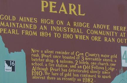
At the overlook above the valley surrounding Emmett we read about
the gold mine at Pearl 10-miles or more east of here in the mountains.
Freezeout Hill near Boise
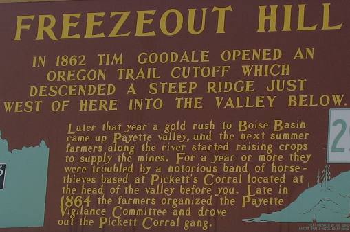
This kiosk was also at the pullout and was about happenings in the
well watered Payette Valley where Emmett is located.
After visiting Emmett we decided that this was NOT going to be the
route we would be taking north. Things were just not as portrayed.
It does appear that orchards may become more prevalent north of Emmett.
Wednesday found us scouting areas to the south and west of Nampa
(Boise). We took SR-45 southwest
out of Nampa heading to the Snake
River and the historical site of Walters Ferry.
For fifty years from 1863 an important link in the Boise-San
Francisco stage route.
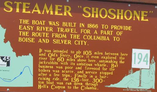
At the site of Walters
Ferry we were able to learn about this steamer on the Snake
River that did not make a go of it. I bet that was one hair-raising
ride through Hell's
Canyon to the Columbia River.
Walter's Ferry Museum
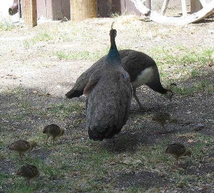
At the Walter's
Ferry site an individual has developed a "menagerie"
for lack of a better term. Museum might describe a portion of what
is there but smorgasbord would be a better description. When you arrive
at the Snake
River on SR 45 proceed to the store/gas station on the north
& east side of the river. As you pull into the store notice that
there is a small road leading to the river, take it as if you were
going to the river. As you near the river you can turn to your left
where there will be a parking lot.
If you are in an RV I would leave in at the top of the hill in the
parking lot around the gas station. It is a very short walk down to
the Snake
River and everything available at the museum/menagerie.
Basalt
near Walter's Ferry
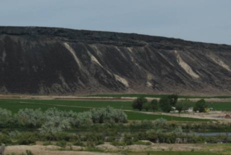
A thin layer of basalt
covered this mesa. As the basalt
weathers it crumbles and falls down the face of this cliff it created
a "dark-face" on the otherwise light colored sediments.
Givens Springs north of Walters Ferry
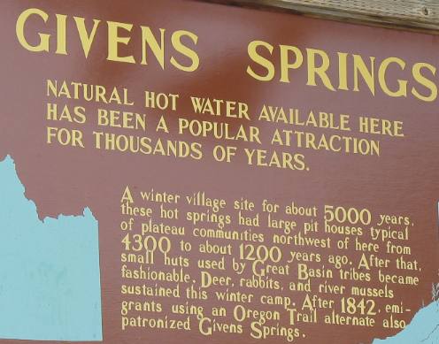
Givens
Springs was located on the west side of the river. If we were
doing the drive again we would take the east side of the river from
Walters
Ferry (at the Snake
River Bridge on SR 45) to Marsing, OR. (SR 45 Bridge on the
Snake
River) on Map Rock Road.
Bales of alfalfa north of Walter's Ferry, Idaho
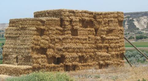
Bales of hay along the Snake
River Valley between Walters
Ferry and Marsing.
Mowing alfalfa hay north of Walters Ferry
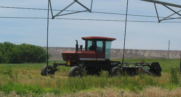
Irrigated hay fields make up the vast majority of farming in this
region.
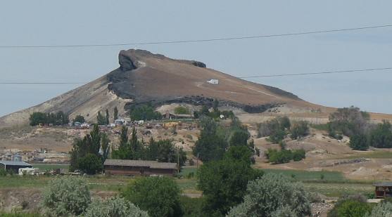
This is an interesting piece of geology. Note the thin lava
rock
cap overlying softer sedimentary layers. Also note the uplift
on the left side pushing the original flat landscape to what looks
like a 45-degree angle.
Froman's Ferry
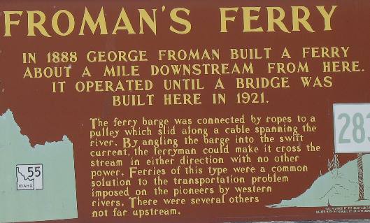
This kiosk was located near the SR 55 bridge over the Snake
River in Marsing. The sign was located on the Idaho
side of the bridge.
Great Egret
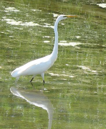
This great egret was fishing in a small pond near the bridge in Marsing
It is amazing to us to see this bird so far north. They are very common
in Florida and Louisiana
swamp areas.
Peach orchard Marsing, Idaho
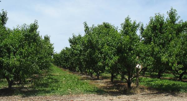
Marsing had some peach orchards.
Irrigated corn field west of Boise, Idaho
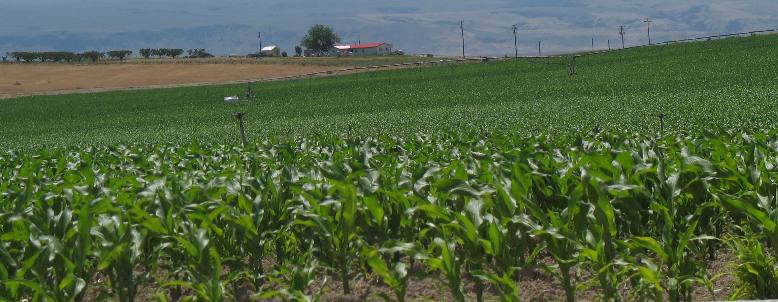
But large fields of corn seem to have replaced the more common hay
fields.
Until next time remember how good life is.
Mike & Joyce Hendrix
Mike & Joyce Hendrix

Mike
& Joyce Hendrix who we are
We hope you liked this page. If you do you might be interested in
some of our other Travel Adventures:
Mike & Joyce Hendrix's home
page
Travel Adventures
by Year ** Travel
Adventures by State ** Plants
** Marine-Boats
** Geology ** Exciting
Drives ** Cute Signs
** RV
Subjects ** Miscellaneous
Subjects
We would love to hear from you......just put "info" in
the place of "FAKE" in this address: FAKE@travellogs.us
Until next time remember how good life is.


