|
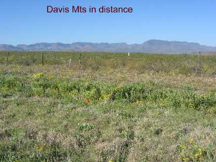
Places Visited: Saturday, April 9 Balmorhea State Park --------Balmorhea, Texas $18-50-amp paved interior streets and pads N30° 56.675' W103° 46.965'. Landscape between Balmorhea and Fort Davis with Davis Mountains in background
This was a day to explore in our Saturn. Fort Davis is just 39-miles south of Balmorhea and we wanted to do the scenic loop west of Ft. Davis. To get to Fort Davis from Balmorhea you go south on SR-17. Shortly after leaving Balmorhea we abruptly exit the limestone geology we have been traveling on through much of Texas. Joyce took this pic not far from Balmorhea as we headed to Fort Davis.
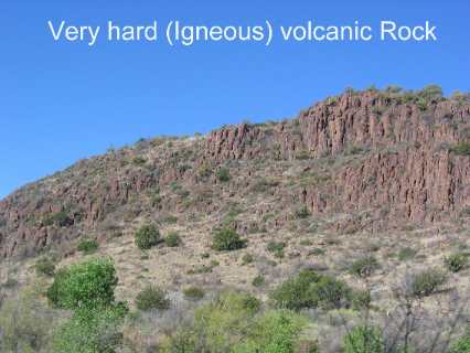
Thick lava flow visible as we near the Davis Mountains
To get to Fort Davis we have to go over the Davis Mountains and their volcanic geology. Thirty million years ago volcanic activity in this area caused molten magma to bulge into the existing limestone crust. On the way to the surface this molten magma pushed up the limestone crust causing cracks and fissures that the molten magma flowed into. Much of the magma cooled and hardened before reaching the earth's surface forming a certain type of rock. Hot molten magma making contact with the limestone crust created a variety of metamorphic rocks that are made by subjecting sedimentary rocks to enormous pressure and heat. As we head into the Davis Mountains we can see anticlines created when sedimentary rocks normally laying horizontally layer upon layer are pushed up at 45-degree angles by the encroaching magma from deep within the bowls of the earth. Then the limestone disappears for the most part and we are in the mountains and volcanic or igneous and metamorphic rocks. The temperature quickly cools and the vegetation changes. The Davis Mountains cause moist westerly winds to rise in order to get over them. In doing so the moist air cools and drops the moisture in the mountains. In the lower areas oak trees and cotton woods are dominant. As we gain altitude we start to see a variety of evergreens, alligator junipers and pinion pines.
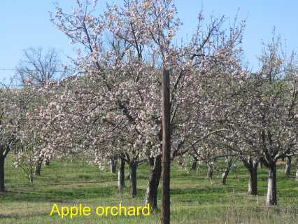
Apple orchard south of Fort Davis
Ten miles or so south of Ft Davis we traversed a peaceful valley with a large apple orchard in full bloom. We had to stop and take this pic.
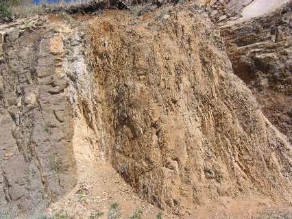
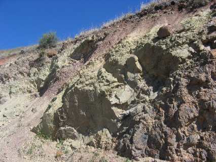
Geology in a road cut near the McDonald Observatory in the Davis Mountains west of Fort Davis, Texas
Near Fort Davis we turn west on SR-118 and head toward the McDonald Observatory. We continuously climb as we head away from civilization and the mountain where McDonald Observatory is located. The road cuts along this road are an interesting variety of geological occurrences that make me wish we had a geologist with us. We are using Texas Roadside Geology as a guide, and it is good, but I want to ask so many questions. What caused that? Is that volcanic ash? Why is it green? Why is that red? What are those white crystals? One road cut at the entrance to the Visitors Center for McDonald Observatory could occupy an entire geology class. Everything in the world is happening in this road cut.
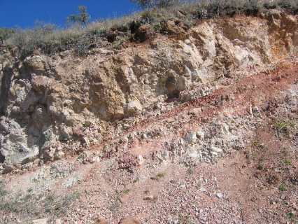
Geology in a road cut near the McDonald Observatory in the Davis Mountains west of Fort Davis, Texas
This is more of that road cut at McDonald Observatory. Some of it is volcanic ash while other rocks are different forms of molten/gaseous lava that cooled & hardened over various lengths of time thus becoming different types of rocks.
Geology in a road cut near the McDonald Observatory in the Davis Mountains west of Fort Davis, Texas
This is more of that spectacular road cut at McDonald Observatory. A lot was happening here 35-million years ago when this area was experiencing a volcanic orgy. From McDonald Observatory SR-188 descends to the western side of the Davis Mountains where we turn south on SR-166 as we traverse huge remnants of the volcanic history of this area. Once we get to the southern edge of the Davis Mountains SR-166 turns back to the east following the old Stage Coach trail back to Ft Davis. In the days prior to our modern highways people heading west pulling wagons and stage coaches had to avoid going over the Davis Mountains. That meant following the eastern edge of the mountains until they got to Ft. Davis on the southeastern corner of the Davis Mountains then they could once again head west without negotiating the steep mountains.
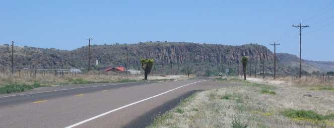
Molten lava created this wall of columnar jointed basalt
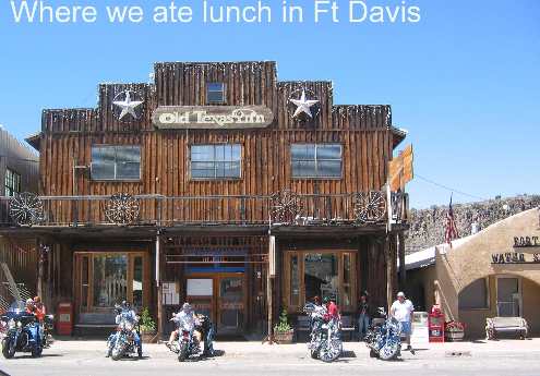
Joyce took this pic looking north toward Fort Davis and the mountains that the wagon trains had to go around when heading west from San Antonio to San Diego. Fort Davis sits at the bottom of that cliff. The geology of the cliff is the same volcanic material that made Devils Tower in North Eastern Wyoming. The molten magma cooled slowly deep underground. Now the edges are forming columns with 5 or 6 sides. It is so spectacular to look at and wonder about. This formation of lava is called columnar jointed basalt. Fort Davis was strategically located to protect the stage lines, westward bound settlers and freight haulers from Indian Attack and desperadoes lurking in the area that would otherwise prey on the unsuspecting. The last Indian attack in the area was in 1890. After that the Fort was abandoned. Today I-10 zooms across the Davis Mountains like they aren't even there but making that path took a lot of dynamite and huge machinery. In the old days they had to go around. Now you know the significance of Fort Davis. Joyce wanted to dine at the Hotel Limpia in Fort Davis but it is only open for dinner and we were there for lunch. Grumpy was disappointed or I should say Sweet Thing became GRUMPY. When she has something like that on her mind you don't want to be around when it doesn't work out. Thankfully, everything worked out because we dined at the Old Drug Store across the street from the Limpia and it had good food and the ambiance that she was looking for at the Limpia. Old Texas
Inn in Fort
Davis, Texas
The old Drug Store in Ft Davis where we had lunch. Note it is NOT where Joyce wanted to have lunch. We enjoyed it just the same. We shared the restaurant with a large group of Harley Bikers from a club in Houston. They had trailered their bikes out here for a big get together riding over the scenic roads that Joyce and I traveled earlier today. They were all around us as we did the scenic drive. I think they were enjoying the scenic drive more than we were if that is possible. Click here for more Texas travellogsUntil next time remember how good life is. Texas AdventuresAdventures by State ** 2005 Travel Adventures
Mike & Joyce Hendrix
Mike & Joyce Hendrix who we are We hope you liked this page. If you do you might be interested in some of our other Travel Adventures: Mike & Joyce Hendrix's home page Travel Adventures by Year ** Travel Adventures by State ** Plants ** Marine-Boats ** Geology ** Exciting Drives ** Cute Signs ** RV Subjects ** Miscellaneous Subjects
We would love to hear from you......just put "info" in the place of "FAKE" in this address: FAKE@travellogs.us Until next time remember how good life is.
|
| ||
|
| |||
|
| |||
|
|