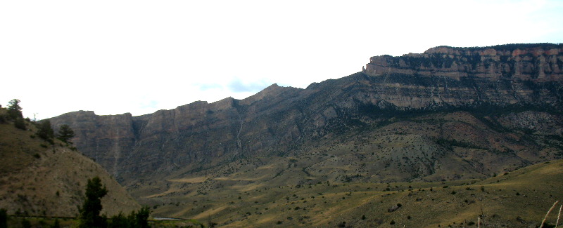
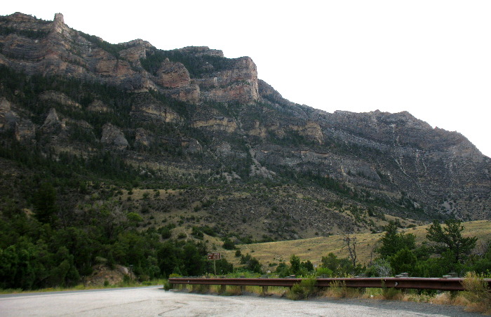
Shell Canyon in Big Horn Mountains of WyomingNorthern wall of Shell Canyon taken on US-14 from around Shell Falls in the Big Horn Mountains
How beautiful is this view! This is a good view of how over 9,000-feet of sedimentary rock was thrust upward in the mountain building process some 70-million years ago. Even casual observers can see how the horizontal layers of sedimentary rock were thrust up and broken. You can see where cattle, elk, deer, sheep and other wildlife move from the Big Horn Basin to the highland in the Big Horn Mountains. Cattle as well as wildlife spend the winter in the valley and summers at higher elevations. They all make their journey to and from the basin via the same trails. Southern wall of Shell Canyon taken from US-14 from just below Shell Falls in the Big Horn Mountains
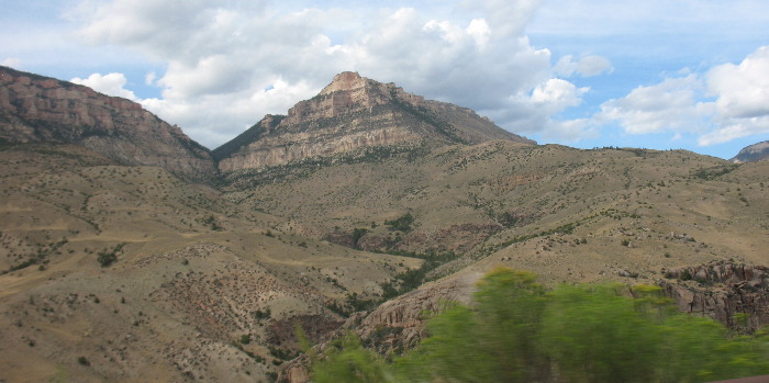
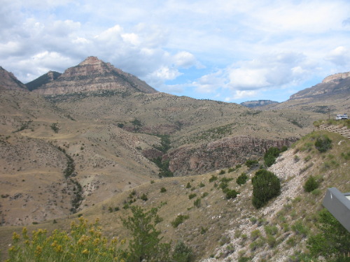
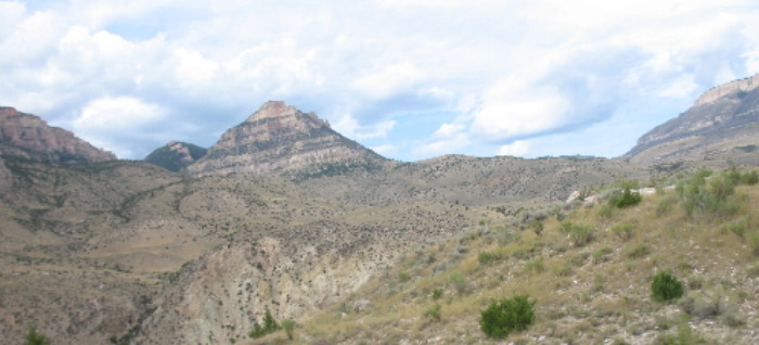
This view of the southern wall of Shell Canyon shows the western exposure of the Big Horn Mountain Range. Even the most casual observer can see where the layers of sedimentary rock closest to us have been thrust much higher. Notice how those layers of sedimentary rock fall at around a 45-degree angle toward the Big Horn Basin floor. Pyramid Peak viewed from US-14 in the Big Horn Mountains in Shell Canyon near Shell Falls
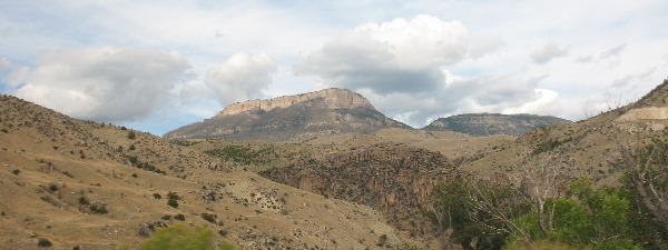
The triangle-shaped mountain is Pyramid Peak. It is comprised of layer upon layer of sedimentary rock. You can distinguish each layer of sedimentary rock by the distinct horizontal lines. Pyramid Peak viewed from US-14 in the Big Horn Mountains in Shell Canyon near Shell Falls
The triangle-shaped mountain to the left is Pyramid Peak. At the bottom of Shell Canyon, Shell Creek flows as it has for the last million years, continuing to cut through these sedimentary and igneous rocks, deepening the canyon. Shell Canyon was formed by this gradual process of stream erosion, cutting through layers of limestone, siltstone, shale, dolomite, and granite. The rolling landscape at the base of the cliffs was formed by slumping, the mass movement of soil and rocks from the cliffs into the Big Horn Basin.
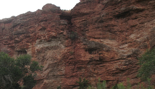
Southern wall of Shell Canyon taken from US-14 somewhere below Shell Falls in the Big Horn Mountains
This is a spectacular view of the southern canyon wall in Shell Canyon with millions upon millions of years of sedimentary rock rock exposed.
View from Shell Canyon taken from US-14 from below Shell Falls in the Big Horn Mountains
So much eye candy. In this picture deep inside Shell Canyon on US-14 in the Big Horn Mountains of Wyoming we are looking at millions upon millions of years of sedimentary rock exposed and tilted in at amazing angles. In the mountain building process the Bighorns were uplifted beginning approximately 70 million years ago. The Big Horn Mountains consist of over 9,000-feet of sedimentary rock strata laid down before mountain-building began: these sedimentary rocks are predominantly marine and near-shore sedimentary layers that are often rich in fossils. Take a minute, if you will, to let your mind contemplate how over 9,000-feet of sedimentary rock was slowly lifted several thousand feet. Just imagine all the cracking and bending that took place. What we see in this picture is a snapshot of the result. Totally awesome.
View from inside Shell Canyon as seen from US-14 in the Big Horn Mountains
As you can see Shell Canyon is one awesome view after the other. It is indeed a geological paradise!
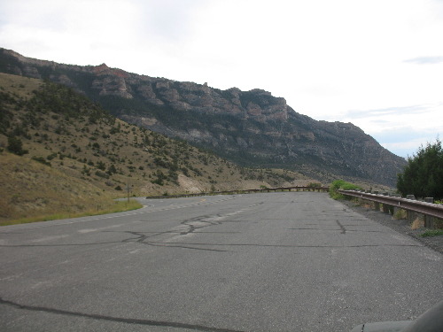
Northern wall of Shell Canyon taken on US-14 from the western end of the canyon in the Big Horn Mountains only a few miles east of Shell, Wyoming
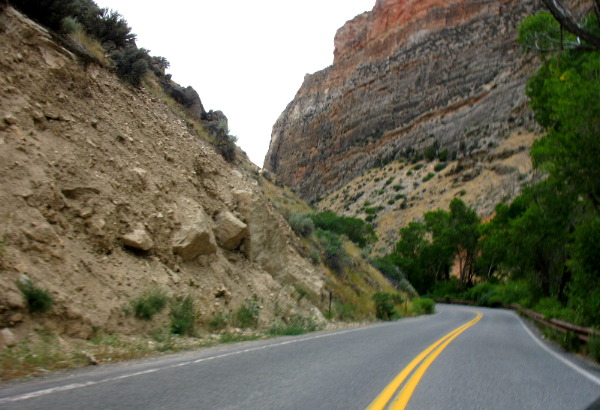
We are very near the western side of Shell Canyon and approaching the small town of Shell, Wyoming in this picture. We are headed west on US-14 as we leave the Big Horn Mountains. Shell Creek is flowing beside US-14 as we squeeze through this narrow section of canyon. The bright green trees are watered by Shell Creek. Away from Shell Creek things turn arid quickly.
Clastic dike captured in northern wall of Shell Canyon as seen from US-14 in the Big Horn Mountains
You probably don't see anything but a canyon wall. However with a more detailed look at that canyon wall you will note horizontal lines in the rock and different shades and colors in that canyon wall. The horizontal lines tell you that it this is sedimentary rock laid down over millions and millions of years. Now look in the center of the picture and you can see a CRACK. That crack was created when the mountain building process took place that lifted the Big Horn Maintains thousands of feet above the existing terrain. In the lifting process the sedimentary rock cracked as it was thrust upward over millions of years. Now you know how and why that crack occurred. At the same time the crack was occurring debris began to fill that crack. The debris that filled the crack is called "clastic". Clastic is a geological term to describe fragments, or clasts, of preexisting minerals and rock. Thus clast is a fragment of other rocks -- chunks and smaller grains of rock broken off other rocks by physical weathering. So a clastic dike is created when a crack is filled by "clast" or chunks and pieces of smaller rocks. Now, look at the center of this picture and locate the vertical crack that has been filled with clast. You can spot where the light colored rock ends and you can see where the horizontal lines disappear when they hit that "crack" that has been filled with clastic. That formation is now defined as a clastic dike by geologist. Click here for some Colorado travellogsUntil next time remember how good life is. More Wyoming AdventuresSome Idaho Adventures ** More 2014 Travel Adventures
Mike & Joyce Hendrix
Mike & Joyce Hendrix who we are We hope you liked this page. If you do you might be interested in some of our other Travel Adventures: Mike & Joyce Hendrix's home page Travel Adventures by Year ** Travel Adventures by State ** Plants ** Marine-Boats ** Geology ** Exciting Drives ** Cute Signs ** RV Subjects ** Miscellaneous Subjects
We would love to hear from you......just put "info" in the place of "FAKE" in this address: FAKE@travellogs.us Until next time remember how good life is.
|
| ||
|
| |||
|
| |||
|
|