Idaho's Clearwater RiverIdaho's Clearwater River
June 27, 2007 We are staying at: Hells Canyon Resort in Clarkston, Washington. Hells Canyon Resort is a top notch RV-Resort at $30 per-night with cable and wifi; FHU totally paved interior roads and pads.
Today we are going to head east on US 12 to the small town of Greer where we are going to turn onto SR 11 and head out to Weippe another small community with tremendous history.
On our way east on US 12 we stopped at several historic sites, provided by the state of Idaho, to help us better understand area history.
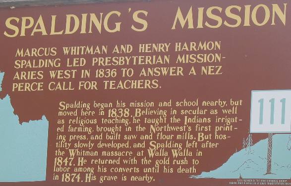
Spalding's Mission
Whitman and Spalding were the ones that proved that wagons could indeed cross North America and women could make the trip as well. Spalding began his missionary work in this area, about 20-miles east of Lewiston, Idaho.
If Marcus Whitman and Spalding's names don't yet ring a bell think of them this way. They were the ones that blazed the Oregon Trail. Someone had to go first. They are those someones.
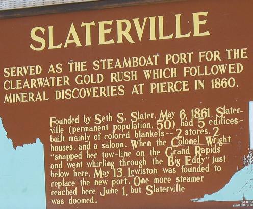
Slaterville, Idaho on the Coldwater River
Slaterville is/was a named community that never really got of the ground. Seth S. Slater founded the city in the hopes that it would be the port used to supply equipment and food to the expanding population gathered on the Coldwater River upstream of this spot by the Coldwater Gold Rush circa 1861. Slaterville was almost immediately abandoned in favor of a better location downstream where current day Lewiston, Idaho is located.
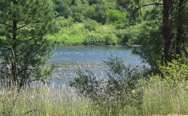
Clearwater River at the site of old Slaterville
It is so hard to comprehend a steamboat operating in a river this shallow. I seem to remember that early steamboats were propelled not by propellers but paddle wheels and I just can't see anything propelled by paddle wheels operating in this shallow rock strewn river. Whatever they got this far with what had to be shallow draft vessels. Also according to the kiosk they didn't make but a few trips this far up river before deciding Lewiston was the more appropriate place to stop their upriver journey.
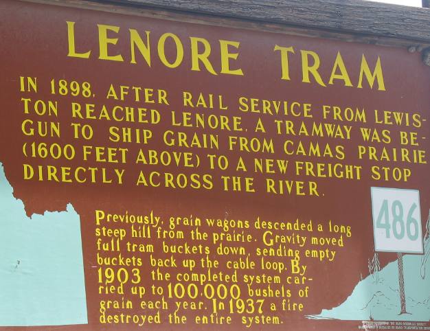
Lenore Tram
Quickly, let me explain where we are. We are driving along the Clearwater River. Think about the Clearwater River like it was the Colorado River ---- as the Colorado River flows through the Grand Canyon. Just like the Colorado River has cut a deep chasm in the surrounding countryside so has the Clearwater River. The Clearwater River has cut a 1,000' to 2,000' chasm in the surrounding plateau. To the south of the River lies the Camas Prairie and to the north lies the Palouse Prairie. Both areas are some of the most fertile grain growing regions anywhere. Now I hope you can understand why this tram was necessary. The Camas Prairie is over a thousand feet above the river valley possibly two-thousand feet but most likely some where in between. That difference in elevation is really steep. In 1898 these people devised a tram to transport grain from the prairie down that steep grade to the rail line along the river. How ingenious!
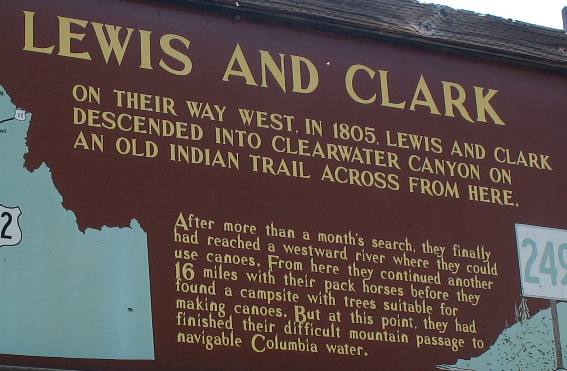
Where Lewis & Clark returned to traveling in canoe's to complete their westward journey
Not far east of that tram we stopped to read this historical kiosk. For those who have read about Lewis and Clarks Corps of Discovery you will recall how important this area was on their transcontinental journey.
The mission of the Corps of Discovery was to locate a water route across the continent. After traveling to the headwaters of the Missouri River, then crossing the Bitterroot Mountains on foot this is where the Corps of Discovery again took to the water to complete their journey to the Pacific Ocean.
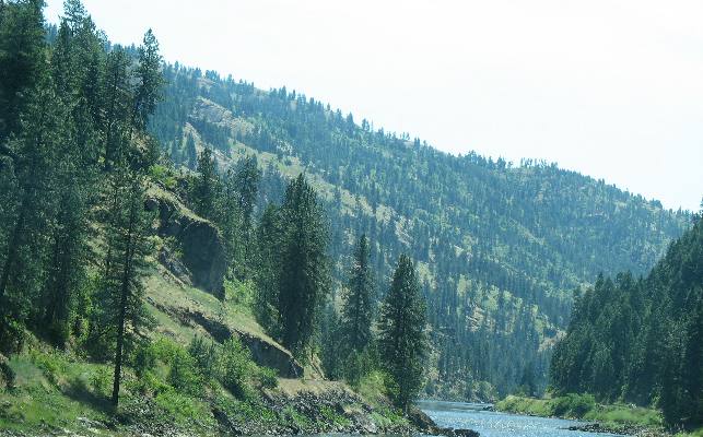
Hill leading from Weippe Prairie to Clearwater River used by Lewis & Clark
This is the hill Lewis & Clark came down. The Weippe Prairie is on the plateau at the top of this steep grade. Lewis and Clark have come from the Weippe Prairie down this grade where they constructed canoes and continued their journey to the Pacific Ocean.
We continued our journey along the Clearwater River until we got to the small community of Greer. At that point we turned east on SR 11 and headed to Weippe the historic place on Lewis and Clarks epic journey where they met a band of Indians that fed them when they were starving.
Once we climb up the canyon wall to theWeippe Prairie Plateau we are greeted with breathtaking scenery, complete with numerous hills, mountains, forests and valleys to delight any photographer. There are plenty of historic sites to experience, including the site where the starving Lewis and Clark Corps of Discovery met the Nez Perce Indians on the Camas Prairie after crossing the terrible Bitterroot Mountains.
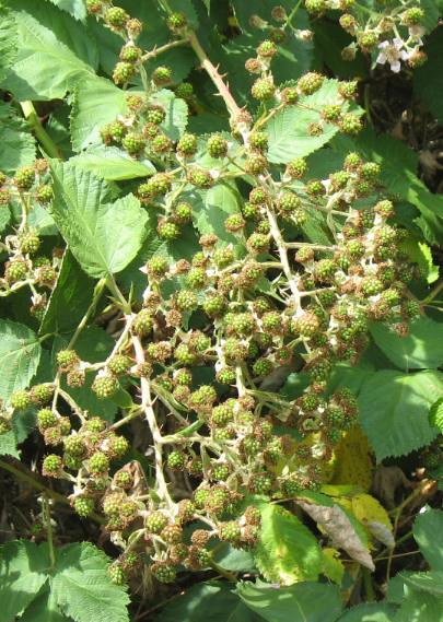
Idaho Black Berries
While we are discussing good berries this area is absolutely full of blackberries. Blackberry thickets full of white flowers can be found along almost any roadside. In the southeast US where we are from blackberry bushes are relatively small and hug the ground. In Idaho the bushes are up to 10 feet tall and have hundreds if not thousands of berries. Within a few weeks all these berries will be ripe.
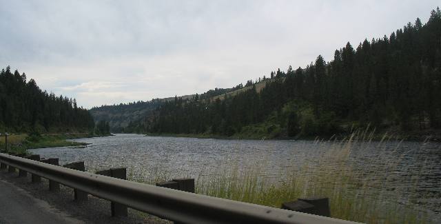
Clearwater River in Idaho
Joyce took this last picture of the Clearwater River as we were returning to our motorhome.
Click here for more Idaho travellogsUntil next time remember how good life is.
More Idaho AdventuresSome of our Miscellaneous Subjects ** More 2007 Travel Adventures
Mike & Joyce Hendrix
Mike & Joyce Hendrix who we are We hope you liked this page. If you do you might be interested in some of our other Travel Adventures: Mike & Joyce Hendrix's home page Travel Adventures by Year ** Travel Adventures by State ** Plants ** Marine-Boats ** Geology ** Exciting Drives ** Cute Signs ** RV Subjects ** Miscellaneous Subjects
We would love to hear from you......just put "info" in the place of "FAKE" in this address: FAKE@travellogs.us Until next time remember how good life is.
|
|
||

|
|||
|
|
|||
|
|
|||
|
|