July 6, 2007.
Passport America - Discount
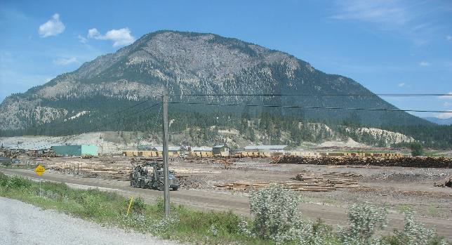
Camping ClubHuge lumber mill near Canal
Flats, British Columbia

We
are on PH 93/95 somewhere near Canal Flats a small community north of Fort Steele.
This is one of several large lumbermills in the area.
This
is lumber country now but back in the 1860's this was a a gold mining area.
The
Wild
Horse Trail led into the gold fields of Canada
from Hope,
Idaho. There was a large movement of men and pack animals along the Wild
Horse Trail until the gold rush ceased around 1880.
The
Wild
Horse Trail originated around Hope,
Idaho east of Sandpoint
passing through Bonner's
Ferry and on into the Gold Mines around Wild Horse Creek in Canada.
Fort Steele is the town that remains after the goldmines around Wild Horse Creek
played out.
In 1864 the Kootenay Gold Rush began. Gold
was discovered on Wild Horse Creek, a small stream which flows into the Kootenay
River just south of present-day Fort Steele. The creek quickly became
the centre of the Kootenay Gold Rush. The makeshift town of Fisherville was started
on the west bank, and by the end of the season it boasted six general stores,
four saloons, a brewery, two butcher shops, a blacksmith’s shop, and a large
number of miners’ cabins. John Galbraith began a ferry service across the
Kootenay River just north of
the confluence of Wild Horse Creek and the Kootenay
River, on the site of the current town of Fort Steele.
By 1865
the Kootenay Gold Rush had reached its peak, the decline of the diggings soon
became apparent. At Wild Horse Creek, the Victoria Ditch was completed and supplied
water to placer claims located high off the creek bed (this ditch can still be
seen today). Hydraulic
mining was introduced in an attempt to recover deeply buried deposits
more efficiently. Peter O’Reilly replaced Haynes as the Gold Commissioner
and the Dewdney Trail, extending from Hope to Wild Horse Creek, in Canada
was completed, providing a direct link with the colonial capital at New Westminster.
Fisherville was demolished because it sat on some of the richest claims, and the
community of Wild Horse was established further up the bank. In case you are trying
to where the Dewdney Tail was located think of it stretching across southern British
Columbia along what is now the Crows
Nest Highway. Hope was Fort Hope located east of Vancouver and Wildhorse
Creek was in the foothills of the Rocky Mountains in southeastern British
Columbia a bit south of Radium
Hot Springs.
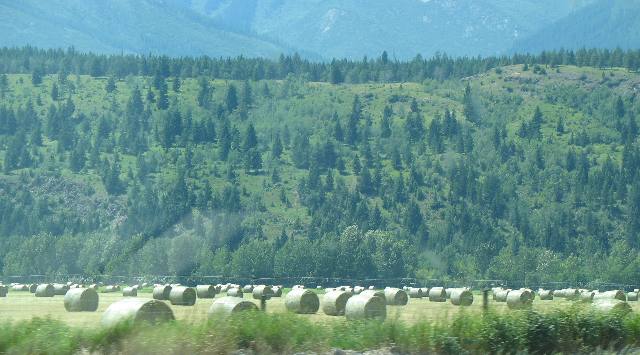
Large hay operation around Fort Steele in southeastern
British Columbia

This
is a large hay operation but there are not nearly as many hay operations along
this route.
Until next time
remember how good life is.

Mike
& Joyce Hendrix who we are
We
hope you liked this page. If you do you might be interested in some of our other
Travel Adventures:
Mike &
Joyce Hendrix's home page
Travel
Adventures by Year ** Travel
Adventures by State ** Plants **
Marine-Boats ** Geology
** Exciting Drives ** Cute
Signs ** RV
Subjects ** Miscellaneous
Subjects
We
would love to hear from you......just put "info" in the place of "FAKE"
in this address: FAKE@travellogs.us
Until next time remember
how good life is.