Crowsnest Pass and Frank SlideJuly 10, 2007. We are staying in the campground at The Great Canadian Barn Dance in Hillspring, Alberta. The campground is a PPA park $12.50 weekdays with no discount on weekends thus $25 for 30-amps and water. We located this place 6-years ago and had a good time at the Barn Dance, this time we decided to stay at their campground. These are great people. If you are looking for the Great Canadian Barn Dance and Campground it is located at: N49° 20.635' W113° 36.972' for those of you not into GPS drive 14-miles south of Pincher Creek on PH 6, then turn east on PR 505 and go another 14-mles where you will see the signs for the Great Canadian Barn Dance. Turn north on that road the Great Canadian Barn Dance will be less than 3-miles up that road, on the west side.
For those of you that are not familiar with PPA
(Pass Port America) it is an organization
you can join for less than $50 per-year. Campgrounds that belong to PPA offer
1/2 price discounts. That kind of savings can quickly add up. While participating
PPA parks generally have some restrictions on dates the PPA offer is valid, or
possibly days of the week the discount is valid, or perhaps the number of days
that the PPA discount will be honored the discount is genuine. Many times PPA
campgrounds are new campgrounds that need help in getting established. Other times
PPA campgrounds may be on the outskirts of town instead of in the "prime"
location thus they need to provide an incentive for campers to stay with them.
Whatever the reason PPA campgrounds generally provide a much cheaper option. PPA
is the only campground organization that I think is worth the cost. PPA does not
have a gimic. What you see is what you get. Once you join they send you a directory
listing all participating campgrounds. The PPA directory is the FIRST directory
we check when trying to locate a place to spend the night. You can join PPA by
calling 228-452-9972. If you decide to join PPA, it would be nice if you gave
them my number "R-0156251" as the PPA member that told you about PPA.
In return PPA will give me a $10 credit toward next years membership fee. I will
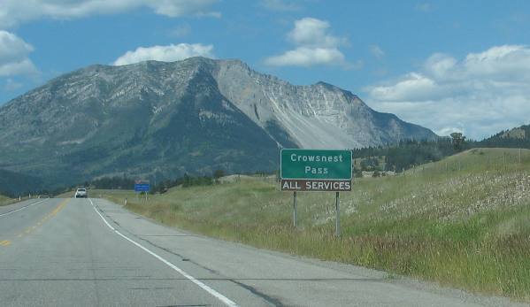
thank you in advance for that kindness. Thank you. Alberta: Driving PH 3 (Crowsnest Highway) west out of Pincher Creek to Crowsnest Pass on the Continental Divide
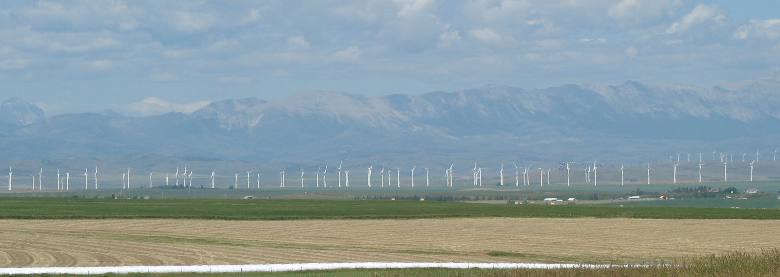
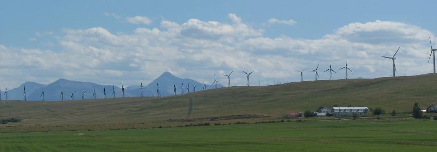
Wind Farm at Crowsnest Pass
Today we are taking a drive on PH 3 the Crowsnest Highway from Pincher Creek west to Crowsnest Pass.
A large wind generator field is taking advantage of winds that flow through Crowsnest Pass. While these wind generators are located in the mouth of the pass other wind generator fields are located further out on the prairie.
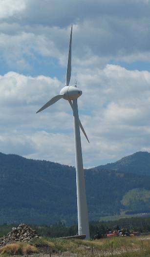
Wind generator at entrance to Crowsnest Pass
This solitary wind generator looked like a relic from the past. The generator portion looks like an egg. It is so different from the modern generators we see in the large fields.
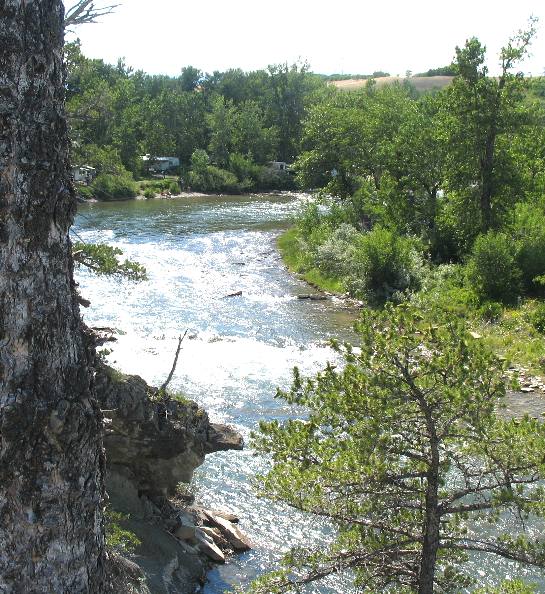
Lundbreck Falls Provincial Recreation Site
When passing through the small community of Lundbreck we saw a sign pointing to Lundbreck Falls Campground so we turned off on a side road to investigate. It took us to Lundbreck Falls Provincial Recreation Site on the Old Man River.
This picture shows the falls as seen from a bluff above the river. From here we also see the campground along the river.
Lundbreck Falls Provincial Recreation Site
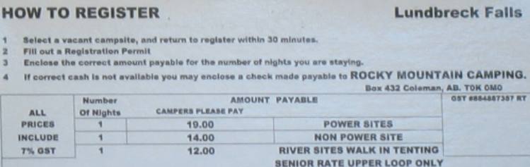
For those interested this is the rates for Lundbreck Falls Provincial Recreation Site Campground. Some of the sites did have electricity but there was no potable water.
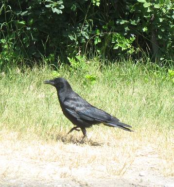
Crow at Lundbreck Falls Provincial Recreation Site
While at the falls Joyce got this picture of a crow. How appropriate since we are traveling on the Crowsnest Highway to Crowsnest Pass.
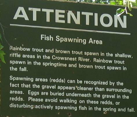
Lundbreck Falls Provincial Recreation Site
This sign was posted in the Campground to warn all persons playing in the river.
Wind generators near Crowsnest Pass
From the town of Lundbreck looking to the southeast wind generators dominate the skyline.
Around Lundbreck we ran across a historical kiosk explaining about the Doukhobors who settled in this area to escape persecution for their religious beliefs and pacifism. In 1899 some 7,500 Doukhobors emigrated from Russia to settle in Canada. Guided by their motto "Toil and Peaceful Life", these members of the Christian Community of Universal Brotherhood first settled in Saskatchewan, and in 1908 many began moving into the interior of British Columbia. In 1915, some 300 people left British Columbia to establish settlements in Alberta at Cowley and Lundbreck. Here they organized small communal villages, built grain elevators, erected a flour mill, and cultivated 12,000 acres of virgin prairie soil. In 1926, a second community, the Lortly Christian Community of Universal Brotherhood, was established near Shouldice, southeast of Calgary. Today, many descendants of these early pioneers still live in Alberta and continue to maintain their distinctive traditions symbolized by bread, salt and water, representing Life, Hospitality and Love to all mankind.
Hay fields near Crowsnest Pass
Hay fields share the landscape with wind generators as we enter the saddle in the mountains that the Crowsnest highway travels through.
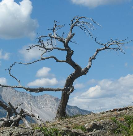
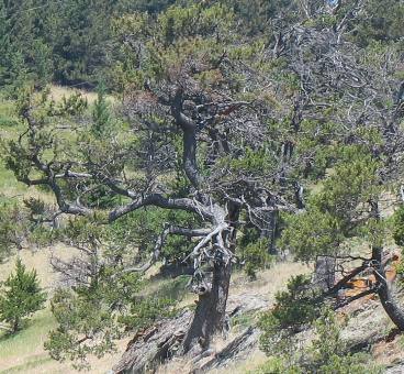
This is the historic Burmis Tree, a limber pine that has marked the eastern edge of Alberta's Crowsnest Pass for an estimated seven centuries. The Burmis Tree was named for a coal-mining town that thrived here in the early 1900s. The tree has become a symbol of endurance for the people of the Pass.
Burmis Tree
Limber pines have one of the longest life spans of any tree in Alberta. The trees grow and prosper in harsh conditions, places were other trees perish. Limber pine roots snake into cracks in the rocks. The branch tips are flexible, so strong winds shape rather than snap its branches.
The Burmis Tree died in the late 1970s. It lost the deep green needles and yellowy brown cones seen on other limber pines growing up this sandstone ridge. Birds such as the Clark's nutcracker, and other seed consumers, harvest cones containing seeds and cache them for later use. Young limber pines sprout in abandoned caches to begin their own battles with the relentless wind in this pass. In 1988, the Burmis Tree lost its battle with the wind and toppled to the ground. Members of the Crowsnest community refused to leave it lying there. A partnership between the provincial government, the federal government, local businesses, community groups, and private citizens raised and stabilized the tree. Stainless steel brackets anchor the roots with rods drilled deep into the sandstone. A pipe inserted into the trunk gives support. Another support reduces the movement of the root section and can be tightened if the tree moves. Now the Burmis Tree once again stands on its sandstone pedestal, greeting visitors to the Pass and signaling to residents that they are home. And now you know the "rest of the story" as Paul Harvey would say.
Limber pines
This is a picture of live limber pines not far from the historic Burmis Tree.
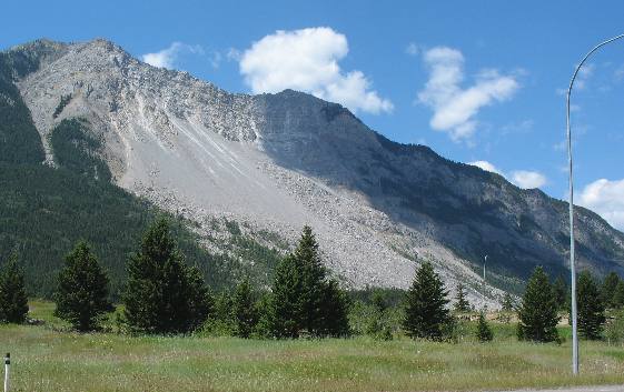
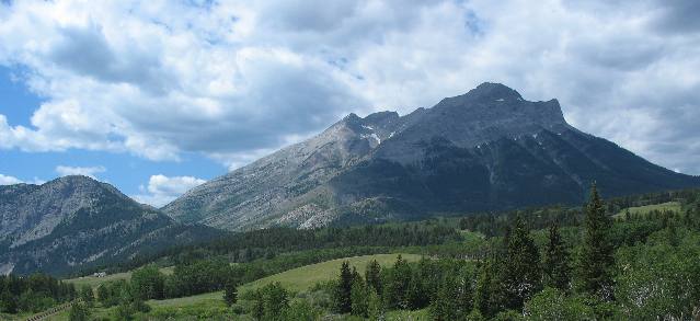
Frank Slide
Not far west of the Burmis Tree we can see the giant scar left by Frank Slide about the same time that we see a sign for Crowsnest Pass. The actual pass is some 20-miles west of here I am not sure what the sign is all about.
Native people called this "Turtle Mountain" because the mountain was slowly moving like a turtle. That slow movement resulted in the Frank Slide. The Native people knew what they were talking about.
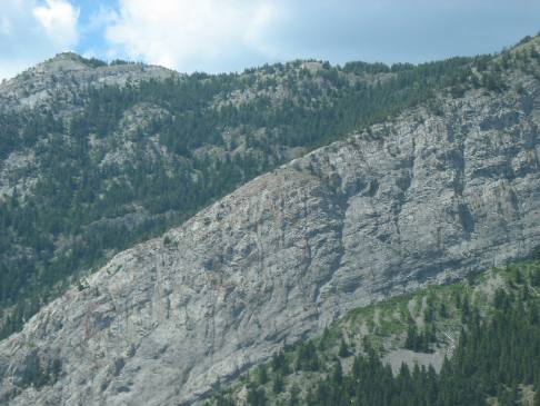
Frank Slide
Frank Slide was such a monumental event that I have dedicated an entire travelogue to it so for now this picture of Frank Slide will have to suffice.
The reason this site is called Frank slide begins in 1900 when S.W. Gebo came to Alberta to search for coal. Being pleased with his findings of seams north of the railway he sent for H.R. Frank, a wealthy man from Butte, Montana. In 1901 the town site which developed as a result of this man's capital and energy was named Frank, in his honor. The Frank Slide buried the town and most of its residents.
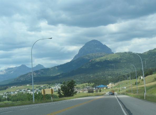
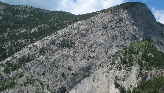
Crowsnest pass Highway
As we continue to the summit of Crowsnest Pass this odd looking formation comes into view. Several communities are scattered along the Crowsnest Highway as we continue climbing west.
Front Range mountains as viewed from Crowsnest Pass highway
We are still in the Front Range as can be seen by these easterly tilted layers of sedimentary rocks.
Summit of Crowsnest Pass
We are now at the summit of Crowsnest Pass and the eastward tilting sedimentary rocks continue to indicate we are in the Front Range.
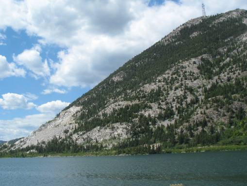
Lake at the summit of Crowsnest Pass
We are standing in a gateway to the Rockies, a narrow gap between Bluff and Turtle Mountains. Here the Crowsnest River has carved a path out onto the fertile prairie of Alberta. To the west lie the Rocky Mountains, and the Continental Divide. This pass, once traversed only by gold and coal prospectors, now serves as a major corridor for Canadia's travel and trade.
This lake is at the summit of Crowsnest Pass.
Thinking about the history of this pass, makes you realize that it was once traversed only by gold and coal prospectors, but now serves as a major corridor for Canadia's travel and trade.
Crowsnest Pass
While this pass was known to the natives it was ignored by early explorers. The first white man to use it was Michael Phillipps, who crossed from west to east in 1873 and returned to cut a pack trail through the pass by 1879. Phillipps, and Sam Steel of the North-West Mounted Police who crossed the pass in 1888, drew attention to the area's coal deposits. In 1897 the C.P.R. built the Crowsnest Pass line to forestall American control of the Kootenay valley. The opening of the pass by rail played a major role in linking southern Alberta and B.C. and in the exploitation of their mineral resources. Summit Lime Works at the Summit of Crowsnest Pass supplies western Canada and the North Western United States with high calcium lime and limestone products. It was making lime prior to 1903 with several beehive pot kilns at Crowsnest. In 1903 Summit Lime Works purchased the operation. In order to have a RR spur line the plant had to be moved west to its present location at Hazell Siding not far from here. The discovery of lead, copper and zinc in southeastern British Columbia in the 1890s gave rise to large-scale American investment in the area. Fearing U.S. domination, the Liberal Government backed the Canadian Pacific Railway in the construction of a line to the British Columbia mines through what was then called Crow's Nest Pass. It was at this point in the late 1890s, that the deposits of bituminous (soft) coal were discovered in this area. The rapid expansion of prairie settlement during this era resulted in a heavy demand for coal to heat the new homes and businesses. At the same time, the presence of a steam-powered railway that used coal to fire its engines provided a degree of market stability. Within a few years the Crowsnest pass, as it is now known, had developed into Alberta's largest coal mining district. Crowsnest Pass contains coal formed from lush forests that were buried from 65 - 130 million years ago. Coal is the main reason for settlement and growth of the region and has been the main industry since. Coal reserves, discovered during the late 1800s, were made accessible to the world when the Canadian Pacific Railway's spur line came through Crowsnest Pass in 1898. Mines and settlements were established immediately after rail transpiration reached the area. Dreams of freedom, wealth and challenge attracted immigrants from many parts of the world. These settlers brought their traditions and the foundation for a rich cultural heritage. We wanted to stop and do the mine tour at Bellevue Mine but time was not on our side. The Bellevue Mine, closed to mining since 1962, has been refurbished and opened by local miners to create an exciting underground visitor attraction. This mine, which operated for nearly 60 years, gives visitors the opportunity to understand and experience the daily lives of the miners who worked in the dark, damp underground world. Approximately 1,200 feet of tunnel and gangway have been retimbered and secured in order to offer you the opportunity to see and understand the complexity of underground mining. I am sorry that we missed this opportunity.
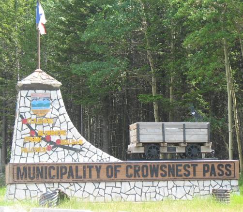
Municipality of Crowsnest Pass
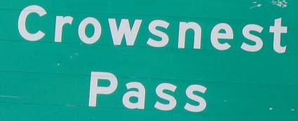
Crowsnest Pass
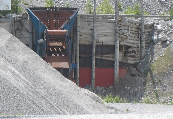
Limestone Mine at the Summit of Crowsnest Pass
This is what we could see of the lime mine at the summit of Crowsnest Pass.
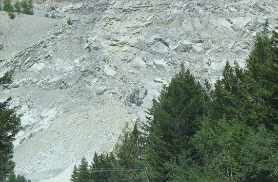
Limestone Mine at Crowsnest Pass
This is the rock that lime mine is after on the summit of Crowsnest Pass.
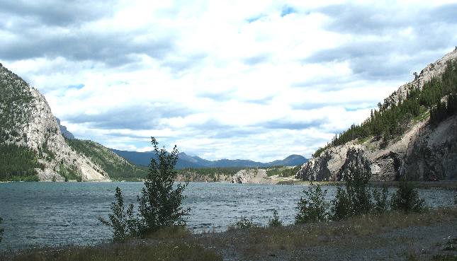
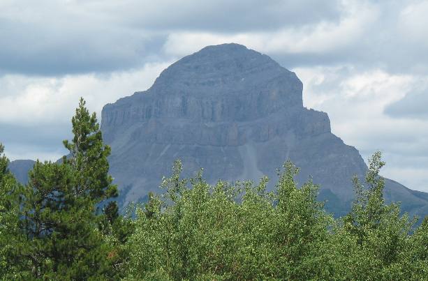
Continental Divide on Crowsnest Pass Highway
Here we are on the Continental Divide and this highly tilted formation is part of the scenery indicating this is a front range mountain.
Canadian Rockies at Crowsnest Pass
In the distance we can see this mountain with relatively flat layers of sediments indicating this mountain is part of the main range.
More Canada AdventuresPlants Trees and Flowers ** More 2007 Travel Adventures
Mike & Joyce Hendrix
Mike & Joyce Hendrix who we are We hope you liked this page. If you do you might be interested in some of our other Travel Adventures: Mike & Joyce Hendrix's home page Travel Adventures by Year ** Travel Adventures by State ** Plants ** Marine-Boats ** Geology ** Exciting Drives ** Cute Signs ** RV Subjects ** Miscellaneous Subjects
We would love to hear from you......just put "info" in the place of "FAKE" in this address: FAKE@travellogs.us Until next time remember how good life is.
|
| ||
|
| |||
|
| |||
|
|