|
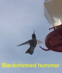
Colorado: Pueblo, Canon City, Royal Gorge Places Visited: Colorado: Pueblo, Canon City, Royal Gorge Wednesday June 7 through Friday June 9 2006: Pueblo, Colorado (On I-25 100-miles north of the New Mexico border). We are in Pueblo West Campground N38° 20.522 W104° 43.097'. Pueblo West Campground is located on US-50 about 5-miles west of I-25. It is totally gravel with huge pull-thru sites (trees are limited); 50-amps, water and sewer, $20 per-night 719-547-9887. This is a campground and equestrian facility. We could easily stay in the campground on Raton Pass for another week. There is that much to see and do in the area. But we are on our way to Idaho so we headed north about 100-miles today, stopping in Pueblo, Colorado. Hummingbirds at Cedar Rail RV-Park atop Raton Pass on I-25 Raton, New Mexico
We had to say good by to the humming birds that had been keeping us entertained then we were off, heading north on I-25.
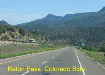
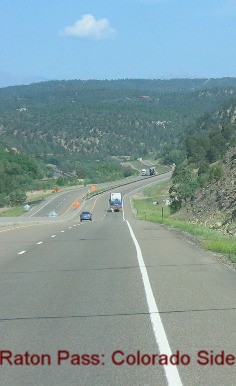
Falling off Raton Pass on I-25 heading into Trinidad, Colorado
The first order of business was to engage the exhaust brake on our motorhomes diesel engine. Since we were about to drop down the northern side of Raton Pass, in other words around 10 to 12-miles of 6% grade. The exhaust brake is a magical device that puts a butterfly valve across the exhaust pipe so that a diesel engine can act like a gasoline engine and provide "engine-braking" except in a diesel it is exhaust braking.
Falling off Raton Pass on I-25 heading into Trinidad, Colorado
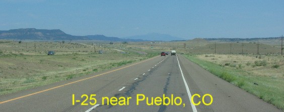
Anyway, with our exhaust brake holding us back we drifted down that 6% grade at 35-mph to 45-mph as easily and comfortably as driving down any highway. I-25 near Pueblo, Colorado
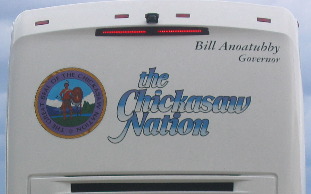
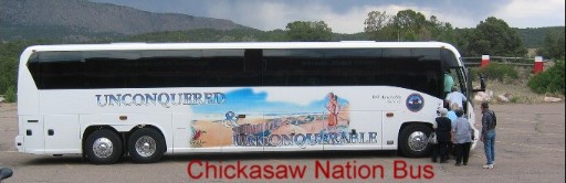
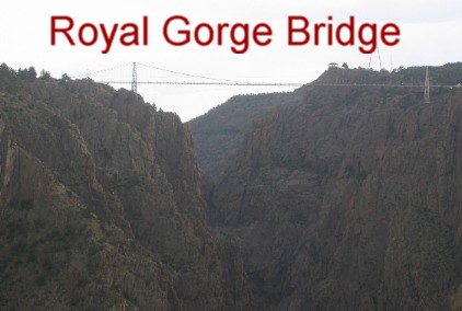
Trinidad, Colorado is at the bottom of the grade. Once we were clear of Trinidad the countryside became rolling hills of dry almost desert like foliage. It was that way all the way to Pueblo where we exited west on US-50 and headed to Pueblo West as you might imagine Pueblo West is a community about 12-miles west of Pueblo. That is where the RV-Park that we are going to stay in is located. After checking into Pueblo West Campground we jumped in the Saturn and headed to Canon City and the Royal Gorge. We drove out to Royal Gorge and found that the bridge we had heard so much about was a tourist attraction. The road ended---into the turnstiles of an amusement park, of sorts, with the Royal Gorge Bridge as the main attraction. We got out in the parking lot to see what the situation was. We found out it costs $21 to get into this "attraction" when all we wanted to do was just see the bridge or walk on it. I had never seen a bridge that cost anything like $21 to cross, it just didn't make sense. Something was wrong or at least it seemed to be wrong to me. As it turns out the Royal Gorge Bridge is a tourist attraction not a State/Federal bridge constructed for traffic. The bridge across Royal Gorge was built as a tourist attraction that is why it cost $21 just to get close enough to see the bridge. You can do more for your $21 than just see the bridge. There is a zoo, a tram ride across the canyon, an inclined RR that carries passengers down the side of the canyon 1,000 to the bottom and the river that are included in that $21 entrance fee. We decided that we were not going to spring for $42 just to walk on that bridge across the gorge. Chickasaw Nation Tour Buss at Royal Gorge in Colorado
A mile or so from the Royal Gorge attraction operated by Canon City, we stopped at a narrow gauge RR that would take you out to the Royal Gorge where you could see the Royal Gorge Bridge, the Canyon and the Arkansas River that runs through the Canyon. It was only $9 a head so we took it. We got our moneys worth on this ride. I think we were the only people on this narrow gauge RR with small open cars that were not with a tour group of Chickasaw Indians from Oklahoma.
Chickasaw Nation Tour Buss at Royal Gorge in Colorado
The Chickasaws told us that the Tribe owned 6 luxury busses and 3-air craft. One of their traveling companions had fallen ill (altitude sickness) and the Tribe sent one of those air-craft out to pick up the woman and take her back to Oklahoma. Without talking to the gregarious group and them telling us we never have suspected that they were a group of Indians from Oklahoma. They looked like every other tour-group that we see except this group was extremely nice.
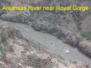
Arkansas River flowing through part of the Royal Gorge in Colorado
That $9 narrow gauge RR carried us out to the canyon so we could gaze down into the yawning cavity carved out by the Arkansas River. While we weren't at the highest point of the "Royal Gorge" we were within a mile or so of the Royal Gorge Bridge that we had intended to walk out on.
Royal Gorge Bridge in Colorado
This is a picture of the Royal Gorge bridge constructed as a tourist attraction taken from our seat on the narrow gauge train.
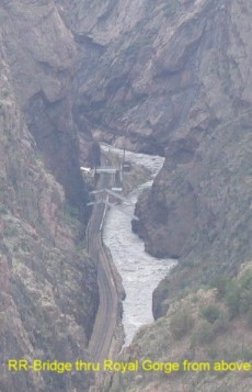
Arkansas River, the Royal Gorge and the Royal Gorge Rail Road tracks
This is a picture of the Arkansas River in the deepest part of Royal Gorge. That is Royal Gorge Rail Road tracks you see running down the left side of the canyon very near the river. The canyon gets so narrow at one point there is absolutely nothing for the Rail Road to build a bed on so the RR engineers constructed a bridge comprised of those two steel beams that you see extending from one side of the canyon to the other. The train tracks are suspended above the river for a 100-yards or so hanging from those two steel beams. We are going to ride the Royal Gorge Train tomorrow and get a close up view of that unique RR Bridge.
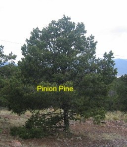
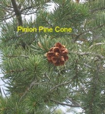
Pinion Pine on the cliff above Royal Gorge in Colorado
While just outside the "tourist park" at Royal Gorge we pulled off in a picnic area where we saw this pinion pine and tumbleweed.
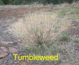
Tumbleweed on the plateau above Royal Gorge
This tumbleweed was with the pinion pine at 6,000' elevation or somewhere close to that. We have always seen them at much lower elevations.
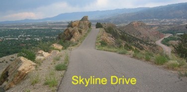
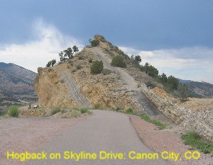
View from Skyline Drive in Canon City, Colorado as it goes over the top of the hogback
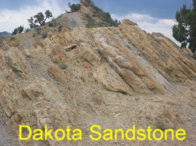
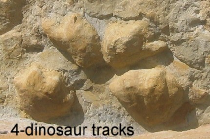
On the way back to Canon City on US-50 we took the "Skyline Drive" exit and drove back to Canon City on the Skyline Drive. So many people have told us about the "Skyline Drive" that this was something we just had to do. Thanks, to all our friends that recommended that drive it is awesome to say the least. Skyline Drive is a two and one half mile, one way, one-lane, paved road that climbs the steep side of a "hogback" then traverses the crest of the hogback for several miles before descending the other side of that hogback with a series of hairpin turns on a fairly steep grade. The geology of the hogback is nothing short of amazing. Then, to top it off there is an exhibit near the top where dinosaur prints have been preserved in a layer of the Dakota Sandstone.
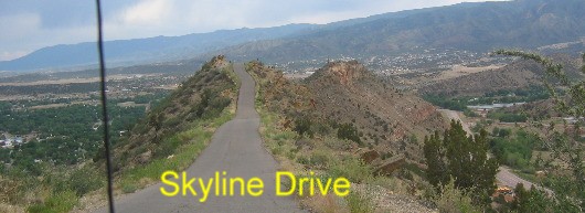
I just hate it when I read a description of something and realize that I do not understand what the description said. That is kind of the way "layer of Dakota Sandstone" hits me. I see that description all the time but didn't have much of a clue about what it conveyed other than the rock was sedimentary since sandstone is a sedimentary rock. While researching "Dakota Sandstone" Google helped me find the following: View from Skyline Drive in Canon City, Colorado as it goes over the top of the hogback
How rocks are named:
View from Skyline Drive in Canon City, Colorado
Back to my friend Mr. Google and I get the following:
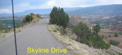
View from Skyline Drive in Canon City, Colorado
The Dakota sandstone formation stretches all along the Front Range of the Rocky Mountains. 65 million years ago the great mountain building forces that created the Rocky Mountains pushed upwards and the Dakota formation broke and turned vertical. Over millions of years the Rockies have weathered and eroded back. Skyline drive now follows the crest of that exposed hogback.
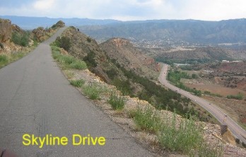
Hogback along Skyline Drive in Canon City, Colorado
Ok, now we have it, 135-million years ago to somewhere around 100-million years ago a great inland see covered much of the United States. During that time layers of sand and clay were deposited as erosion carved the landscape. Dinosaurs left footprints in the wet mud along the shoreline of this inland sea that was drying up. Then 35-million years passed while more layers of sediment was deposited on top of the "Dakota formation". And where we are on Skyline Drive at Canon City, Colorado the mountain building forces deep within the earth began pushing up the sedimentary layers of earth/rock above it around 35-million years ago. Here on Skyline Drive we can see one dramatic example of how this section of Dakota formation broke and was pushed almost vertical. Once the process is explained it becomes fairly easy to see.
Dinosaur tracks on Skyline Drive in Canon City, Colorado
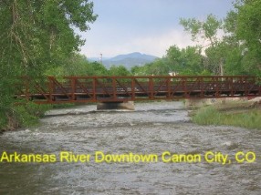
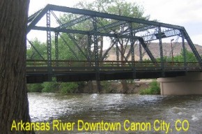
In 1999 a paleontology student at The University of Colorado spotted dinosaur tracks in an outcrop of Dakota Sandstone on Skyline Drive. In February of 2000 Skyline Drive was closed while a group of paleontologist armed with hammers, picks, shovels etc., worked to clear the rocks covering these tracks and other fossils. Finally, in April of 2000 Skyline Drive was reopened and the public was informed of the dinosaur tracks. Today there are kiosk telling about the dinosaur tracks and how the "hogback" of Dakota Sandstone was formed. The Arkansas River in downtown Canon City, Colorado
Once back in Canon City we dropped by the train station to check on tomorrows schedule. Once we accomplished that we went for a walk in the park next door and along the Arkansas River that cuts through town.
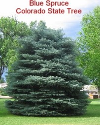
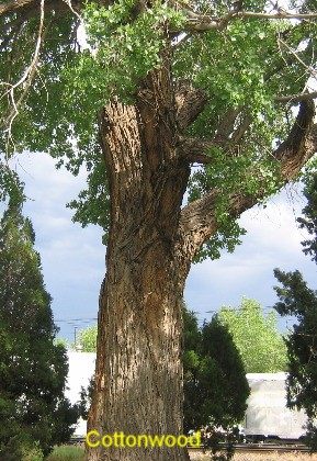
Blue Spruce and giant cottonwood trees in a park near the Arkansas River in Canon City, Colorado
Many people in Colorado utilize the blue spruce as a Christmas tree. Someone told us that you can tell how much water a blue spruce gets by how blue it gets. I don't know if that is true but this one in a well watered park has a nice blue tent to it. In that same park was this giant cottonwood tree. Someone in the visitor center told us that it had a 6' diameter. In any event it was a BIG cottonwood.
Click here for some Colorado travellogsUntil next time remember how good life is. More Colorado AdventuresAdventures by State ** More 2006 Travel Adventures
Mike & Joyce Hendrix
Mike & Joyce Hendrix who we are We hope you liked this page. If you do you might be interested in some of our other Travel Adventures: Mike & Joyce Hendrix's home page Travel Adventures by Year ** Travel Adventures by State ** Plants ** Marine-Boats ** Geology ** Exciting Drives ** Cute Signs ** RV Subjects ** Miscellaneous Subjects
We would love to hear from you......just put "info" in the place of "FAKE" in this address: FAKE@travellogs.us Until next time remember how good life is.
|
| ||
|
| |||
|
| |||
|
|