Mt. Taylor in New MexicoMay 6, 2007. We are staying in the Blue Spruce RV Park $13.50 for 50-amps, water & Cable TV with central dump. Blue Spruce is located on the south west corner of the I-40 exit 81 intersection. This was our last day in Grants and we took the opportunity to drive up and into the Mt. Taylor area. Mt. Taylor is one of the highest points in New Mexico. I will show you another picture of Mt. Taylor from Sandia Peak in Albuquerque over 60-miles east of Mt. Taylor in a later travelogue. The Mt. Taylor footprint and awesome height make it visible from a large portion of New Mexico.
Mt Taylor
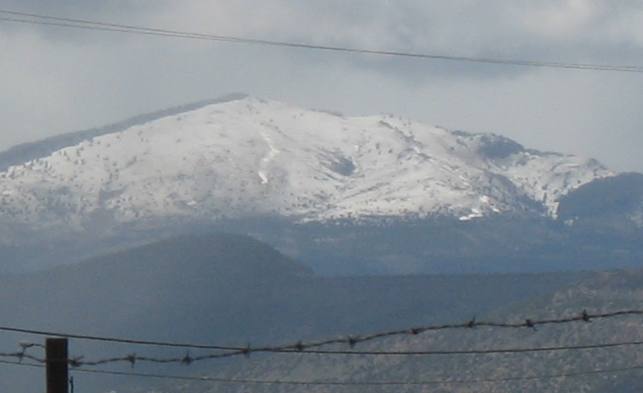
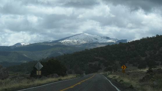
As we pulled out of Blue Spruce RV-Park Mt. Taylor was staring at us in all its glory. It has been snowing for several days. It is not sticking below 7,000 feet but it appears to be sticking at the higher elevations of 11,300 foot Mt. Taylor. Mt Taylor was called Cebolleta (tender onion) by the Spanish. It's name was changed in 1894 in honor of then president Zachary Taylor. Mt Taylor is a stratovolcano, or composite volcano. Stratovolcanos are tall, conical volcanos built up by many layers (strata) of hardened lava, pumice, and volcanic ash. Stratovolcanoes are characterized by a steep profile. Lava that flows from stratovolcanoes typically cools and hardens before spreading far. Mount Taylor was active from 3.3 to 1.5 million years ago. It is surrounded by a field of smaller inactive volcanoes that stretch to the south. We have an earlier travel log that covered the Bandera Cinder Cone which is one of the volcanos in this field. Another one of our travel logs dealt with many of the other cinder cones in this field. Repeated eruptions built lava domes and produced lava flows, ash plumes, and mudflows. The mountain is surrounded by a great volume of volcanic debris, suggesting multiple major eruptions.
We headed northeast out of Grants on SR-547 (Lobo Canyon Road) climbing, continuously climbing as we got closer and closer to Mt. Taylor.
Intrusion of igneous rock created this dike & liccolith
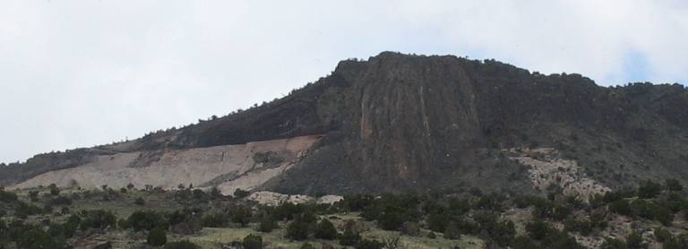
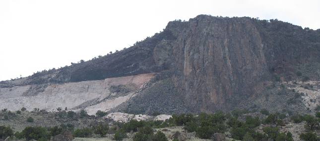
While still in Grants we begin the grueling climb. Not long out of Grants we pass this fantastic piece of geology. Now mind you I am no geologist but we have been visually inspecting western geology for 6-years now and we have seen this often enough to know that it is an intrusion of molten lava (the dark rock) while deep in the earth, into a crack in overlying rock, in this case sandstone (the light colored rock). This exposure is as good at showing this as any example in a geology book. You can see the dike that intruded from the center of the earth as molten lava in the right center of this picture. When it intruded into the sandstone other layers of sandstone were still between this intrusion and the surface. None the less this dike intruded into a vertical crack in the sandstone then began to spread out horizontally in a horizontal crack called a sill or liccolith. The overlying sandstone has eroded away leaving only this dike and the very hard licolith (igneous rock that spread out horizontally in that crack between two layers of sedimentary rock). It now serves as a cap rock protecting the much softer sandstone under it. This is an extremely small example of how mountains are formed when molten lava uplifts sedimentary layers as it makes its way to the surface.
Intrusion of igneous rock created this dike & liccolith
This example of a dike and intrusion is so awesome I just had to show you a close-up so you can better see the vertical dike that intruded in the vertical crack in the light colored sandstone. An intrusion is created when molten (igneous) rock intrudes into older rock (in this case sedimentary sandstone) then hardens. Keep in mind that this vertical dike as well as the horizontal parts "liccolith" cooled while underground, resulting in igneous rock that is different from molten rock that is exposed to the atmosphere while it is still molten and cools rapidly. The time spent cooling results in different types of igneous rock.
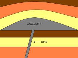
This is a pictorial explaination of the liccolith you see in the above pictures
Look closely at the above pictures of the liccolith and you can see the dike that delivered the molten rock to the area between two layers of sedimentary rock where the liquid rock intruded then cooled leaving behind this extremly hard igneous rock.
Mt Taylor
Keep in mind that we are driving toward Mt. Taylor and keep getting a fleeting glimpse of our goal.
Mt Taylor
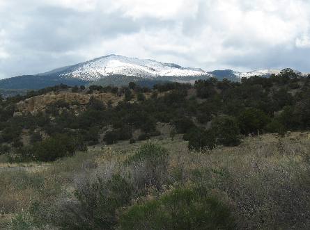
We continue to climb in elevation and catch another glimpse of snow covered Mt. Taylor.
Mt Taylor road cut
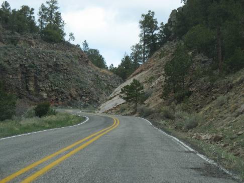
Road cuts are a part of climbing mountains and this one is no exception.
View of valley west of Mt Taylor
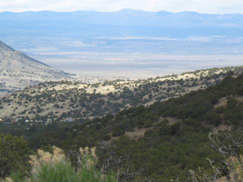
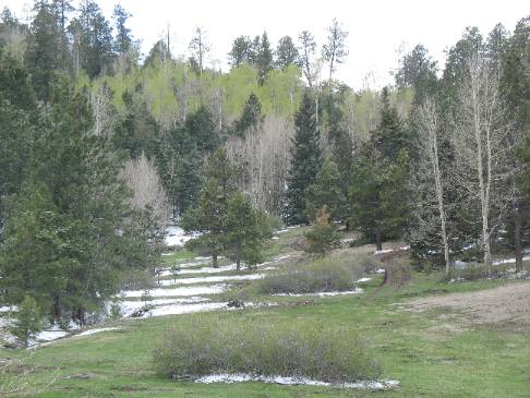
After all this climbing we pop out into a clearing where we get this magnificent view, to the west, of a wonderful valley stretching to the west of Mt. Taylor.
Pines and snow on Mt Taylor
As we climb more and more snow is sticking.
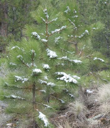
Pines and snow on Mt Taylor
Joyce snapped this picture of snow on what looks like a small ponderosa pine.
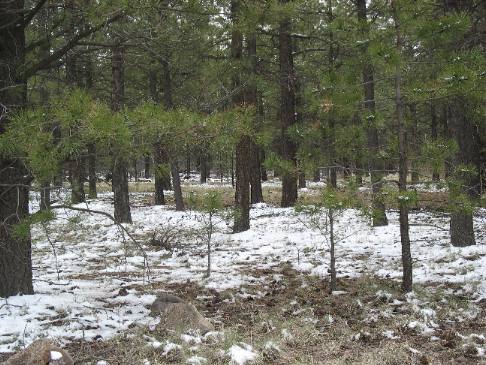
Pines and snow on Mt Taylor
Pines and snow on the slopes of Mt. Taylor as we get above the 7,000 foot level.
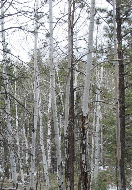
Aspen trees on Mt Taylor
Natural stands of aspen are occurring at the higher elevations.
Snow on Mt Taylor
Note that the aspen trees have not budded out yet.
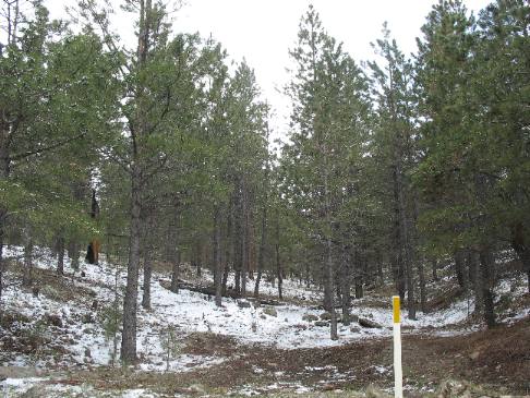
Snow on Mt Taylor
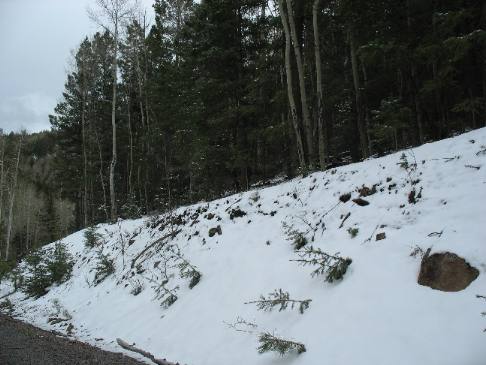
A roadcut complete with snow while we are still above 7,000 feet.
Snow on Mt Taylor
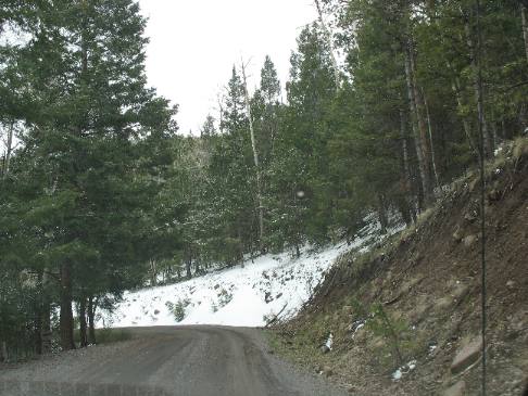
Somewhere on the western slope of Mt. Taylor the road unceremoniously changes names and becomes SR 197 and or SR 334 as we make our way down to the small mining community of San Mateo.
More New Mexico AdventuresSome Exciting Drives** More 2007 Travel Adventures
Mike & Joyce Hendrix
Mike & Joyce Hendrix who we are We hope you liked this page. If you do you might be interested in some of our other Travel Adventures: Mike & Joyce Hendrix's home page Travel Adventures by Year ** Travel Adventures by State ** Plants ** Marine-Boats ** Geology ** Exciting Drives ** Cute Signs ** RV Subjects ** Miscellaneous Subjects
We would love to hear from you......just put "info" in the place of "FAKE" in this address: FAKE@travellogs.us Until next time remember how good life is.
|
| ||

| |||
|
|
|||
|
| |||
|
|