Places Visited:
New Mexico: The La Mesilla Valley from the Texas
border at El Paso through La Mesa, San Miguel, La Mesilla, Radium Springs, Hatch,
Garfield and Arrey. Then I-25 through Truth or Consequences, San Antonio and Socorro
May
1, 2007.
It was time to move on or we will not make Idaho this summer. We
have a lunch date with friends Max & Tonie on the west side of El Paso so
we packed up the motorhome this morning and said good bye to our friends Harry
and Sue that we had been staying with. We were staying near exit 37 on I-10, which
is located a good bit east of downtown El Paso, while the restaurant where we
were meeting Max and Tonie was off exit-13 on the west side of El Paso. The ride
through El Paso is always exciting in the motorhome but it wasn't all that bad
at 10:00 in the morning.
We were Meeting Max & Tonie at the State Line
BBQ on west Sunland Park Drive. We pulled the motorhome into the Casino down the
street from State Line BBQ. Then we unhooked the Saturn and drove it to State
Line BBQ where we met Max & Tonie.
It is always wonderful to visit
with good people. Max and I both enjoy an online RV-newsgroup. We have communicated
virtually but we finally got to put faces with the virtual person on the news
group.
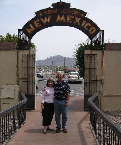
Max
took this picture of Joyce and I walking through the gate of State Line BBQ. The
gate, under the sign, is the Texas/New Mexico border. The parking lot is in Texas
while we are a few feet inside New Mexico. The Restaurant is also in New Mexico.
If
you are in the area and looking for BBQ, State Line Restaurant is the place.
After
lunch we connected the Saturn to the motorhome and headed north generally on New
Mexico 28 to Las Cruces. From Las Cruces we continued north on New Mexico 185
to Hatch then New Mexico 187 north to I-25 exit 59 where we got on I-25 and continued
north to Socorro.
We were trying to avoid traveling on I-10 and I-25. By
traveling back roads we are able to experience the real countryside. You just
can't see or experience the essence of a place from the interstate.
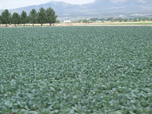
Not
far north of El Paso we see fields of cabbage like this one. These fields are
irrigated with water from the Rio Grande River.
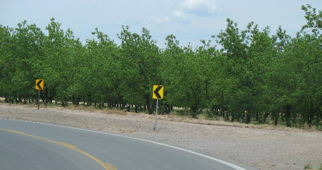
Pecan
fields like this one dot the landscape, all watered by the Rio Grande River.
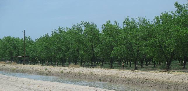
Pecan
orchards and irrigation canals are common sights along New Mexico 28.
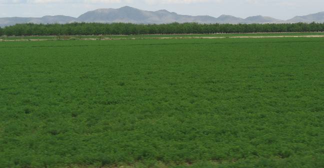
This
is alfalfa with an onion field and pecan orchard in the distance. In the far distance
is either the Organ Mountains or the northern reaches of the Franklin Mountains.
I can not determine where one range ends and the other starts. The two mountain
ranges look like one long range from where we are viewing it in the valley.
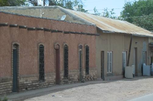
These
adobe buildings were in one of the small communities, San Miguel I think, along
New Mexico 28 south of Las Cruces. This is an old community.

Cabbage,
onions and pecans along New Mexico 28 south of Las Cruces.

Pecan
orchard, irrigation canal and the Organ Mountains. Note that this pecan orchard
extends to the horizon. If you ever wonder where those expensive pecans come from
you should probably think of the Rio Grande Valley of southern New Mexico and
western Texas east of El Paso, which is also in the large valley created by the
Rio Grande River.
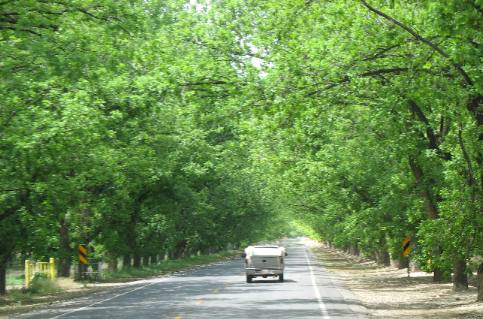
Stahman's
pecan grove is one of the largest pecan orchards anywhere. This scene goes on
for miles. Stahman's pecan groves are located a few miles south of La Mesilla
on New Mexico 28.
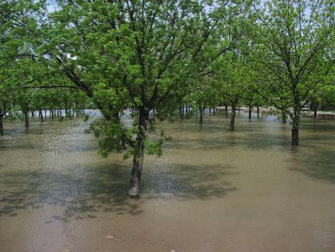
Pecan
orchards in this region are flooded every so often. This one has just been flooded.
It will be flooded again in a week or so when it dries out. When flooded it probably
has about 3-inches of water on the grove. Groves are laser level in order to accommodate
irrigation by this method.
This field was north of Las Cruces on New Mexico
185 where there are as many acres of pecans as south of Las Cruces.
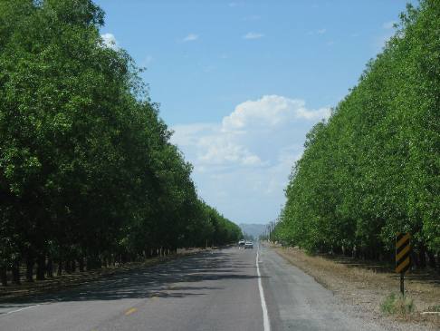
This
is another pecan orchard along New Mexico 185 somewhere south of Hatch.
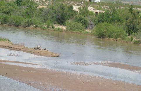
Joyce
snapped this picture of the Rio Grande River a bit south of Hatch. Be aware that
the vast majority of the Rio Grande River has been captured in a reservoir where
the water is then dispensed into myriad irrigation canals. From what I see it
appears 90% of the Rio Grande is diverted into irrigation while possibly 10% continues
to flow in the old river bed.
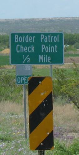
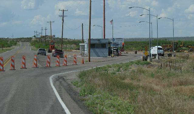
South
of Hatch we ran across a Border Patrol Station. It involved us detouring around
that building where we were briefly questioned (15-seconds) by a Border Patrol
agent then we were on our way.
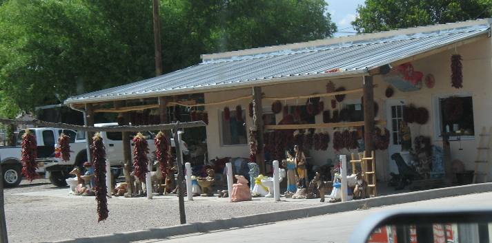
Joyce
snapped this picture of a Hatch pepper store. The strings of red peppers are called
ristras. Hatch is the chili pepper capital of the world or some such. Whatever
they grow a lot of peppers in this area. Pepper connoisseurs consider Hatch chili
peppers to be the best.
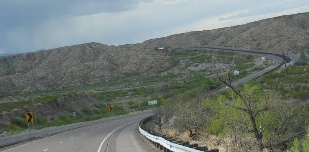
We finally got on I-25 at MM-59 a bit south of Truth or Consequences.
On I-25, as on most interstates, the scenery is less than appealing. Along this
stretch of I-25 there is a lot of up and down.
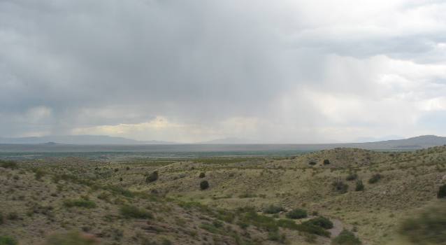
Joyce
snapped this picture looking east from I-25 across White Sands Missile Range somewhere
near San Antonio. Carrizozo is somewhere at the base of those mountains on the
eastern side of White Sands Missile Range while Ruidoso, and Capitan are in those
mountains, in the distance.
We stopped for the
night in Socorro at Casey's RV-Park $22.76 for water and 30-amps with central
dump station. It is nothing great but adequate. We could have dry camped in Wal-Mart
but the weather was hot and severe weather was forecast for the afternoon and
evening hours. We thought that we might be safer if we could take advantage of
the campgrounds concrete block shower & bath rooms in case of a tornado. Electricity
to run the air conditioner was also welcome so we pulled into Casey's.
Until
next time remember how good life is.
Mike & Joyce Hendrix