Montana: Ennis, McAllister, Cameron and views from throughout the Madison Valley July 30 thru July 2, 2007. We are staying in Cameron RV-Park & Store in Cameron, Montana. Cameron is a STORE located 10-miles south of Ennis in the Madison Valley. The Cameron RV-Park is about 12 sites located behind the Store & Saloon (the social gathering place for miles around). The PPA campground is nothing fancy but for the PPA price of $12.50 for FHU it is just fine. The view over the Madison Valley and mountains surrounding Virginia City is worth the $12.50. For those of you that are not familiar with PPA (Pass Port America) it is an organization you can join for less than $50 per-year. Campgrounds that belong to PPA offer 1/2 price discounts. That kind of savings can quickly add up. While participating PPA parks generally have some restrictions on dates the PPA offer is valid, or possibly days of the week the discount is valid, or perhaps the number of days that the PPA discount will be honored the discount is genuine. Many times PPA campgrounds are new campgrounds that need help in getting established. Other times PPA campgrounds may be on the outskirts of town instead of in the "prime" location thus they need to provide an incentive for campers to stay with them. Whatever the reason PPA campgrounds generally provide a much cheaper option. PPA is the only campground organization that I think is worth the cost. PPA does not have a gimic. What you see is what you get. Once you join they send you a directory listing all participating campgrounds. The PPA directory is the FIRST directory we check when trying to locate a place to spend the night. You can join PPA by calling 228-452-9972. If you decide to join PPA, it would be nice if you gave them my number "R-0156251" as the PPA member that told you about PPA. In return PPA will give me a years membership free. I will thank you in advance for that kindness. Thank you.
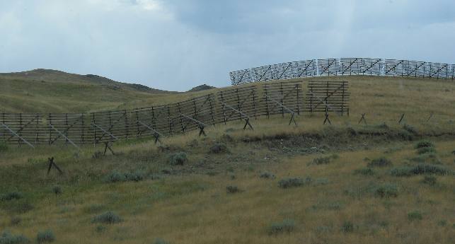
Ten miles north of Ennis on US-287 is Norris Hill a pretty gnarly hill when heading south. I had to put the motorhome in second gear to pull it and my speed was dropping toward 25-mph, where I would have shifted into 1st gear. These snow fences on the western side of the the road were protecting the summit. Upon arriving at the summit of Norris Hill we were wondering why this grade wasn't covered in Mountain Directory West, our book that provides information on steep grades in the western states. They overlooked this bad boy for some reason. Trailblazers John Bozeman and John Jacobs opened the Bozeman Trail in 1864 (near the end of the Civil War) as a shortcut between the Overland Road (Oregon Trail) and the newly discovered Montana Gold fields. The trail began near Casper, Wyoming (40-miles east of South Pass where the Oregon Trail crossed the Continental Divide). The Bozeman Trail ended in the Gallatin Valley around current day Bozeman Montana on I-90. Some emigrants left the Bozeman Trail near Livingston and went up the Yellowstone River (toward present day Yellowstone National Park) to Emigrant Gulch. However, most continued over Bozeman Pass (on I-90 between Livingston and Bozeman) to Virginia City (Alder Gulch) and Bannack. These emigrants utilized local roads from the Bozeman Valley to Virginia City and Bannack. This road that we are using over Norris Hill (US-287) already existed when it was used in 1864 as an extension of the Bozeman Trail from current day Bozeman and the Gallatin Valley to Alder Gulch and Virginia City. Heavy traffic continued on this road (current day US-287) in 1865 and 1866. Indian resistance to the trail in the Powder River country forced the closure of the Bozeman Train to emigrants after the 1866 travel season. The Powder River country was on the section of the Bozeman trail between Casper, Wyoming and Livingston, Montana. The roads from Bozeman to Virginia City remained in heavy use for agricultural products produced by Gallatin Valley farmers, ranchers and mill owners as they had a lucrative market in the gold camps of southwestern Montana (Alder Gulch, Nevada City, Virginia City, Bannack, etc.,). The old wagon road used in the 1860s is supposed to be visible to the west of the present highway but we were too interested in the snow fences and the steep grade to see it.
Settlement of the Madison Valley followed on the heels of the "Gold Rush" to Alder Gulch (Virginia City/Nevada City) in the mid-1860s. Homesteaders grazed livestock in the lush meadows of the valley and surrounding mountains to feed the miners. Today, in addition to meat production, these ranches serve another ecological role, that of maintaining open space for wildlife.
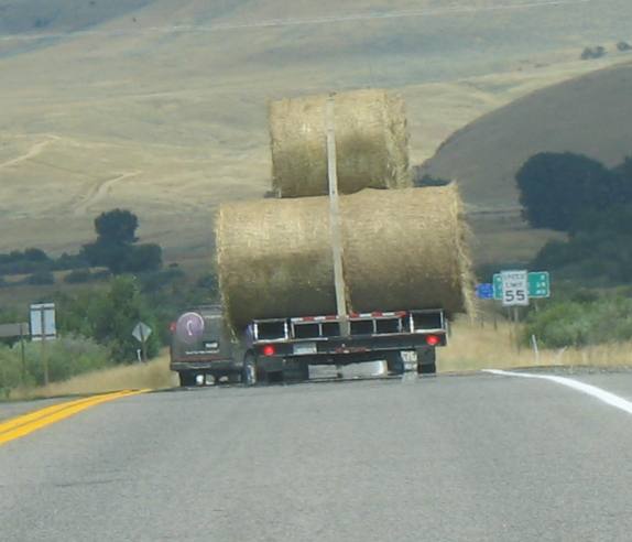
Hay is BIG business in the Madison Valley.
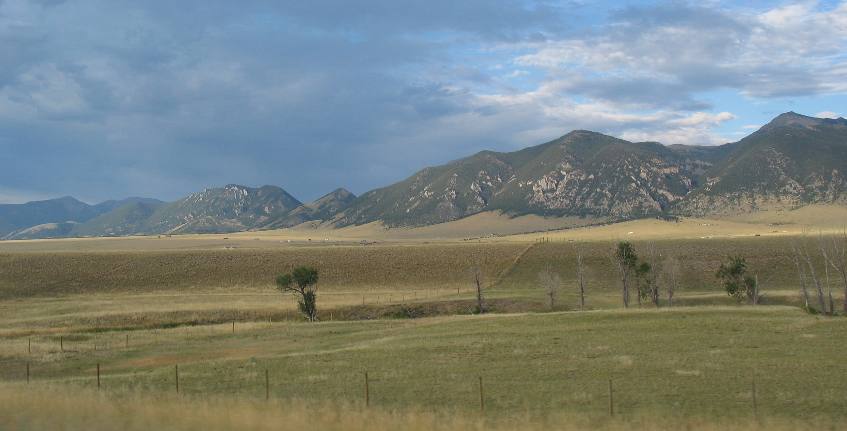
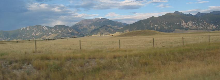
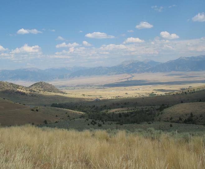
The line of trees between us and the mountains line the Madison River.
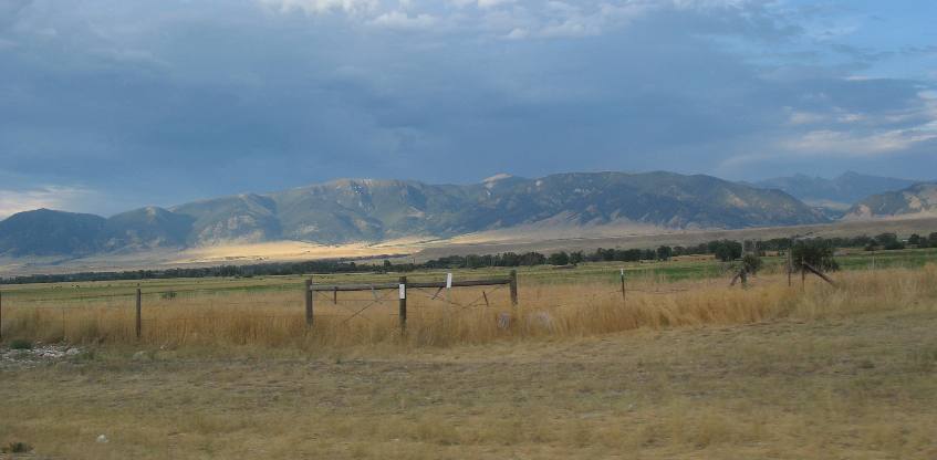
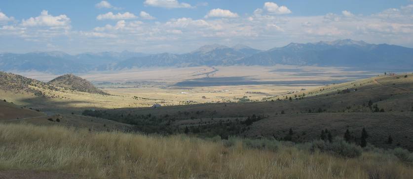
This is typical Madison Valley scenery. This time the line of trees is following a creek that is flowing out of the Gallatin National Forest to the east. This picture is looking south through the Madison Valley from a vantage point about 10-miles north of Ennis.
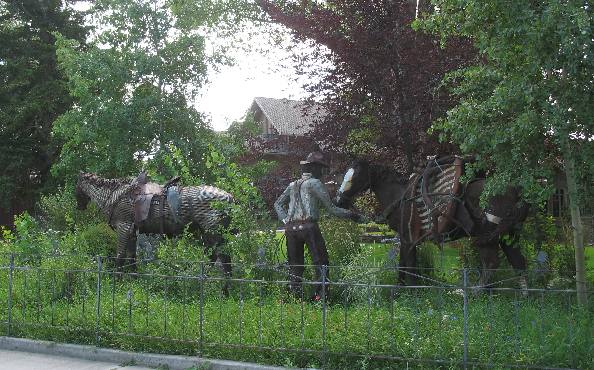
This was an iron sculpture in front of the largest bank in downtown Ennis. The tall flowers and other annuals add to the realism.
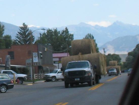
Two loads of hay heading south on US-287 through downtown Ennis. It is amazing the load they put on these hay hauling rigs. In most places that would require a wide-load sign wouldn't it?
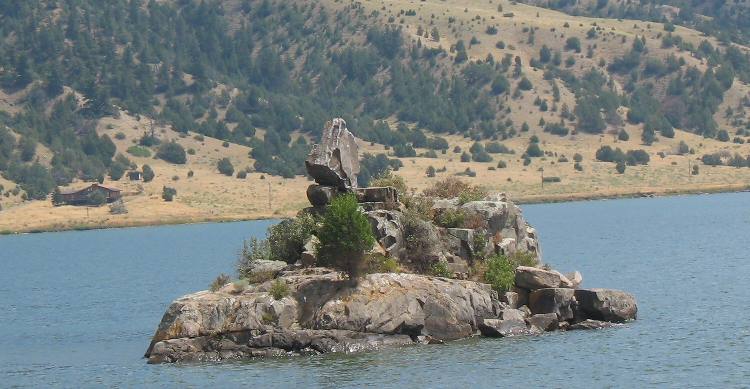
Ennis Lake a few miles south of Ennis is created by a dam on the Madison River. We liked this "Balanced Rock" on a small island in the lake.
We learned that there are cattle drives through Ennis every Spring and Fall. It seems that every Spring ranches south of Ennis trail their cattle north through downtown Ennis on US-287 to National Forest Service land west of McAlister about 6-miles north of Ennis. In McAlister they turn west off US-287 onto South Meadow Creek Road. That road eventually forks and the cattle drive follows the north fork. This road is gravel and it passes a multitude of ranches as it slowly makes its way up and into Deerlodge National Forest. The cattle drive takes more than one day so the cattle have to be overnighted on a ranch somewhere along the way. Of course in the Fall they reverse that train and return the cattle to the ranch for the winter.
We were discussing these semiannual cattle drives with a lady that lives on one of the ranches (her husband manages a 6,400 acre spread) when she said that one year her cows started coming home earlier than they were supposed to and the highway patrol called to tell them their cattle were on the highway. She told us that in normal years the cattle would come out of the national forest lands and gather in the area around the entrance to the forest. When this started happening ranchers (generally 3 to 5) that used that national forest access for their cattle would go up and separate their cattle into groups before taking them down the highway to their ranches. To understand all this you have to realize that Ranchers in the valley own the cattle and have brands on them. They have to feed the cattle during the winter. Winter is also when they drop their calves. However, when the cattle are "on the ranch" they have to be fed. As soon as possible in the spring these cattle are driven (as in an old fashioned cattle drive) to the National Forest where they are turned out to graze for the summer. National Forest Service personnel monitor this program and determine how many cattle can be grazed in the forest and if need be contacts the ranchers to move their cattle to other areas of the forest.
Some of the ranchers south of Ennis have to drive their cattle through the city in order to reach the National Forest area where cattle spend the summer. Around Cameron we talked with Ranchers that drove their cattle south, along US-287, for about 10 miles before turning off the highway onto a gravel road where it was another 10 - 15 miles, before reaching the National Forest. The lady who lived on the ranch her husband managed (the 6,400-acre ranch) said that they could only support 110 cows because the land was so poor. They did not have irrigation thus were not able to grow hay during the summer. Ranches with irrigation to grow hay on could support a lot more cattle through the winter. We didn't question the number of cattle too closely but I would think that the 110 number would be the "breeder" size of the herd consisting of possibly 5-bulls and 105 females of breeding age. If that is the case then then immediately upon the cattle returning to the ranch in the fall ranchers will take all of the steers born last winter to market in addition to any of the females born last year that are not being retained as part of the breeding herd. I suppose it would be reasonable to assume that some of the "breeder" females would be marketed each year as they got older and replaced with younger "breeder-age" cows in the herd. In any event from what this lady said they would only have 110 cattle wintering over on their 6,400 acre ranch. We are intrigued by this way of life. It is a much slower pace of living and much closer to the land. These folks are attuned to the environment. Ranchers have to constantly mend fences and maintain water access for their cattle. Noxious weeds are also something that has to be fought on a continuing basis. There is always something to do on these large ranches. By the way, Ted Turner has purchases some of the large ranches in this area. Montana folks do not like Ted Turner. It seems every resident has a story about "Ted Turner" and it generally has something to do with a restaurant (generally located in the Bozeman area) refusing to serve Ted and Jane (when Ted Ted Turner and Jane Fonda were married). The story varies according to who is telling it but it seems to take place in a "popular upscale" restaurant. Ted supposedly arrives with Jane in tow and announces that he is "Ted Turner" and wants to be seated-----ahead of the waiting line of locals. The restaurant owners then tells Ted and Jane that he is a veteran and that he isn't welcome in the restaurant and won't seat either of them and ALL of the locals waiting in line clap and cheer. Everyone that tells the story got the story from one of the "locals" standing in line when this happened. We enjoy hearing the ranch stories and learning about the way of live in these parts. It is a major part of our traveling experience.
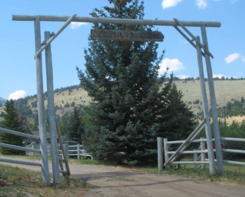
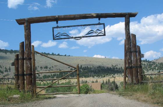
We were following this gravel road out to the National Forest so we could see for ourselves how far the cattle were driven to their summer range. On the way Joyce was taking pictures of ranch gates. She started taking pictures of ranch gates back in Texas where ranchers like to go "all-out" when constructing a gate. These are more modest but many show creativity.
This one is not ostentatious by any means but it should win a creativity award.
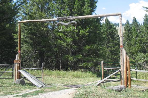
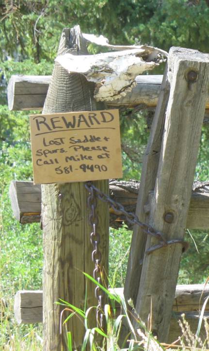
We saw this sign on the fence/gate leading into the National Forest. Just how do you lose a saddle & spurs?
We visited Virginia City several times while staying in the Madison Valley. Virginia City is located west of Ennis over a hill. I sometimes wonder what the difference in a hill and a pass is. Talk about gnarly, this is one bad boy. As far as I know it is not know as anything but the Ennis to Virginia City Hill but is is much worse than many passes. It is 14-miles from Ennis to Virginia City 10 of those miles are climbing a 7% grade. These pictures were taken from a view point about 3/4 of the way to the top. The picture is looking east toward Ennis and the Madison Valley.
The Madison River runs from right to left through this picture. That means the Madison River is running from south to north through this valley.
Now back to navigating the "hill" once at the summit the road flattens for a bit then there is a 7% grade that takes you through Virginia City. Big (as in heavy) rigs have to be controlling their downhill speed from the beginning on a hill like this or they will go screaming through Virginia City unable to slow down.
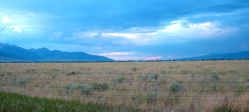
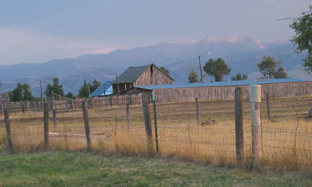
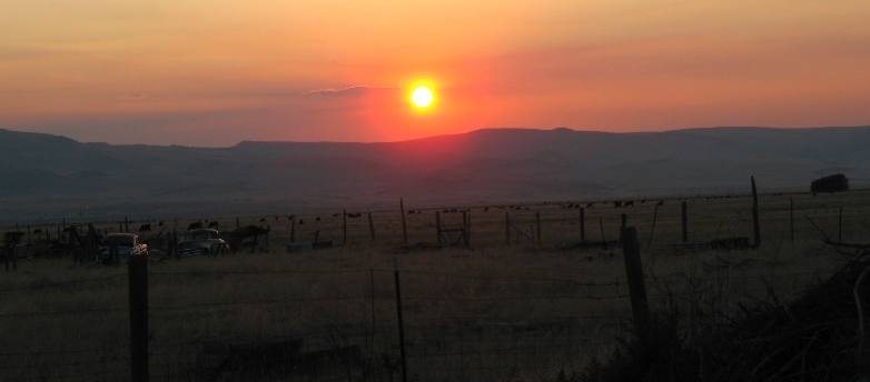
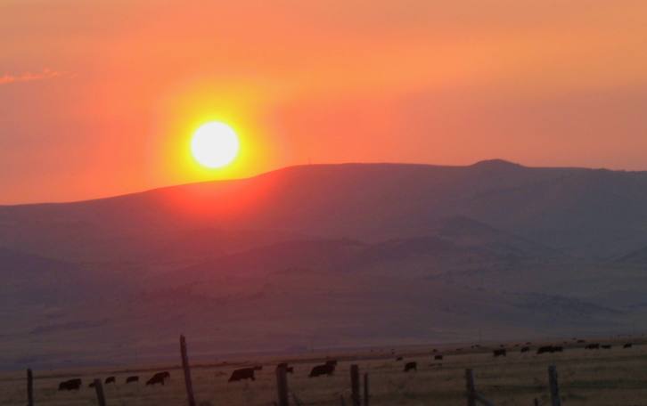
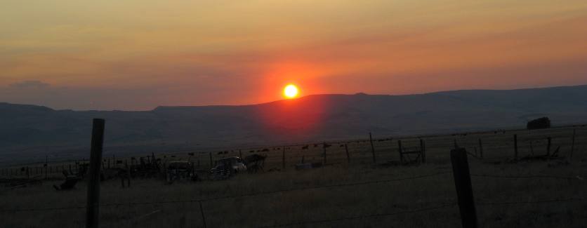
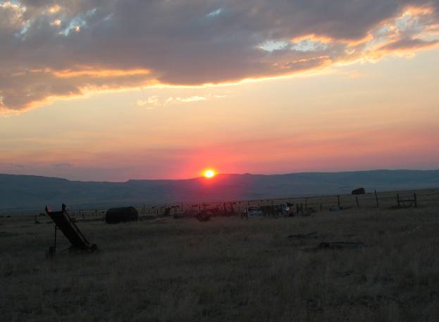
Joyce took these pictures from the RV-Park in Cameron looking west.
Cameron appears to be carved out of a large cattle ranch as cattle surround us.
We always enjoyed watching the sun go down although we were not there for any spectacular sunsets. No matter it is always enjoyable to watch the sun drop behind the mountains.
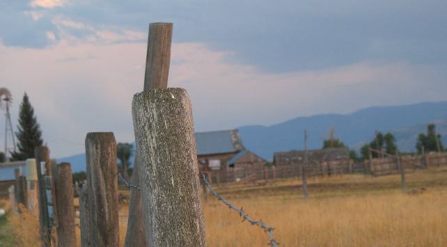
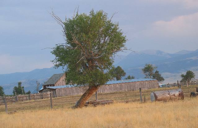
These are just rustic pictures Joyce was taking from the RV Park in Cameron.
We will always cherish the days we spent in Cameron enjoying the Madison Valley and the slower way of life.
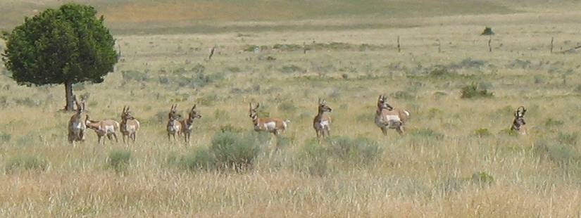
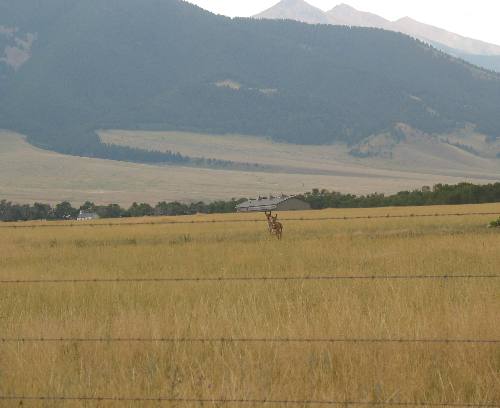
Thousands of elk, mule deer, whitetail deer, antelope, and other smaller animals live, eat, and migrate through the Madison valley. While public lands in the Beaverhead and Deerlodge National Forest provide protected habitat in the mountains surrounding the Madison Valley, ranch lands of the valley provide essential food, security, and freedom of movement for many animals, particularly in winter.
None of the sunsets were spectacular but relaxing and enjoyable none the less.
This is a nice herd of pronghorn antelope.
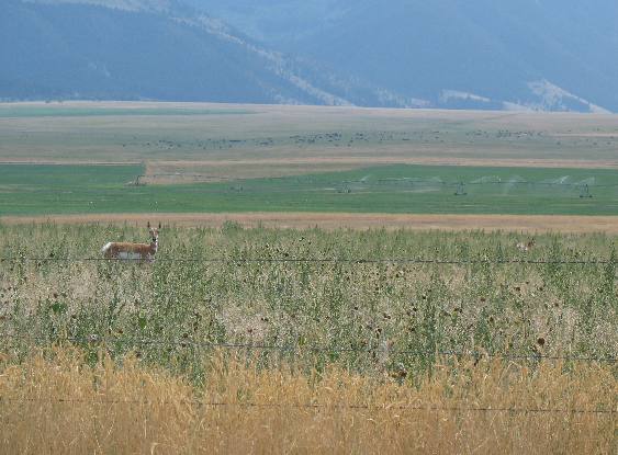
In this picture you can see an irrigated hay field as well as this unirrigated pasture land with an antelope that is watching us even as we are watching him.
This open range land provides habitat for wildlife such as these antelope. The ranchers cattle will be grazing on this piece of property in the winter.
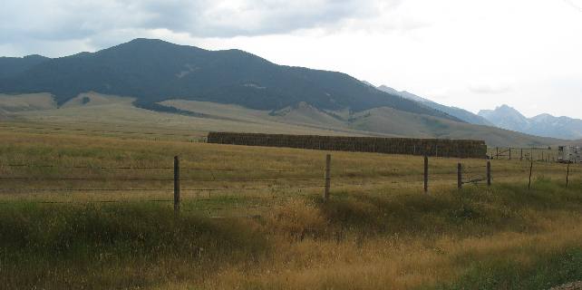
In addition to having the range land you can see in this picture this rancher also has some irrigated land where he is producing hay. Lots of hay from the looks of enormous inventory of hay in this picture.
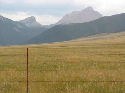
This pasture is preparing for the cattle that will reside here all winter. If no cattle graze on it all summer, hopefully there will be enough forage for this rancher's cattle to survive the winter, otherwise he will have to provide them expensive hay. Remember that this rancher's cattle are grazing on National Forest land during the summer months.
Until next time remember how good life is. Mike & Joyce Hendrix
|
| ||

| |||