Places Visited: Montana: Visiting Headwaters of the Missouri Park near Three Forks Montana. July 30, 2007. We are staying in Cameron RV-Park & Store in Cameron, Montana. Cameron is a STORE located 10-miles south of Ennis in the Madison Valley. The Cameron RV-Park is about 12 sites located behind the Store & Saloon (the social gathering place for miles around). The PPA campground is nothing fancy but for the PPA price of $12.50 for FHU it is just fine. The view over the Madison Valley and mountains surrounding Virginia City is worth the $12.50. Today we are traveling in our motorhome from Helena, Montana to Ennis, Montana and have stopped at Wheat Montana a well known business that specializes in wheat products from flour to bakery goods. We dropped the motorhome in their parking lot while we drove our "little red Saturn" to visit Headwaters of the Missouri State Park near Three Forks, Montana. We dropped the motorhome at exit 274 on I-90 then drove the Saturn east to exit 278 where we exited onto the road that took us into Headwaters of the Missouri State Park. I suppose about this time you are asking "What is the attraction with Headwaters of the Missouri" --- and that would be a good question. The best I can tell you is that the spot is historically important since it is the headwaters of North Americas longest river. It is also historically important because Lewis (of Lewis & Clark fame) was charged by President Jefferson to locate the headwaters of the Missouri River. You can also say that it was a significant place for anyone that has read journals about the Lewis and Clark expedition. I suppose that we are stopping here to check off another place mentioned in Lewis and Clarks account of their epic journey. I think Thomas Jefferson's instructions to Meriwether Lewis on July 4, 1803 was: "The object of your mission is to explore the Missouri River, and such principal stream of it, as, by it's course & communication with the waters of the Pacific ocean...may offer the most direct & practicable water communication across this continent..."
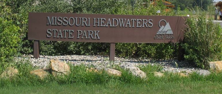
Here we are.
This is where three great rivers join together forming the Missouri River, waterway to the nation's heartland. This headwaters region has lured people for thousands of years. Native people, trappers, explorers like Lewis and Clark, Mountain Men like John Colter, miners, homesteaders and speculators have all passed this way. The three rivers that join at this spot are the Madison, Jefferson and Gallatin Rivers forming the Missouri River thus the name Headwaters of the Missouri.
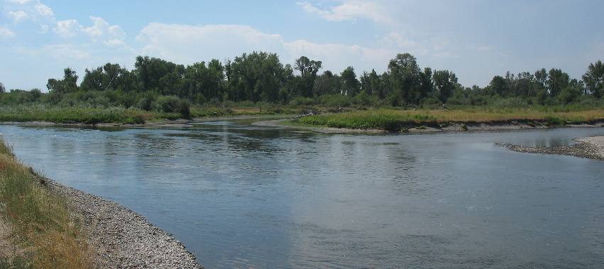
This is where two of the river join. To the left is the Madison River while the river entering from the right is the Jefferson. Of course the Jefferson River is named for President Thomas Jefferson while the Madison River is named for James Madison who at the time was Secretary of State (I think) and later became President. Wasn't it Madison that negotiated the Louisiana Purchase?
Native Americans have a long tradition at the Headwaters, considered by many to be a sacred place. Many different tribes came here to camp, hunt, fish and gather plants along the river banks. In 1805, Lewis and Clark passed through this area following President Thomas Jefferson's orders to search for a Northwest water passage he believed might cross the continent. Lewis and Clark and their men camped here for three days.
This region was alive with beaver, otter and game before the white men came it was disputed hunting territory with the Indian tribes. Sacajawea, the Shoshone squaw who helped guide portions of the Lewis and Clark Expedition, was captured near here when a child during a battle between her people and and another tribe. Her memories of this country were invaluable to the explorers. The Expedition, westward bound encamped near here for a few days in the latter part of July 1805. The following year Captain Clark and a party of his men came back, July 13, 1806, on their way to explore the Yellowstone River.
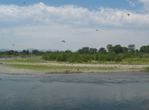
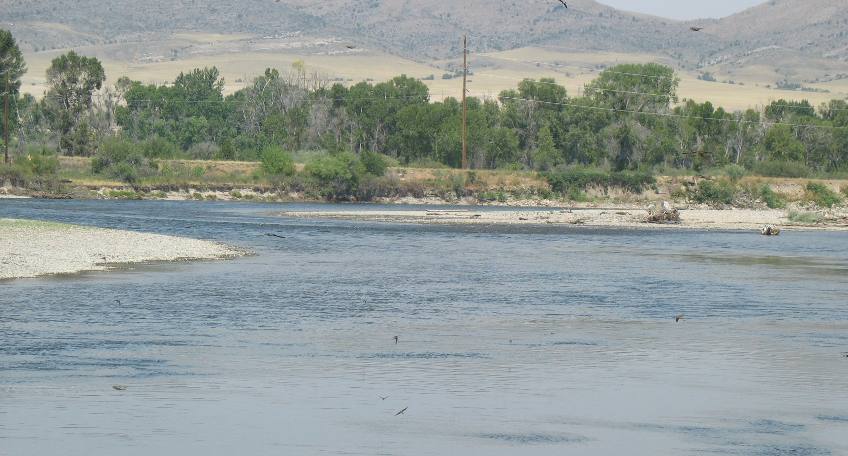
This is the Confluence of the Jefferson and Madison Rivers that results in the Missouri River. While I took this picture at the confluence of these rivers I was trying to get a picture of the huge flock of bank swallows flying over the river. They were nesting in the bank on this side of the river. The bank was about 10' feet and steep with absolutely no way to get to the water and walk along the bank. That is why the bank offered them a safe nesting place. In any event we are standing on the eastern bank with the camera pointed to the west. That is the Jefferson River you can see in the distance on the left side of the picture. The Madison River is flowing from the south which is to the left.
But to me the best story emanating from this area is that of John Colter. If you remember John Colter was the "Mountain Man" credited with discovering Yellowstone Park. He was also a former member of the Lewis and Clark Expedition. John Colter was released from service by Lewis and Clark on the Expeditions return trip in 1806 sometime before they arrived back in St Louis. John wanted to return up the Missouri River with a group of trappers. Lewis and Clark released John on the condition that no other members of the expedition would be allowed to leave until the mission was complete. John Colter became a noted Mountain Man and explorer after his release from the Louis and Clark Expedition in 1806. In 1808 John Colter was trapping on a stream in the vicinity of the Headwaters of the Missouri when he was captured by a band of Blackfeet. His only companion was killed. Colter was stripped naked, given a head start, and ordered to run across the flat which was covered with prickly pear. The Indians were hot on his heels but Colter undoubtedly made an all time record that day for sprints as well as distance events. He outran the Indians over a six-mile course and gained the cover of timber along the Jefferson River. Once in the stream he dove and came up under a jam of driftwood. This hide-out saved him from a lot of disappointed and mystified Indians. When night came he headed east, weaponless and outnuding the nudist. He traveled in this condition for seven days to Fort Lisa, his headquarters, at the mouth of the Big Horn River. Like I said, that story about John Colter, the noted Mountain Man, is one for the record books. Sacagawea was a child when she was kidnapped near here and it was several years later when she was probably 17 years old, with an infant, that she came back through here with the Lewis and Clark Expedition. In the years during the Civil War , ( circa 1863) a few entrepreneurs started a small town here that survived only a few years. These entrepreneurs had dreamed of becoming a major transportation center, with steamships connecting to stage lines. I do not know why they thought steam boats could operate up this far on the river knowing about the Great Falls of the Missouri that Lewis and Clark had written about. Steam boats don't climb water falls.
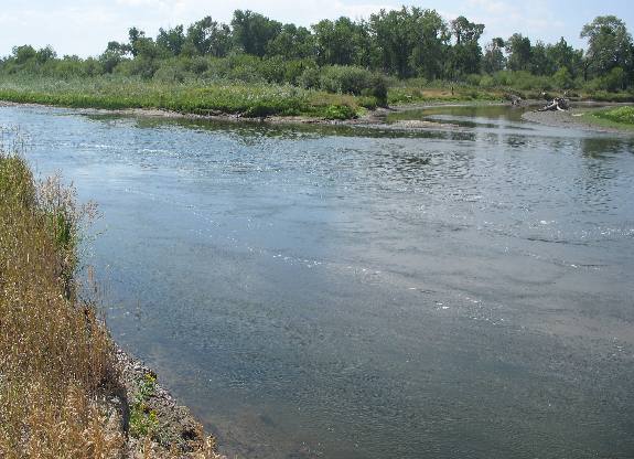
This is another picture of the confluence of the Madison and Jefferson Rivers. This time I am facing more or less south. The Madison River is flowing from the left while the Jefferson River is flowing from the right. The river in the foreground is the Missouri that was created at the confluence.
The Madison River flows out of Yellowstone National Park. The Jefferson River has its headwaters near Twin Bridges, Montana some 100-miles to the southwest.
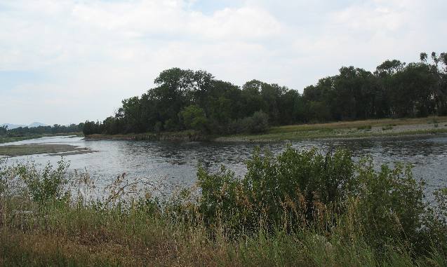
This is another picture of the Madison River before it meets with the Jefferson. As you can see the Madison River has a significant volume. The Madison River's headwaters are in Yellowstone National Park. For those of you who are familiar with Yellowstone National Park the Headwaters of the Madison River are located at Madison Junction where the road to West Yellowstone intersects with Grand Loop Road. It is the Gibbon River that flows under the bridge just south of the Madison Junction (even though the sign on the bridge identifies the river as the Madison). The Gibbon River and the Fire Hole river meet to form the Madison River a few hundred yards west of that bridge. The confluence of the Gibbon River and Firehole River takes place in the Madison Campground area located on the southwest corner of Madison Junction. The Fire Hole River flows in from the south and the Gibbon River flows in from the north. The confluence of the Fire Hole and Gibbon Rivers form the Madison River.
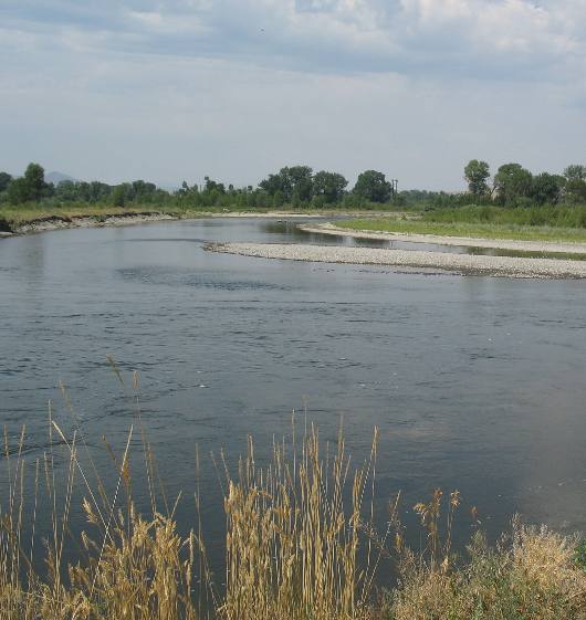
This is the Jefferson river as it merges with the Madison River. The Madison River has double the volume of the Jefferson, in my opinion. The Missouri River begins at this spot.
This is another look at the Madison River prior to merging with the Jefferson River forming the Missouri River about a mile downstream.
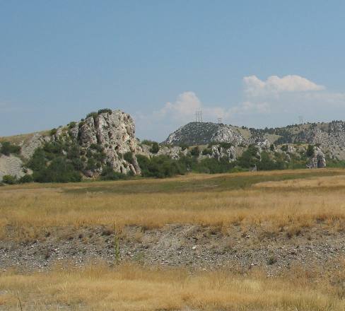
Lewis climbed on this limestone cliff to survey the surrounding area. He described this rock but I don't have my Lewis and Clark books handy and the Park didn't have a kiosk that provided that information.
After the fur trade died down gold was discovered in Montana. The first wave of white settlers flocked to this region. The early farming settlements in the Headwaters area were started to supply the gold camps at Virginia City along Alder Gulch. In 1863, Montana got its first ferry here at the Headwaters. It mostly carried wagons and stages across the river for people traveling to Helena, the gold camps, or the Gallatin Valley. Each person paid 25-cents to cross. Don't let that 1863 date of the first ferry in Montana slip by without recognizing that it was during the Civil War. It was at this spot that after a grueling trip up the Missouri River, the Lewis and Clark expedition reached the Headwaters of the Missouri River in July of 1805, fulfilling one of the main directives from President Thomas Jefferson. They became the first non-Indians to explore this area, at least they are the first to document that they visited this area.
The Gallatin River has its headwaters in Yellowstone National Park a few miles north of Madison Junction.
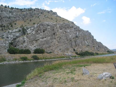
This magnificent limestone cliff is on the newly formed Missouri River a few hundred yards downstream from the confluence of the Gallatin River. The Missouri River is flowing north at this point and will continue in a northerly direction for around 100 miles before turning to the northeast and finally east, near the Canadian Border. It will flow east across the top of Montana and part of North Dakota before turning south into South Dakota.
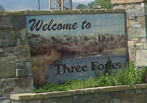
Upon leaving Headwaters of the Missouri State Park we headed in to the city of Three Forks. It was only about 3-miles into the city.
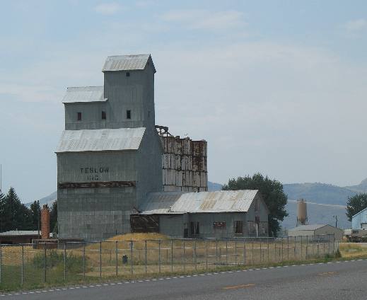
On the way into Three Forks we passed this old grain elevator. There seems to be a good number of these old grain elevators still in existence. I wonder if this one is still in operation. We did not see any activity around the building so I would guess not.
Three Forks has several restaurants and a museum but we didn't stop. It is hot and we want to get back to the motorhome and continue our journey to Ennis.
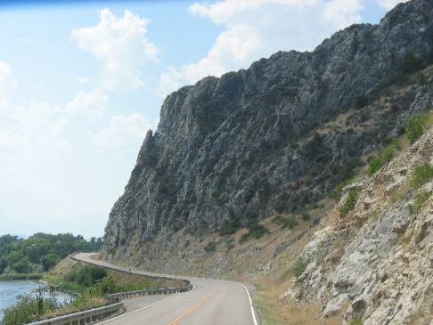
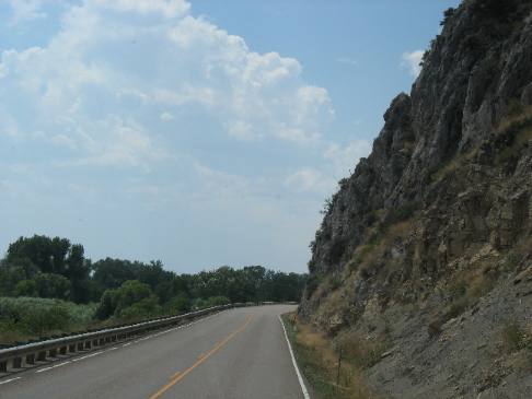
As we continued south on US-287 from exit 274 on I-90 the highway followed the Jefferson River for a few miles. The road during this section was notably scenic as the narrow highway threaded its way between the sheer cliffs and the river.
And one last look at the cliffs carved by the Jefferson River as it makes its way down to Headwaters State Park.
Until next time remember how good life is. Mike & Joyce Hendrix
|
| ||

| |||
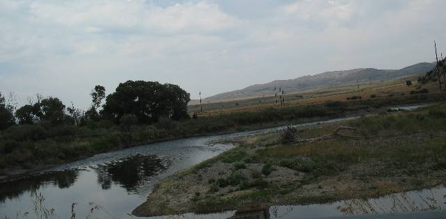 This
is the Gallatin River the third and final river to meet at this spot. It actually
joins the Missouri River several hundred yards north of the confluence of the
Madison and Jefferson Rivers. You can't actually see the confluence of the Gallatin
River and Missouri River in this picture. We both wanted to walk to the spot but
it was nearly 100 degrees outside and was just too hot. We both walked to the
confluence of the Madison and Jefferson Rivers and have not yet recovered from
that walk. The heat is brutal. The area is locked in a record breaking heat wave.
The actual confluence is less than 100 feet from where this picture stops. Close
but no cigar.
This
is the Gallatin River the third and final river to meet at this spot. It actually
joins the Missouri River several hundred yards north of the confluence of the
Madison and Jefferson Rivers. You can't actually see the confluence of the Gallatin
River and Missouri River in this picture. We both wanted to walk to the spot but
it was nearly 100 degrees outside and was just too hot. We both walked to the
confluence of the Madison and Jefferson Rivers and have not yet recovered from
that walk. The heat is brutal. The area is locked in a record breaking heat wave.
The actual confluence is less than 100 feet from where this picture stops. Close
but no cigar.