Places Visited: Montana: Cut Bank on US-2 east of Glacier National Park, and Camp Disappointment of Lewis and Clark fame. July 17 to 19, 2007. We are staying in the Riverview RV Park in Cut Bank, Montana. We are in a water & electric site $24.08 with 10% Good Sam discount. It is nothing but an OK RV-Park in a small town. The park only has a few small trees but the park does have location ------- in the city.
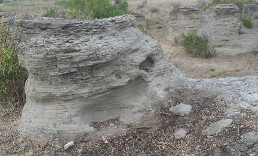
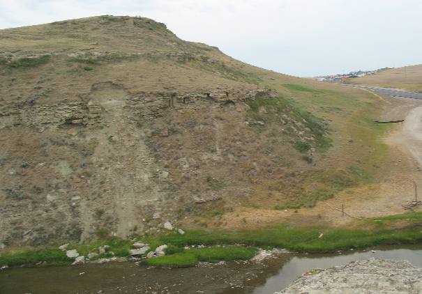
Our motorhome is located in Riverview RV Park in the small prairie town of Cut Bank, Montana. Cut Bank is the hub for agricultural activity in this area. The campground is located where you can walk to the bluff (Bank) and see the small river below us. Erosion in and around the campground has created a variety of interesting hoodoos. Hoodoos like this one form when a harder layer of sediment protects softer sediments located below it.
Here you can see several hoodoos that have formed on the bank.
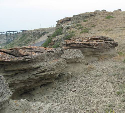
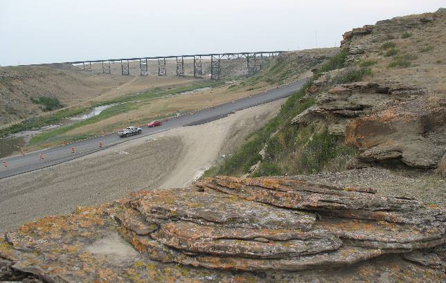
This picture captures not only the harder "cap rock" that is protecting the softer sedimentary layers underneath but it also captures US-2 (The Theodore Roosevelt International Highway) as it threads its way across this part of the North American Continent. The Burlington Northern Railway bridge is in the background and the river is at the bottom of this "Cut Bank".
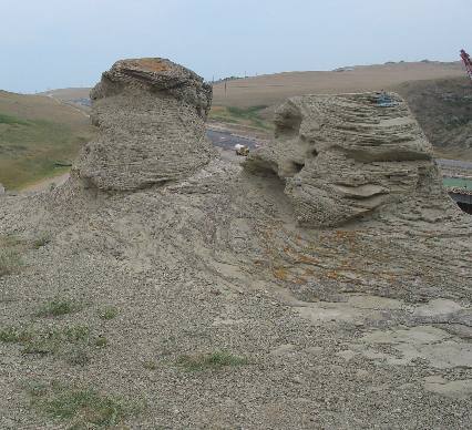
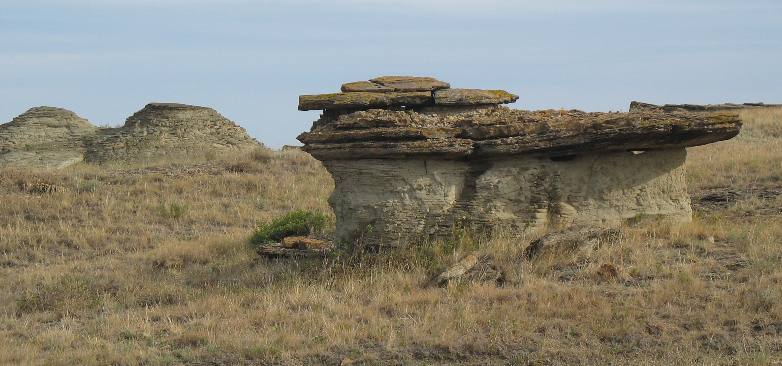
Only a small fragment of harder "cap rock" remains on the hoodoo on the left while the cap rock appears to be all but gone from the hoodoo on the right. Once the cap rock is gone the top of the hoodoo will become pointed.
Looking across the river to the bank on the opposite side one can clearly see three different layers of harder rock all protecting the softer sedimentary layers underneath.
Isn't it interesting how this hoodoo developed. In this picture it is fairly easy to see how the harder "cap rock" protects the softer material underneath from water born erosion.
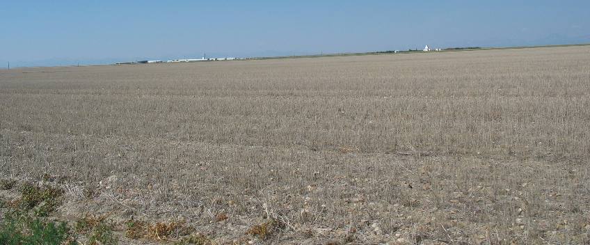
We went for a drive in the countryside surrounding Cut Bank. The entire area consists of large grain growing operations. Farmers in this area rotate crops leaving the land to sit for one or two years while it replenishes moisture and nutrients. This field is "resting". In the background you can see some large white buildings. It appears to be one of the Hutterite communities in the area. Huterites live in communes. This one is located on the Blackfoot Indian Reservation.
In this location grain is growing to the horizon or should I say it appears to be growing to the horizon.
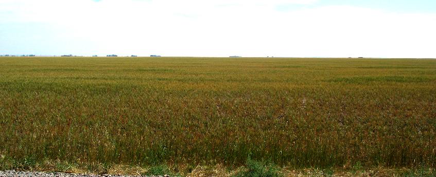
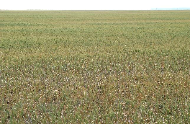
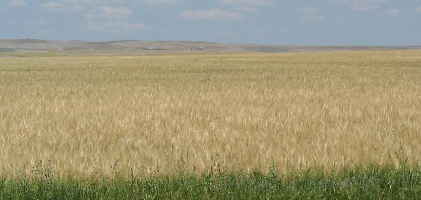
This is another grain field that appears to stretch to the horizon. This is known as "dry" farming as no irrigation is used.
It will not be long before this field of grain will be full of harvesters.
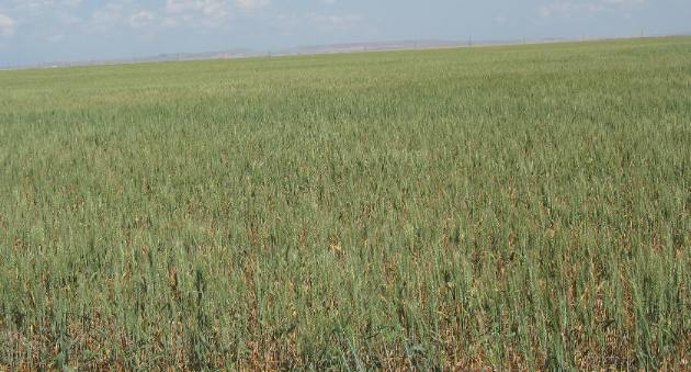
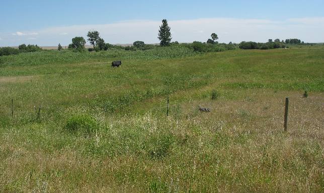
This field is still green and will not see harvesters for another month or so.
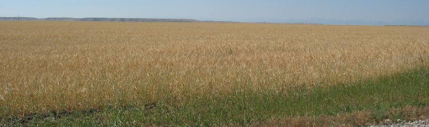
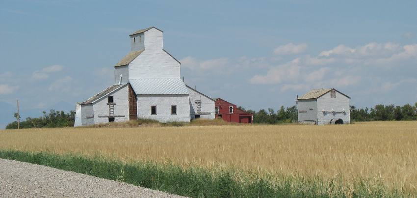
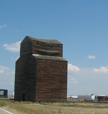
This is an old grain elevator along with a field of grain that is almost ready for harvest.
This old barn was near one of the Hutterite communes so I suspect it is used by them.
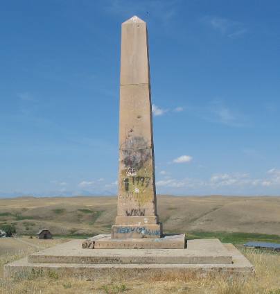
If you have read any accounts of the Lewis and Clark Expedition you will recall Camp Disappointment. Camp Disappointment is located 15-miles west of Cut Bank. A monument has been erected on a hill easily accessed from US-2 to commemorate the farthest point north reached by the 1804-1806 Lewis and Clark Expedition. The monument was erected by the Great Northern Railway in 1925.
To refresh your memory about Camp Disappointment we have to backtrack a little. Lewis and Clark of the Corps of Discovery traveled west to search for an all water route to the Pacific Ocean. Prior to departure, Captain Lewis was given instruction on mapping their route. Throughout the journey, Lewis and Clark took daily observations using the stars and the sun and charted the area using a sextant, compass, and chronometer. On the return trip Lewis and Clark decided to split up somewhere along the Idaho/Montana border with Clark taking some of the the men and heading out over land in search of the Yellowstone River.
While Lewis would take the other men and explore the area north of the Missouri River in Northern Montana. Lewis with three of his best men left the main party at the Missouri River and embarked on a side trip to explore the headwaters of the Marias River. He hoped to be able to report to President Jefferson that the headwaters arose north of the 49th parallel. Although the Marias flows predominately westward, Lewis decided to go up the more northern Cut Bank Creek, hoping the waters would extend the boundary of the newly acquired Louisiana Purchase. When Lewis reached Camp Disappointment in present-day Montana on July 22, 1806, he attempted to take an observation and continued over the next few days to determine their exact location, but the cloudy weather made Lewis' readings inaccurate. According to Meriweather Lewis' journal the party camped on the Cut Bank River July 22-25, 1806 in a "beautiful and extensive bottom." Deep in the territory of the dreaded Blackfoot the men were uneasy. Lewis wrote "game of every description is extremely wild which induces me to believe the Indians are now, or have been lately in this neighborhood." After viewing the country from a vantage point near his camp, Lewis concluded that the river traversed the mountains to the west rather than to the north as he had hoped. Disheartened by this conclusion, the unseasonably cold and rainy weather, and the shortage of game, Lewis wrote "I had the horses caught and we set out biding a last adieu to this place which I now call camp disappointment..."
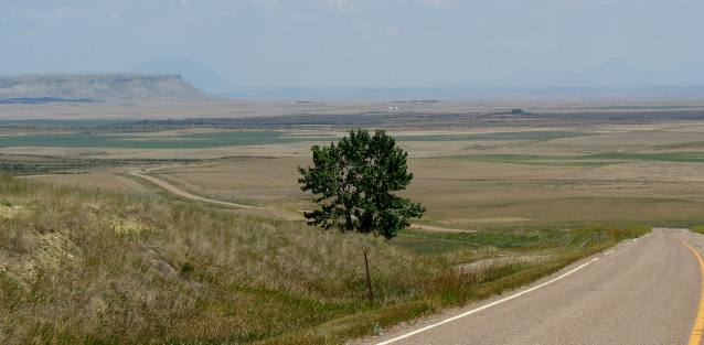
Lewis and his men left "Camp Disappointment" on July 26, 1806. Later that day Lewis and his men met three young Piegan Blackfeet warriors and camped with them on the Two Medicine River. The meeting resulted in tragedy when an unfortunate event led to the death of one warrior and the wounding of another. The unfortunate incident had a profound effect on American relations with the Blackfeet for decades. Lewis and his men retreated at full speed to where they had left the remainder of their troops and boats where they quickly cast off and headed down the Missouri River toward home. Now you know the significance Camp Disappointment played in the early history of our Country. The above picture attempts to capture the "beautiful and extensive bottom" Lewis described in his journal. Today Camp Disappointment is deep in the Blackfoot Indian Reservation.
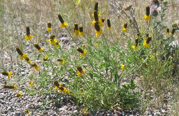
This appears to be a prairie coneflower or Mexican hat that Joyce photographed in the highway right of way. This is the furthest north we recall seeing coneflowers.
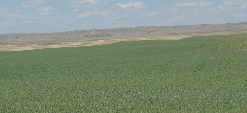
Leaving Lewis & Clark's Camp Disappointment behind we continued to check out the local area. Everywhere we looked grain is the norm as is the practice of leaving acreage idle to replenish the moisture and nutrients. Remember that farming in this region is "dry" farming meaning they do not use irrigation.
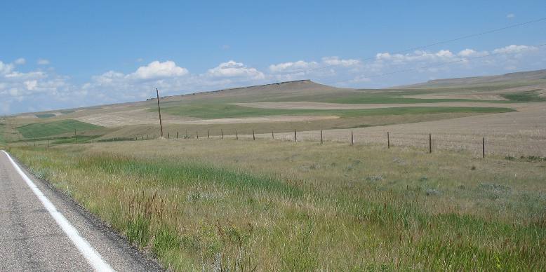
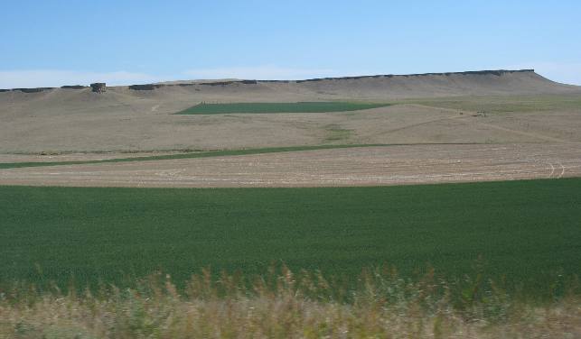
This picture clearly highlights green grain fields along with acreage being left to rest. On the butte in the distance it is fairly easy to see the harder "cap rock" that has protected this butte from water erosion.
This grain looks ready for harvest. I suspect harvesters will be running through this field within a few days.
We were exploring the area north and east of Cut Bank when we found the edge of the plateau we had been traversing. In this picture we are heading east or possibly northeast and we are very near the Canadian border 10 to 15 miles north of Shelby, Montana.
Some of the grain fields are ready for harvest while other fields are bright green.
Many of these old grain elevators are being disassembled for the old wood and sold to the Japanese who prize it for flooring.
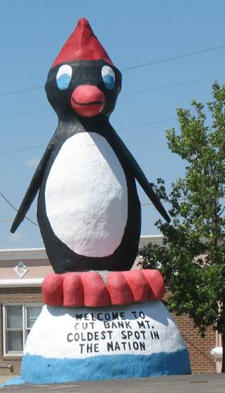
And we leave you with this penguin located on the east side of Cut Bank, Montana.
Cut Bank, Montana the coldest spot in the Nation.
Until next time remember how good life is. Mike & Joyce Hendrix
|
| ||

| |||