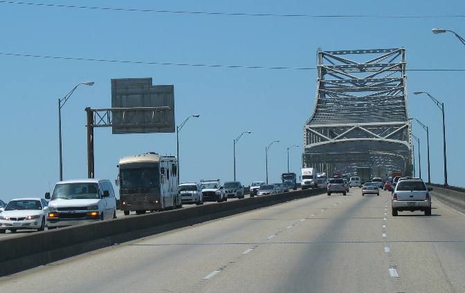
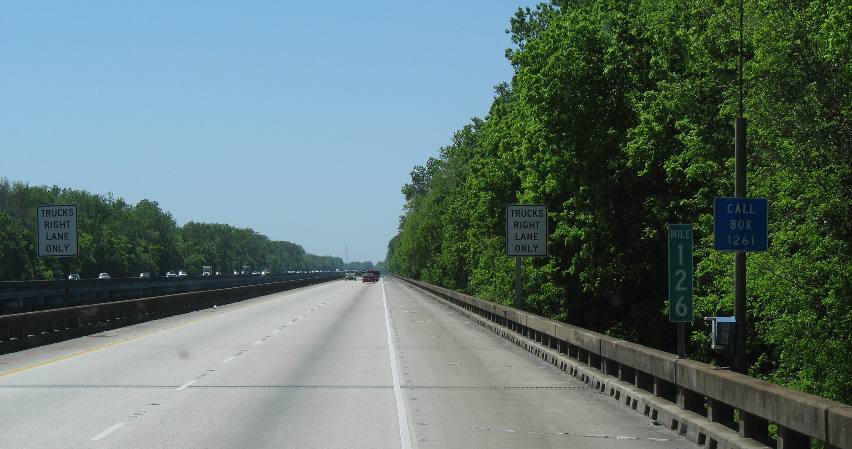
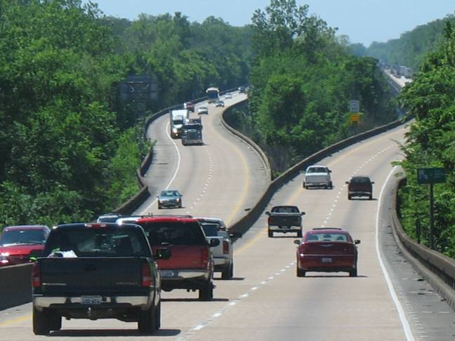
Places Visited: Traveling I-10 from Pensacola, Florida to Lafayette, Louisiana. Louisiana: Baton Rouge, Lafayette, Beaux Bridge April 5, 6 & 7 2007. After an extended stay in Pensacola we headed out for the summer on Thursday the 5th of April. It was good to be in the motorhome heading out for this summers adventure. Our destination today is Lafayette, Louisiana over 300 miles west of Pensacola on I-10, that ribbon of asphalt and concrete that connects Jacksonville, Florida on the east coast with Los Angeles on the west coast. We have made this journey so many times that we did not want to dilly dally between Pensacola and Lafayette. However, Lafayette is one of those places that beckons us like a moth to a light. Traveling I-10 can be a very different visual experience. We are always infatuated with our journey through Louisiana. There is no other bridge on I-10 like the monster bridge in Baton Rouge, Louisiana over the Mississippi River. This bridge towers above the river so high that huge ocean going tanker ships cruise under the bridge bringing crude oil to refineries lining the Mississippi River north of Baton Rouge.
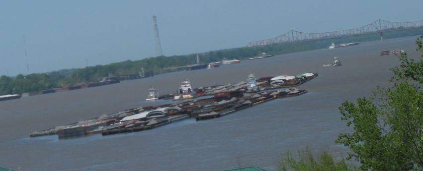
This is a picture taken from the I-10 bridge over the Mississippi River looking north. The view from the top of this bridge is breathtaking.
This is the view from that bridge looking north, as in up-river. Barge traffic on the Mississippi is hectic as usual. The bridge in the background is the ancient US-90 bridge that crosses the River a few miles north of Baton Rouge. Ocean going vessels do NOT go upriver past that bridge. If you are in an RV or pulling an RV that bridge (the US-90 bridge) is very narrow and is not one you would relish driving a big RV across unless you are looking for an adrenaline rush. Can you imagine narrow?
The bridge looking at the west bank as taken through our motorhome windshield. In contrast to the US-90 bridge this modern monster has nice wide lanes.
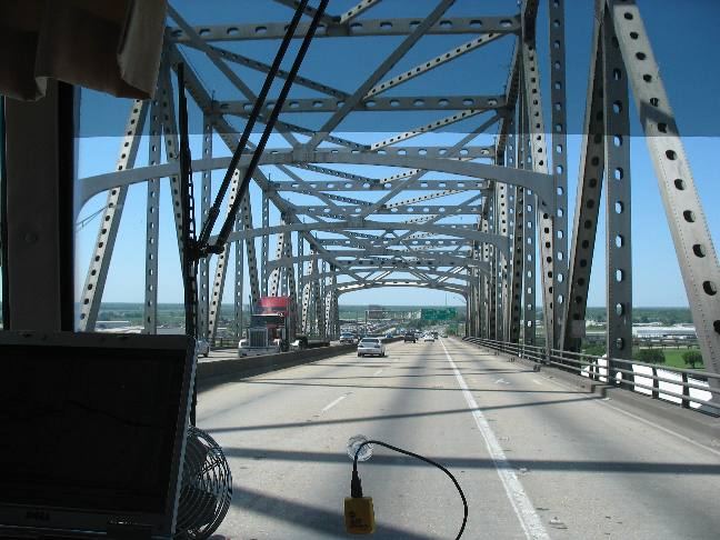
About 15-miles west of the Mississippi River Bridge is the equally impressive Atchafalaya Basin Bridge. While the I-10 Mississippi River Bridge is huge in terms of size (6-lanes) plus it reaches for the heavens in order to allow ocean going ships to pass underneath the Atchafalaya River Bridge is equally impressive in length and the engineering feat that was required to construct this 20-mile bridge across America's most daunting swamp.
The Atchafalaya Basin is the traditional flood plain of the Mississippi River and still functions as such in times of high water, usually associated with traditional spring runoff and flooding. Before being "controlled" by the Corps of Engineers two-thirds of the mighty Mississippi used to flow to the Gulf of Mexico through the Atchafalaya Basin. Now huge levies hold back the Mississippi River and direct two-thirds of the flow through Baton Rouge and New Orleans. In times of high water more gates are opened to allow excess flow from the Mississippi River into the Atchafalaya Basin. As you can see from this picture of the Atchafalaya Basin Bridge, near the eastern side, the bridge is constructed as an east bound and west bound highway. What makes the Atchafalaya Bridge different from most is the bridge is traveling along in tree tops along much of its 20-mile length. In order to construct this portion of the bridge a canal was first constructed between what is now the two bridges that allowed barges with cranes to operate. Wheeled vehicles would sink out of sight in the mud. Also this canal provided a transportation link to move construction materials.
Remember this bridge is 20-miles long. It doesn't take long before you begin to comprehend the tremendous engineering feat required to overcome this terrain.
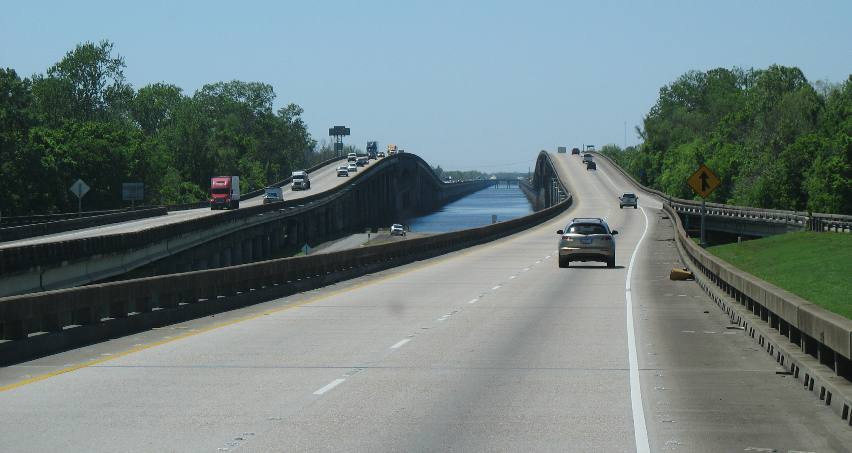
Several navigable rivers flow through the Atchafalaya Basin. The east and west bridges merge when crossing these rivers. We are descending from one of those bridges in this picture. These bridges are constructed high enough so that barge traffic and the tow boats that push them can pass underneath.
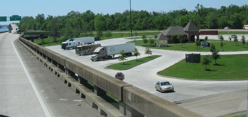
Somewhere near halfway across the Atchafalaya Basin the bridge crosses a small island that supports a Louisiana visitor center and rest area. As you can see there is parking for RV's.
View from the island that houses the Louisiana visitor center and rest stop looking west.
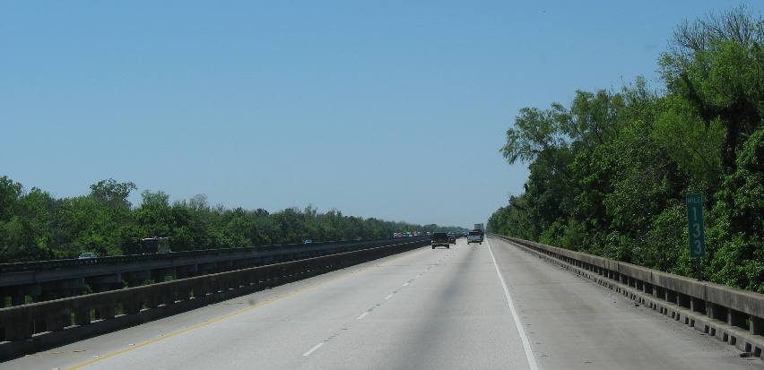
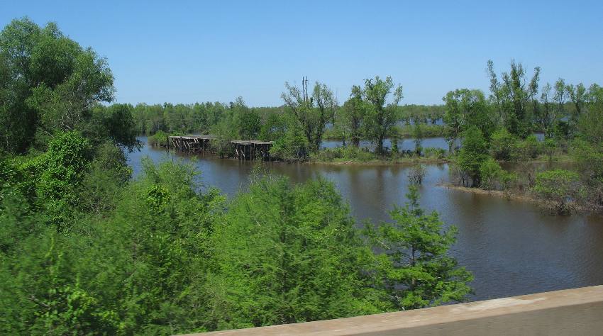
Western portion of the Atchafalaya Basin as seen from the I-10 bridge.
Typical scene from the western end of the Atchafalaya Basin as viewed from the I-10 bridge.
Once on the western end of the Atchafalaya Basin we are getting near our destination. We were both dreaming about real Cajun food and one of our favorite feeding holes is at exit-115. Needless to say we pulled off and got diesel fuel as well as stopping at the Boudin Shack. The Boudin Shack is located on the northwest quadrant of exit-115. While not exactly a shack it ain't a 5-star palace either. It is more along the lines of a "locals" place where Cajuns from near and far arrive to sample the victuals. I sampled the crawfish etouffee, fried crawfish balls and potato salid while Joyce sampled the boudin balls and red-beans with rice. Ahh, we are truly in Cajun Country. Life don't get much better than this. Back on I-10 we continued west to exit-104 in Lafayette where we exit onto Lafayette street and head about 1/2-mile south to Alexander and turn east to Acadiana City Park and Campground $13 for 50-amps and water. Can you say welcome to Lafayette any better than that? To boot the park is situated in a setting of huge oak trees that provide much appreciated shade during the summer months. After getting set up at Acadiana City Park we jumped in our Saturn and headed to the Nature Conservancy heron rookery on the south end of Lake Martin hoping to enjoy one of the countries largest heron rookeries. Although herons were there and nesting they were not as visible from the viewing road as they have been in the past. It seems they are roosting further back in the swamp. We can see activity several hundred yards back in the swamp but we are used to the nest being within 100-feet of the viewing road. The alligators that are usually abundant under the canopy of nests have moved to where the activity/opportunity is and are not to be seen as well. Oh well, we settled for viewing the plant life which we enjoy as well.
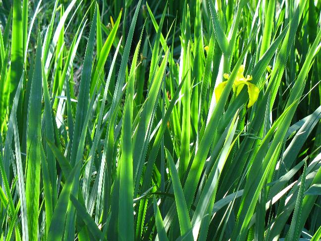
Yellow iris can be seen growing wild throughout south Louisiana this time of year.
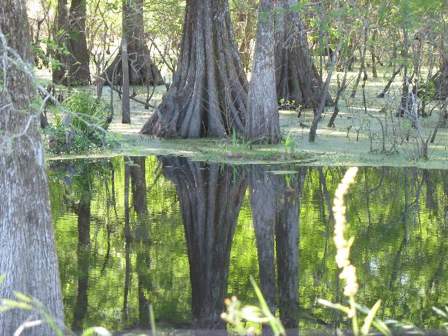
Massive cypress trees reflecting in afternoon light.
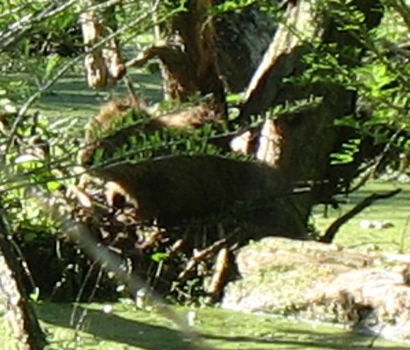
Nutria the rodent imported from South America that has invaded Louisiana. Nutria pelts became popular when beaver were hunted almost to extinction in North America. Now there is a bounty on nutria and trappers are paid to rid the waterways of these pest.
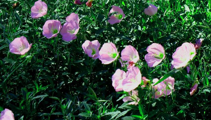
Evening primrose in bloom along many of the highway rights of way.
Joyce decided that I was going to take her dancing tonight and Randall's in Lafayette was going to be the place for both dinner and dancing. Needless to say we had a good time. Randalls is our pick of places to dine and dance when in the area for a weekday night. Mulatte's in Beaux Bridge is OK but the food is just so-so to be kind. The food at Randalls is much better as is the band and the dance floor. The food at Prejeans is very good but the dance floor is almost non-existant and the music doesn't start until after 9PM.
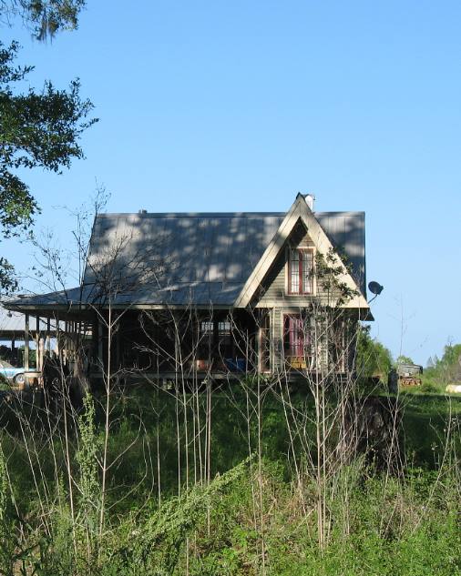
Cajun home on the prairie south of Beaux Bridge, Louisiana.
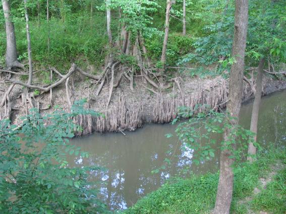
Coulees are small streams, gullies or ravines. In southern Louisiana where there is very little change in elevation these coulees do not have noticeable water-flow. Now contrast that with the water-flow at Grand Coulee Dam. It does have noticeable water-flow --- but you will note that the "Grand Coulee Dam" is NOT in south Louisiana and that sure enough is a "Grand Coulee" agreed. The odd looking pieces of wood protruding from the waterline on the far bank are cypress knees.
Saturday morning arrived and Joyce was up with the birds. It was Saturday afterall and Saturday's in this neck of the woods meant a live band playing zydeco music would be performing at Cafe Des Amis in Beaux Bridge. They start at 8:30 and play till noon. Cajuns from miles around meet at Cafe Des Amis every Saturday to expend energy on the dance floor. One thing is for sure, no one is going to get any sleep if they are near zydeco music. The Cajuns describe zydeco as "high-energy" Cajun music. High energy is right. Every zydeco song is along the lines of "Proud-Mary" on steroids if you get my drift. After the band stopped playing we got a table and had lunch at Cafe Des Amis one of our favorite dining places in Cajun Country. I sampled crawfish and sweet-corn bisque and had some turtle soup. Both were to die for. Joyce opted for a chicken dish. How can someone order a simple chicken dish when in Cajun Country? She made up for that by splitting a white chocolate cream sauce bread pudding with me for desert. Absolutely devine --- to die for good. Folks, if you are ever in this area you just have to stop by Cafe Des Amis in downtown Beaux Bridge.
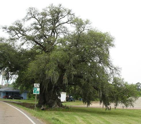
This is an ancient and champion live oak tree in Parks, Louisiana 15-miles southeast of Lafayette. It is the massive girth of this tree that makes it a champion. I think they measure the trunks circumference about 3' from the ground. This tree is hundreds of years old.
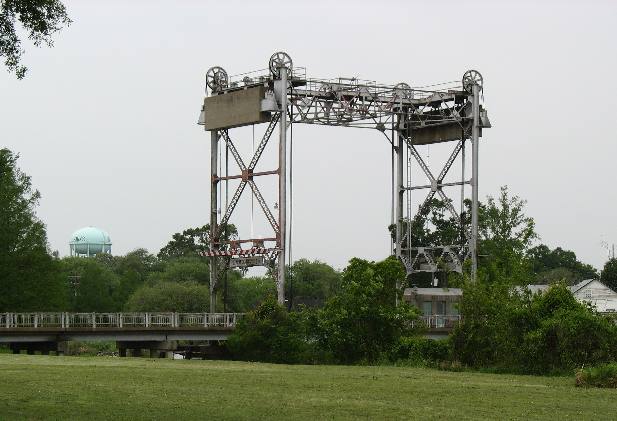
Joyce took this picture of a bridge across Bayou Teche in Parks, Louisiana. Obviously this is an OLD bridge. Note the massive concrete counterweights dangling at the top.
Saturday night we headed to the Atchafalaya Club for a night of dancing. The Atchafalaya Club is located near Henderson, Louisiana. To get there from Henderson head east on the road leading to the levee. The Atchafalaya Club is located on the corner at the levee. Don's Restaurant is located there as well. The Atchafalaya Club is located on the far end of Pat's Restaurant complex so turn in at Don's and drive to the far end of the parking lot. The Atchafalaya Club was made to hold party crowds. The place has a huge dance floor able to hold several hundred couples. An absolutely great band was there playing 60's music. The band was one of those right out of the 60's complete with a brass section (trumpet, sax and trombone). The band didn't take a break the entire 3-hours we were there. We left and went home out of sheer exaustion. We could stay here for months but our destination beckons and we know the price of dillydallying. We have to move on tomorrow. Until next
time remember how good life is. Mike & Joyce Hendrix
|
| ||

| |||