Places Visited: July 4, 2007. We are staying in Pair-A-Dice RV-Park, in Creston, British Columbia. $26.71 gravel interior roads, FHU including cable. This is an OK RV Park.
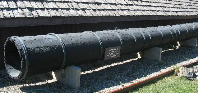
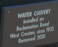
We stopped by the local museum in Creston, British Columbia. One of the things that grabbed my attention was this old wooden water pipe. I have always been intrigued by wooden water pipes. I was surprised by the dates this wooden pipe was in use. I included the information provided so that you would believe it --- 1935 to 2001. Now I am really impressed. I had no idea that there were any wooden water pipes in use in 2001.
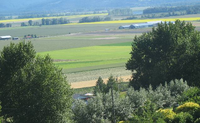
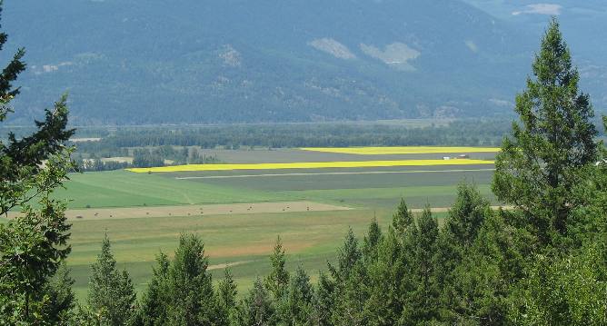
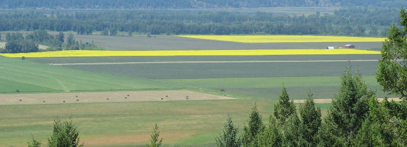
After visiting the museum in Creston we decided to explore north of Creston on PH 3A which travels on the eastern side of what locals call "the flats". The flats happens to be the valley on both sides of the Kootenay River that flows through the middle of the valley.
When white men laid eyes on this valley it was a vast swamp that flooded each spring. It was the dream, in the 1880's of W.A. Baillie-Grohman, British sportsman and financier, to reclaim these fertile flats from the annual river floods. His canal diverted part of the Kootenay River into the Columbia River but it was abandoned. The first successful reclamation came in 1893. Now 25,110 acres lie secure behind 53 miles of dikes.
The Kootenay River still flows through this lovely valley but now it is controlled between two decks.
From this vantage point we can see fields with bales of hay, bright green fields of grain and equally bright yellow fields of canola.
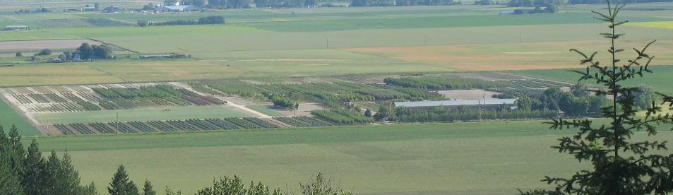
This appears to be a plant/tree nursery in the "flats".
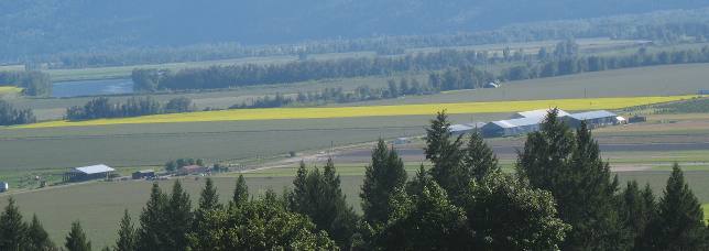
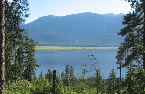
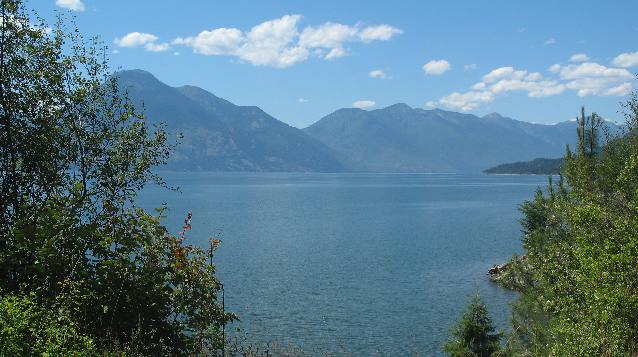
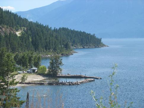
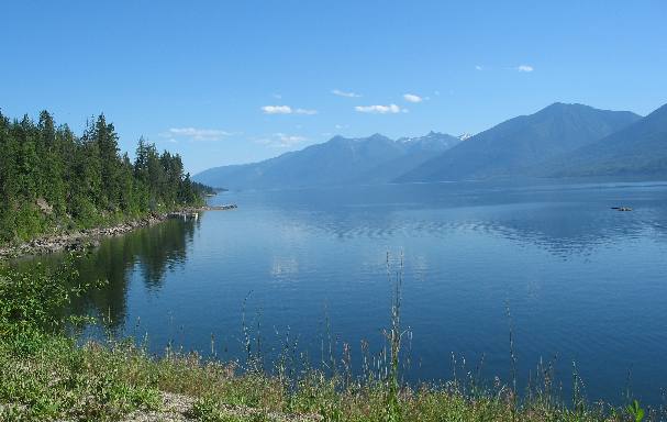
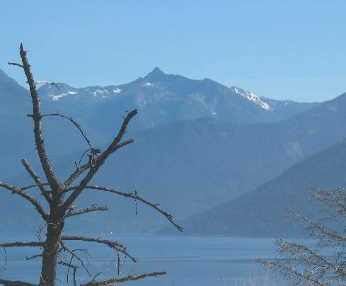
The views from PH 3A on the eastern shore of Kootenay Lake are stunningly beautiful.
On our trek north on PH 3A this is where the agricultural "flats" ends and Kootenay Lake begins.
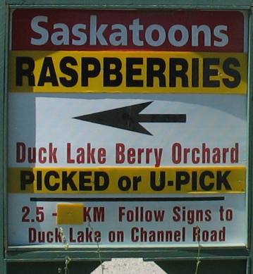
But before we reached Kootenay Lake we stopped to visit Duck Lake Berry Orchard located down on the flats.
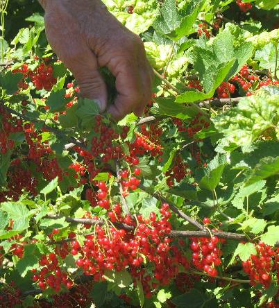
Duck Lake Berry Orchard specialized in currants, saskatoons and jostaberrys. Saskatoons were sold as fresh fruit but most of the currants and jostaberrys were made into jams, jellies and syrups in their own kitchen. These small red berries are "red currants".
And these grape size berries are jostaberries. Jostaberry is a new berry that is a cross between a gooseberry and a black currant. The cross is a totally new berry that combines the best qualities of both the gooseberry and currant. The Jostaberry has a flavor resembling a gooseberry with just a hint of the black currant. One good thing about the plant is the absence of gooseberry thorns.
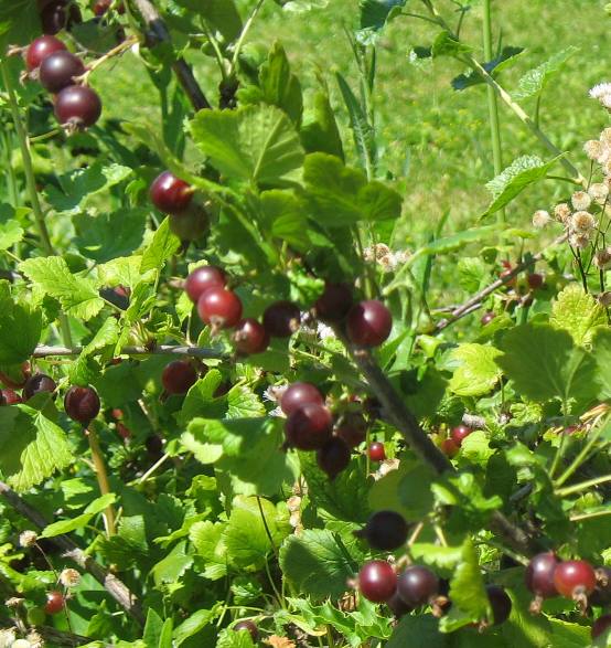
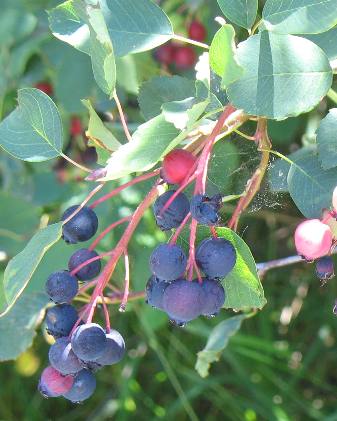
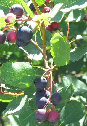
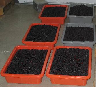
These are saskatoon berries. The saskatoon is also known as a saskatoonberry or The small purple berries, ripen in June and July.
The
berries are consumed fresh as well as made into several Joyce took this picture of saskatoon berries being readied for the freezer where they will remain until made into jams and syrups. These berries were picked by workers this morning. They only pick berries in the morning, stopping picking operations when the berries get warm.
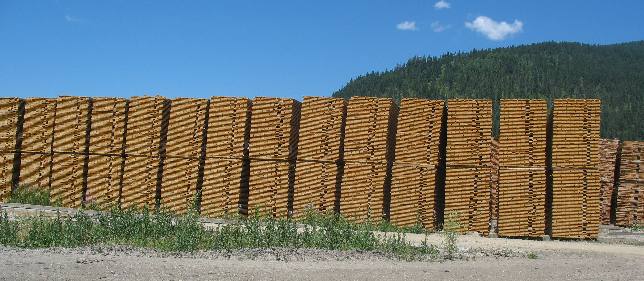
This lumber mill was down the street from the berry orchard.
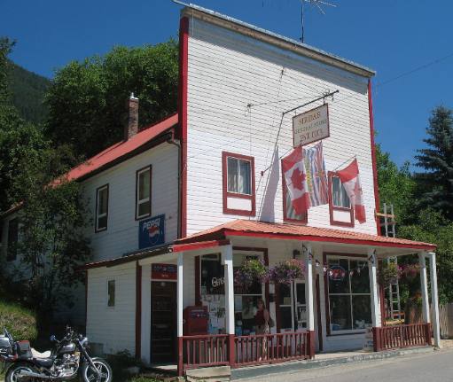
We stopped by this old country store in one of the small communities north of Creston.
Joyce and I discussed what this part of the drive reminded us of and several places came to mind. First of all it reminded us of an Alaskan cruise up the inland passage. The water and mountains remind us of that cruise.
The scenery especially on the side of the lake where we are driving reminds us of driving the California coast south of Monterey. There are a lot of up and downs and many twists and turns just like the drive south of Monterey.
Kootenay Landing served as the western terminus of the Canadian Pacific Railway's Crowsnest Pass route between 1898 and 1931. An extensive trestle system, large steamer docks, and rail car transfer slip joined land to water transportation. A fleet of sternwheelers and tugs met the trains here, transporting ore, coal, lumber, mail and passengers to the West Arm of Kootenay Lake where the rail line continued westward.
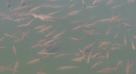
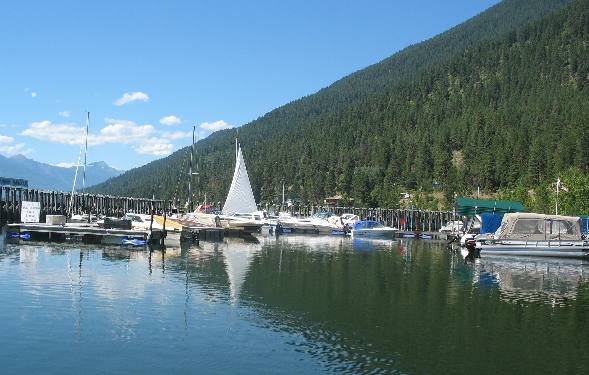
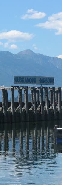
We stopped at Kuskanook Harbor where these fish were milling about in the harbor. There were thousands of these fish all about 8 inches long. Does anyone know what these fish are?
Kuskanook Harbor is a nice harbor complete with boat ramp about 20-miles north of Creston.
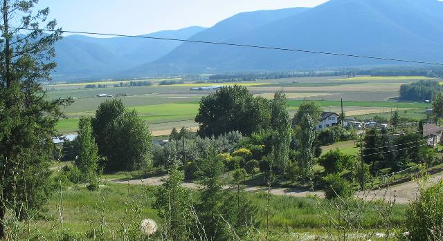
The views from PH 3A are totally awesome as we continue our journey up the east side of Kootenay Lake.
Someone from the area told us this drive from Creston to Kootenay Bay along the eastern shore of Kootenay Lake was the number one motorcycle drive in Canada. I don't know if that is true but we did see a lot of motorcycles on our drive today.
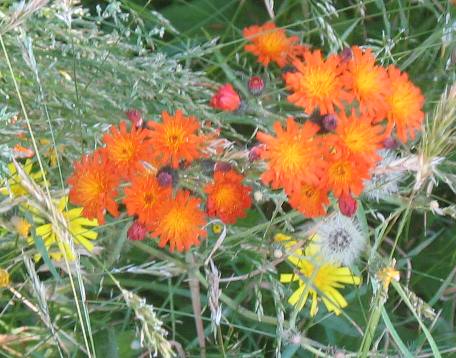
These flowers were in a roadside ditch in the community of Crawford Bay which is noted for the artisans that have shops there. While in Crawford Bay we watched a modern day blacksmith making a variety of parts, a glass blower creating expensive colorful glass works of art, a weaver plying his trade. We skipped a pottery shop and a shop where they were manufacturing brooms. The broom manufacturing would have been interesting, I am sorry that we missed that.
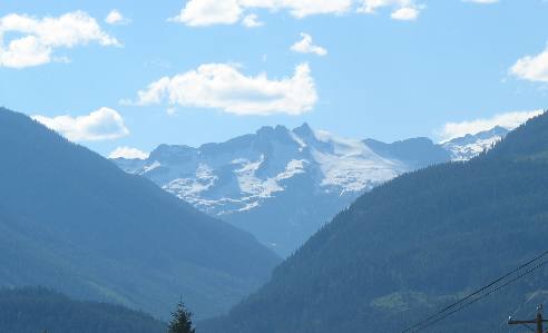
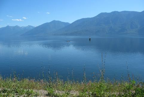
The landing for the free ferry across Kootenay Lake is located only a few miles north of Crawford Bay. There is one peak of this snow covered mountain just before arriving at the ferry landing.
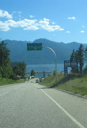
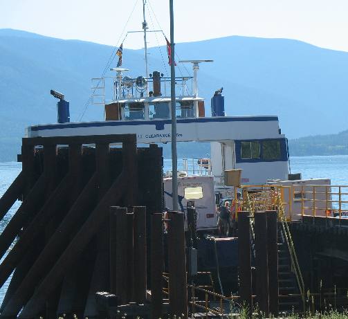
This is the descent to the ferry landing and that is the ferry visible in the picture on the right.
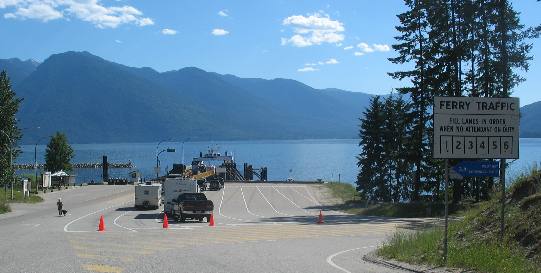
You can see several motorhomes in the process of boarding the ferry for the 45 minute ride across the lake.
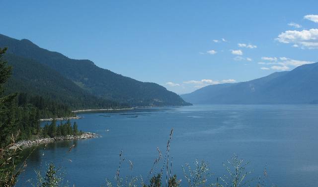
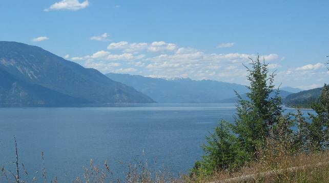
From one end of Kootenay Lake to the other views like this are standard.
A good, full service, RV-Park is available in Crawford Bay.
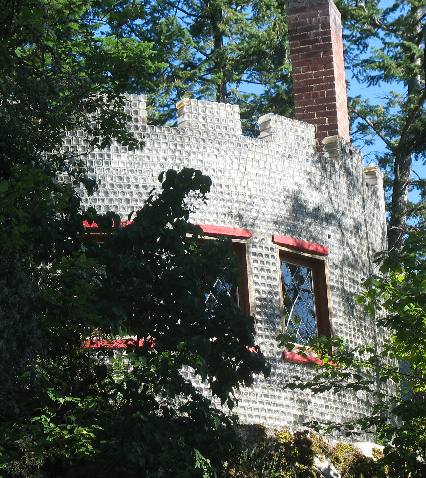
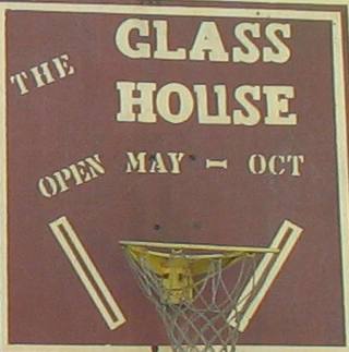
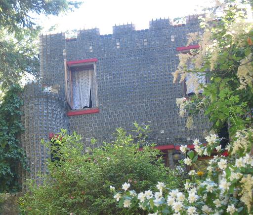
This is the "glass house" located about 25-miles north of Creston. It was constructed in 1959 out of 500,000 embalming fluid bottles. We took this picture from the road. For some reason seeing a house constructed out of embalming fluid bottles did not interest either of us.
And one last look at the famous glass house.
The beauty is truly stunning around every turn in the highway.
Until next time remember how good life is. Mike & Joyce Hendrix
|
| ||

| |||