Moraine Lake - Canadian Rockies - Continental
Divide
July 8, 2007
We are staying in the Tunnel
Mountain National Park Campground in Banff, Alberta. Tunnel Mountain Campground
offers no hookups, electricity only and full hookups. We are in one of the $29.70
electricity only sites. I do not know what FHU or no hookups cost but they are
all in the same area. All sites are paved.
Vistas
on the road from Lake Louise to Moraine Lake
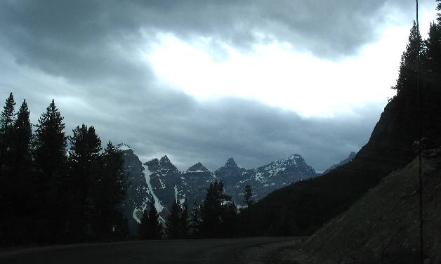
After
visiting Lake Louise we stopped by Moraine Lake less than 10 miles away. It may
only be 10 miles but the ride is spectacular. The light available for these picture
doesn't do justice to the landscape.
As you can tell the sky is
ominous looking.
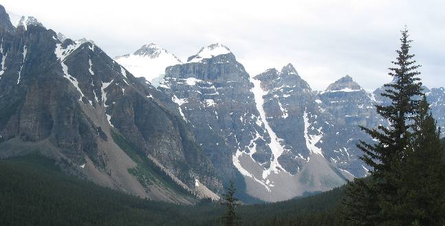
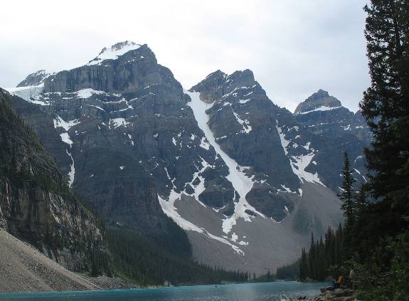
Canadian
Rockies avalanche chutes and talus
slopes
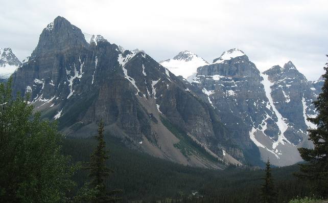
By
now you can tell that these are Main Range mountains because of their elevation
and because of the horizontal layers of sedimentary rock.
The lighter colored
rubble at the bottom is called talus.
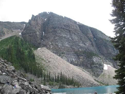
Canadian
Rockies avalanche chute and talus
slope
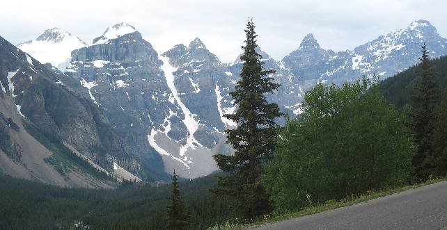
An avalanche chute is visible on the far mountain. This
avalanche chute looks like it just might be a permanent glacier.
That rubble
at the bottom of the avalanche chute is called talus.
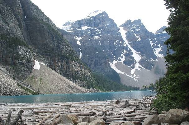
Glacier
carved valley with talus
slopes
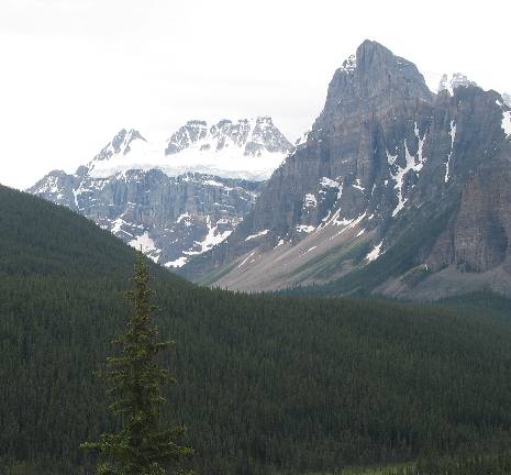
This is a classic view of a glacier
carved mountain. During the ice age huge glaciers covered the entire valley and
carved out these U shaped valleys. Rivers carve V shaped valleys while glaciers
carve U shaped valleys comprised of almost vertical walls.
The rubble at
the bottom of these sheer cliffs is talus.
Glacier
carved valley with talus
slopes
This
is more evidence of where a large glacier filled this valley with ice as it carved
the sides of these mountains.
The rubble at the bottom of these avalanche
chutes is called talus.
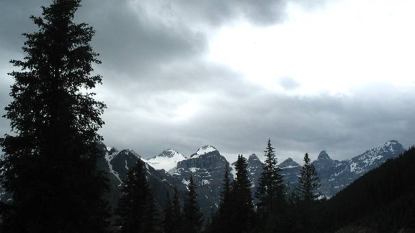
Canadian
Rockies Continental Divide
These
mountains are running down the Continental Divide.
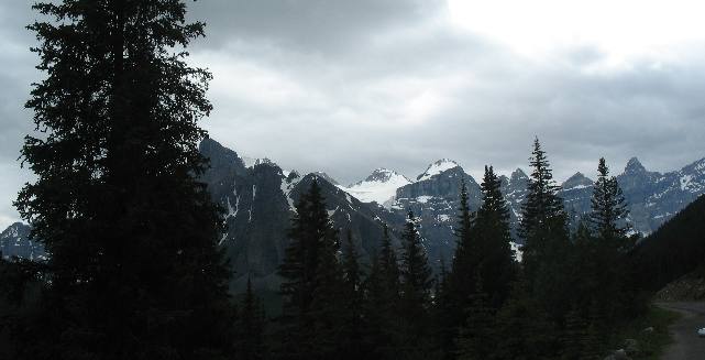
Canadian
Rockies between Lake Louise & Moraine Lake
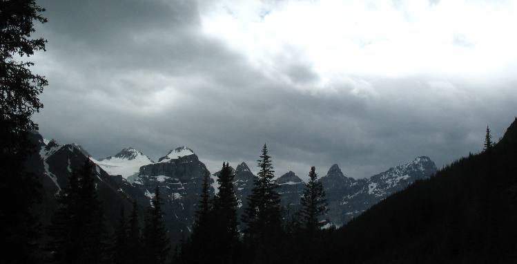
Canadian
Rockies looking west toward Continental Divide
This
view was totally awesome even though the lighting wasn't conducive to good photography.
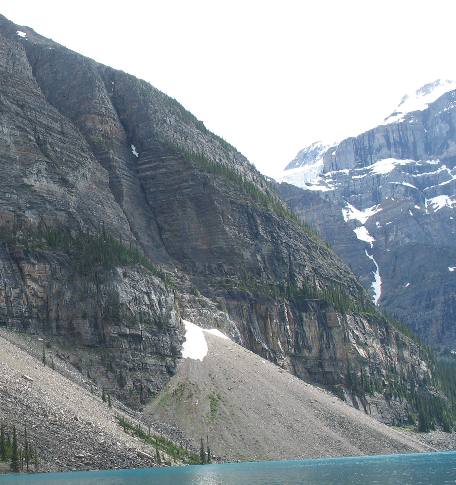
Canadian
Rocky Mountains & talus
slopes
This
is a classic example of a Main Range Mountain, with brown sedimentary rocks laid
in flat layers with almost perpendicular sides.
The talus
slopes along the side of this mountain were created in a variety of ways.
Some of them were caused by rock falling from the cliffs above, while others were
deposited when the rock fell on a moving glacier and transported to this spot,
when the glacier melted thousands of years later the rocks ended up here. Geologist
can tell when this happens by the composition of the rocks. Many times they can
even tell where the rocks were transported from.
Talus
slopes along shores of Moraine Lake
Talus
slopes dot the shoreline of Moraine
Lake.
Moraine
Lake and Continental Divide in Canadian Rockies
This
is a combination glacier and avalanche slope located on the Continental
Divide.
Note the talus
located at the bottom of these mountains.
The
sedimentary rock found in these mountains is porous. Rain water and melting snow
percolate down through the sandstone and limestone and along the separating sheets
of shale.
This moisture trickles into cracks, freezes and
expands, splitting even the hardest rock. Loosened by repeated freezing and thawing,
frostbroken fragments bounce down the cliffs and collect in these cone-shaped
piles called talus
or scree slopes.
Moraine
Lake in the Canadian Rockies
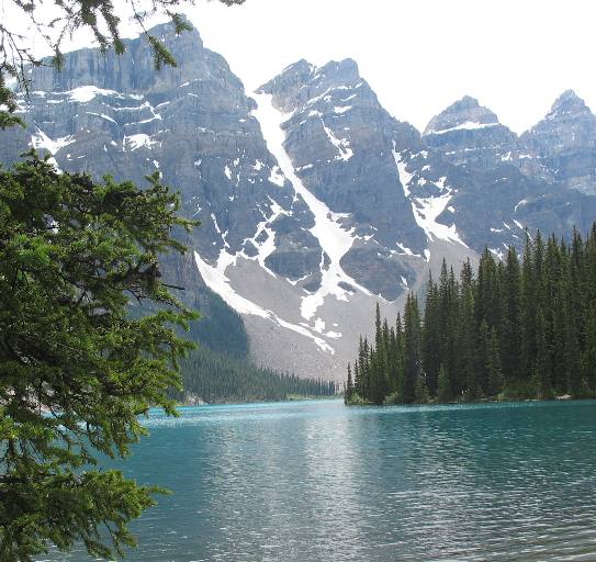
The
emerald/turquoise color of Moraine Lake is visible in this picture. Too bad we
could not capture that color at Lake Louise.
Note the talus
slope at the bottom of those avalanche chutes.
Moraine
Lake Lodge
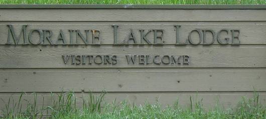
Yes,
there is a Lodge
at Moraine Lake but we did not get a good picture of it. We promise to
do better next time.

Mike
& Joyce Hendrix who we are
We
hope you liked this page. If you do you might be interested in some of our other
Travel Adventures:
Mike & Joyce Hendrix's
home page
Travel
Adventures by Year ** Travel
Adventures by State ** Plants **
Marine-Boats ** Geology
** Exciting Drives ** Cute
Signs ** RV
Subjects ** Miscellaneous
Subjects
We
would love to hear from you......just put "info" in the place of "FAKE"
in this address: FAKE@travellogs.us
Until next time remember how good life
is.