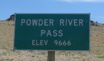
Places Visited: Wyoming: Casper, Buffalo, Ten Sleep, Powder River Pass in Big Horn Mountains. July 16, 2006: Casper East RV-Park Casper, Wyoming. Casper East RV-Park is a mom and pop operation without a mom & pop! N42° 51.357' W106° 17.338' $28 for full hookup $4 cheaper for water & 30-amps central sewage. They feature gravel interior roads & pads: This is NOT a destination campground by any means however, it certainly looks much better than the Fort Casper RV-Park which is nothing but a crowded dusty dirt parking lot. Joyce had a day in the "Big Horne Mountains" planned for us today. Whenever we were in this area in the past we were always passing through in the motorhome. Taking our motorhome over the Big Horn Mountains is NOT an option for us so we always skirt around them. Today we headed to Buffalo for the express purpose of taking the Saturn over the Big Horns from Buffalo to Ten Sleep. The 5,000 foot change in altitude is a hard pull for even the Saturn. We can't believe that some people pull motorhomes and 5th wheels over that pass. I suspect that most who do it the first time will not do it again. Along the way we saw a number of motorhomes in distress and could only wonder what they were thinking now. For those of you who are not familiar with the Big Horn Mountains let me set the stage. The Big Horns are some serious mountains that trend north and south in north central Wyoming. I-25 that runs north south through Wyoming skirts the eastern foothills of the Big Horns. If you are familiar with I-90 you will know that when westbound I-90 gets to Buffalo it turns north toward Sheradin, Wyoming and continues northward to Billings, Montana skirting around the northern end of the Big Horns before continuing west. Only two decent roads traverse these mountains US-14 from Sheridan to Greybull and US-16 from Buffalo to Ten Sleep. Be prepared for serious mountain grades when crossing either of these. US-14 starts in Sheradin at 3,745' and ends in Greybull with Granite Pass at 9,033 in between. US-16 over the Big Horns for us started in Buffalo situated in the eastern foothills at an elevation of 4,645' then went to Powder River Pass at 9,666' before dropping into Ten Sleep at 4,206' in the western foothills, all in 62-miles. For those of you from the east who are not accustomed to mountain driving that is a serious grade any way you dice it. While the grade is serious engineers were able to negotiate those grades without the customary series of switchbacks. US-16, as I recall, was relatively free of switchbacks. I do not recall any switchbacks that required us to reduce speed to 15-mph or anything close to that.
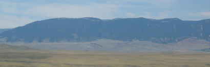
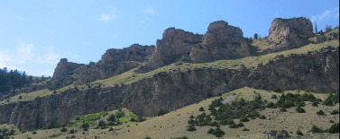
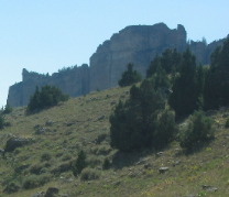
Joyce took this picture of the Big Horn mountains as we drove to Buffalo on I-25 with the Big Horn Mountains on our western flank. The mountains are 5 to 10 miles to the west.
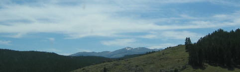
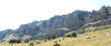
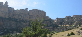
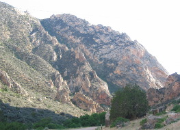
This picture of the Big Horns was taken from US-16 as we were in the foothills heading into the heart of the mountains. In case you are wondering that is snow on the peaks.
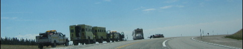
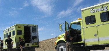
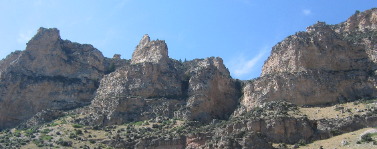
At the top of Powder River Pass elevation 9,666', igneous rock on the peak was visible. This group of "hot shot" fire fighters from Craig, Colorado were waiting for assignment in the parking area on Powder River Pass.
Yes that is a female "hot shot" fire fighter. That is not uncommon with these fire fighting units.
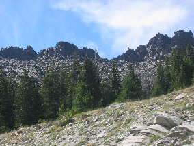
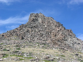
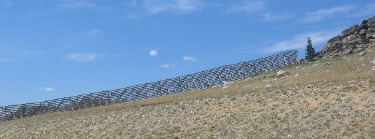
That is the craggy peak of Powder River Pass. Massive snow fences are set to protect the pass from wind blown snow.
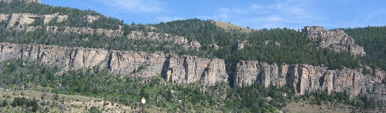
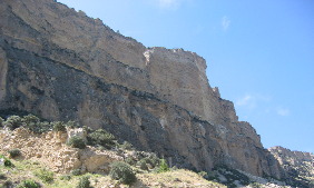
As we near the Ten Sleep we enter about 10-miles of spectacular canyon cut by the Powder River.
Millions of years of geology are exposed in this canyon.
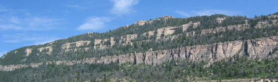
Spectacular is the only way to describe Ten Sleep Canyon.
On both sides the geology memorizes us.
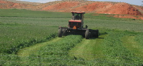
Once we get to Ten Sleep we turned south on State Road 434 following the Nowood River and the western foothills of the Big Horn Mountains. Ranches dotted this road. In the river valley farmers were irrigating vast fields of alfalfa. This farmer was mowing a large field of alfalfa on land at least 1/2 mile away from the river but flat enough to farm.
Ten miles or so down SR-434 we ran across a historical information kiosk that told about one of the skirmishes in the sheep & cattle wars in this area experienced in the early 1900's. The kiosk was was covering the Spring Creek Raid that occurred on April 2, 1909. Cattlemen of the Big Horn Basin dominated the range where sheep were forbidden. Fierce animosity grew between the opposing sheep and cattle ranchers as several sheep camps were raided during the late 1800's and early 1900's. In late March, 1909, Joe Allemand, a French sheepman, ad Joe Emge, a cattleman turned sheepman, left Worland headed for Spring Creek with 5,000 head of sheep. They were accompanied by Allemands's nephew, and two sheepherders. Talk spread like wildfire across the western slope of the Big Horn Mountains as the deadline was crossed and plans were soon made to head off this intrusion. On the moonlit night of April 2, 1909, seven masked riders approached the sheep camp's two wagons where the herders slept. Gunfire lit the night as rifles blazed. The sheep men were killed in their wagons and the wagons set on fire. A monument is located where the murder of these sheepmen took place. Five of the perpetrators were convicted and sent to prison. Public reaction against this brutal and tragic act left no doubt that violence on Wyoming's open range would no longer be tolerated. At least that is what the kiosk said.
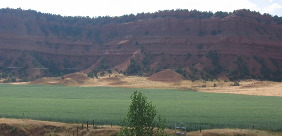
With the history lesson behind us we continued south on that road. It turned to a dirt/gravel road less than 10-miles south of Ten Sleep. The scenery was just too spectacular to stop so on we went. Alfalfa fields and red cliffs make an interesting spectacle on one side of the road while the river and Big Horn Mountains dominate the eastern side.
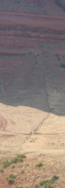
I was fascinated by this fence that climbed up the side of that redstone cliff until it reached the sheer vertical rock wall.
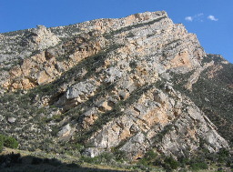
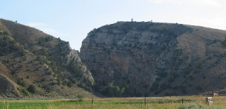
Forty five miles south of Ten Sleep we navigated through a series of canyons that the Nowood River carved through the western flank of the Big Horn Mountains. It is obvious that the river has selected a series of spectacular faults to in which to traverse its way through the mountains. As the earth uplifed the river cut through the hard rock exposing millions of years of geology. The severe angles on these strata provide an indication of the forces involved in shaping this country.
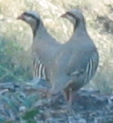
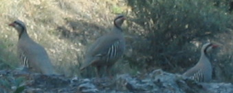
In one of the canyons Joyce spotted these chukar. We had never seen chukar in the wild. In fact the only chukar we had ever seen was at a wild game auction in Harper, Texas.
Sometimes we are proned to think that our hamburgers are raised in pens and forget that ranchers in this part of the country are still driving cattle over miles and miles dirt trails. Here is a sign marking one of those trails leading into the Big Horn Mountains to what I suppose is summer pasture.
This canyon was 50 or so miles south of Ten Sleep and 40-miles or more down that dirt road.
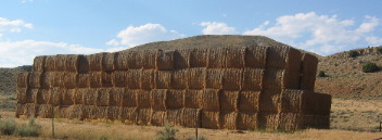
This is the same canyon from a head on angle where a remote ranch is situated at the mouth of the canyon. Near that ranch was this huge stockpile of hay that had been hauled in since there were no alfalfa fields within 10-miles of this ranch house.
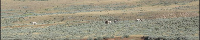
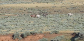
By this time we are in really remote country. Occasionally, we spot small herds of wild horses in the sage.
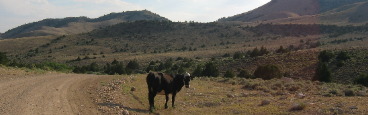
Then we spotted several cows roaming the countryside. We are in "open range" where there are no fences so we are constantly on the lookout for cows in the road.
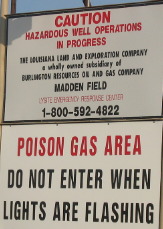
Then we started seeing these signs and evidence of gas wells mixed in the sage grass.
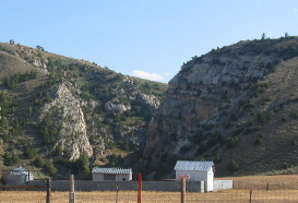
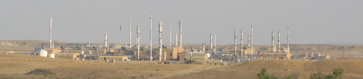
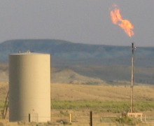
When this gas refinery came into view we knew civilization was near. We were mostly right. The dirt road continued for another 5 to 10-miles.
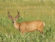
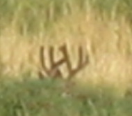
We spotted this buck in tall grass located near a small river.
This buck was mostly hidden in the tall grass. The only thing that gave him away was his huge rack.
This flame was burning off poisonous gas.
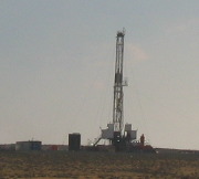
Just before reaching paved road we saw this drilling rig sinking another gas well. Later we learned that these gas wells were over 30,000 feet deep and took 5-years of drilling to reach that depth.
We were on this adventure for over 12-hours. We could not have seen more spectacular country anywhere. Tomorrow will be a down day, we have to recoup.
Until next them remember how good life is. Mike & Joyce Hendrix
|
| ||

| |||