Rock Springs, Wyoming
We are traveling west on I-80 between Rawlins and Rock Springs. July 20, 2006: We stayed at the KOA Rock Springs, Wyoming. N41° 34.086' W109° 17.642 $28.00 (with a KOA Card) for water & 30-amps with central dump station (full hookups were available with 50-amps for another arm and leg) 800-562-8699. Gravel interior roads and pads, in fact the whole 10-acres is gravel. NOTE: we would not have stayed here but the KOA is the only game in town.
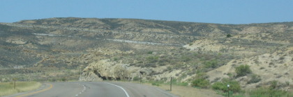
I-80 east of Rock Springs
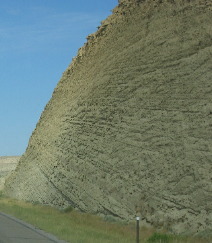
Approaching Rock Springs on I-80 the topography begins to show evidence of uplift and faulting in the sedimentary layers of rock. Many are tilted to the west then dramatically cut or faulted where I-80 and the railroad passes.
I-80 east of Rock Springs
Road Cut on I-80 east of Rock Springs
Road cut through sedimentary deposits east of Rock Springs on I-80.
Uplifted sedimentary deposits along I-80 east of Rock Springs
This mudstone layer does not show evidence of faulting while the sedimentary layers on the right are tilted to the west.
Click here for more Wyoming Adventures
|
| ||

| |||

| |||


