Places Visited: Wyoming: Muddy Gap Junction, Three Forks, Lamont and US-287 over the Continental Divide and into the Great Divide Basin then over the Continental Divide again, Rawlins, I-80 between Rawlins and Rock Springs. July 19, 2006: We stayed at RV World Campground Rawlins, Wyoming. N41° 47.007' W107° 16.366 $23.25 for full hookup 307-328-1091. We have been in Casper for over a week, we had a great time, but it is time to continue our journey. Today we headed west on SR-220 with Rawlins, Wyoming as our objective. Independence Rock on Oregon Trail
About 50-miles west of Casper we passed Independence Rock but didn't stop this time.
Split Rock on Oregon Trail
Then 15-miles further west we passed Devil's Gate where we were able to look across the flat valley and see split rock that was the geographic marker emigrants on the Oregon Trail looked for when they passed Devil's Gate. Split rock resembles a rifle sight to me.
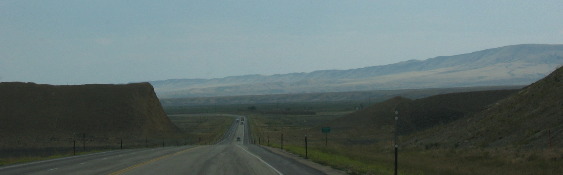
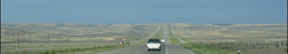
Approching the Continental Divide
Another 15-miles west and we turned south on US-287 toward Rawlins at a spot in the road called Muddy Gap. From Muddy Gap to Rawlins the topography is interesting to say the least. We will soon cross over the Continental Divide traverse 30 to 40 miles of the Great Divide Basin then cross over the Continental Divide a second time before arriving in Rawlins.
High Desert
We are on a high desert the whole time. We started our trip today in Casper at 5,300' elevation and only climbed to a little over 7,000' feet each time we crossed over the Continental Divide
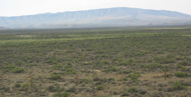
High Desert
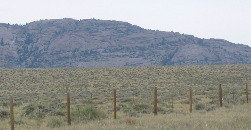
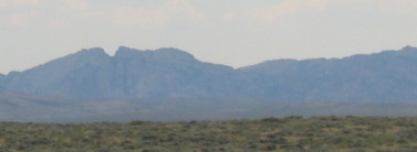
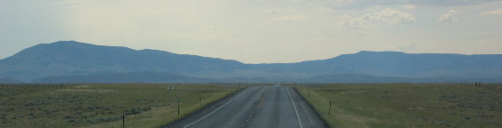
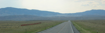
These pictures show the terrain as we head toward the Continental Divide and the Great Divide Basin. Low mountains with vast stretches of inner-mountain plateau is how I would describe the topography. Sagebrush dominates the plateaus.
High Desert
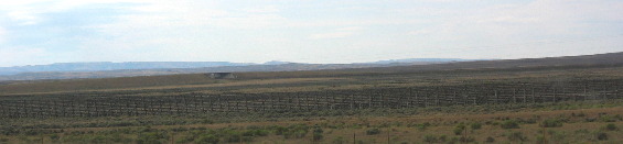
Great Divide Basin
Rain & snow that falls in the Great Divide Basin stays in the basin until it evaporates. Rain & Snow that fall in the Great Divide basis does not flow to any ocean. That is what makes the Great Divide Basin so special.
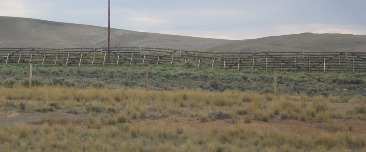
Snowfence
When we cross back over the Continental Divide snow fences are there to keep winter snow off the highway. Note that we are no longer in the Great Divide Basin.
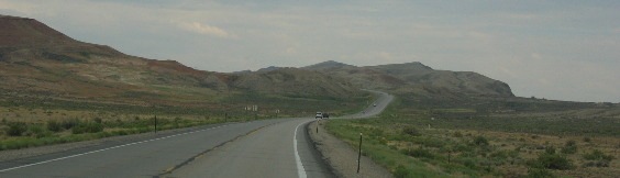
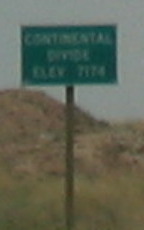
Continental Divide Sign
The Continental Divide along here is only 7,174'. The drop into the Great Divide Basin was only 500' or so. However, there is enough drop so that water does not drain out of the basin.
Sadly we didn't get any pictures of the alkaline terrain in the Great Divide Basin when we were in the basin. Conditions are rather stark with only 12 to 15-inches of rain per-year. Sagebrush is small. While we see evidence of alkaline accumulations we did not see large lakes or flats of alkaline residue.
I-80 west of Rawlins, Wyoming
After spending the night in Rawlins we headed west on I-80 where we crossed over the Continental Divide once again and down into the Great Divide Basin for the second time in as many days.
Great Divide Basin
This unique basin occurs on the Continental Divide. Normally the Continental Divide splits the continent with waters on the west draining to the Pacific and water on the east draining to the Atlantic. That is normally what happens. In Northern Colorado and Southern Wyoming the Continental Divide splits forming a bubble before coming together again. The split in the Continental Divide is around an area known as the Great Divide Basin. A basin is an area where water does not flow out. In the case of the Great Divide Basin all rain and snow melt in the basin evaporates instead of flowing to one of the oceans.
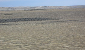
Great Divide Basin
This is how stark the Great Divide Basin looks.
Leaving the Great Divide Basin
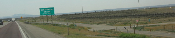
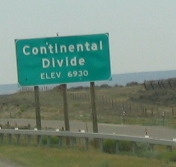
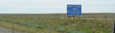
To say the area east of the Continental Divide is dry would be an understatement. When we pass that green Continental Divide marker we will also be leaving the Great Divide Basin.
Continental Divide sign on the western boundary of the Great Continental Divide
The Continental Divide here is only 6930'. Rest areas are a welcome sight when the next one is 102-miles away and not much of anything in between.
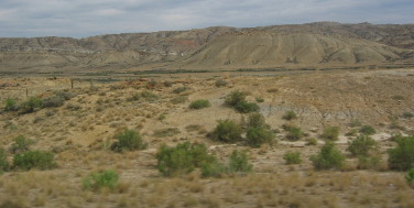
A beautiful site on I-80 west of Rawlins, Wyoming
I-80 east of Rock Springs, Wyoming
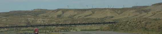
Trains give indication of life in this barren landscape. To the right is a coal train. Coal trains make up the vast majority of train traffic in Wyoming.
Coal Train heading west out of Wyoming
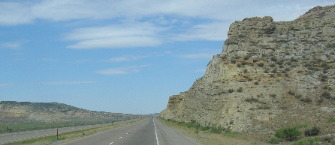
Road cut on I-80 east of Rock Springs
This roadcut was through what appears to be limestone or mudstone. It begins to remind us of I-10 through the Hill Country of Texas.
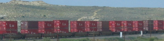
Container Train heading east with goods from Asia
This is an eastbound container train loaded with containers from a giant merchant ship unloaded at one of the west coast ports, probably Oakland, California.
Click here for more Wyoming Adventures
|
| ||

| |||
|
| |||