Places Visited: Colorado: Lamar and Springfield August 17, Palo Duro RV-Park 806-488-2548 Canyon, TX: N34° 58.831' W101° 52.722' $22.50 Full hookups with paved interior roads and gravel pads free WIFI
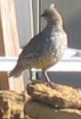
We started the day in Lamar, Colorado about 70-miles north of the Oklahoma border. Before we cranked the motorhome we watched a large covey of scaled quail feeding near the motorhome.
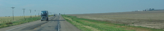
We were heading south into the panhandle of Texas but first we have to traverse 70-miles of southeastern Colorado then 70-miles across the Oklahoma panhandle.
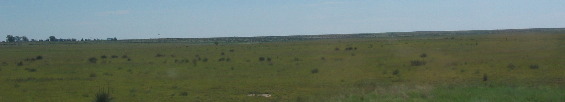
Southeastern Colorado is a vast grassland.
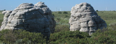
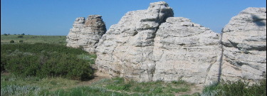
On top of a rise we spotted several hoodoos that were "out of place" on the plains but they were there none-the-less.
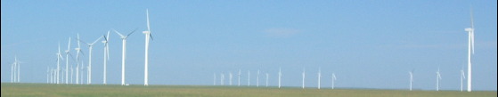
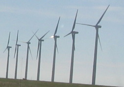
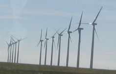
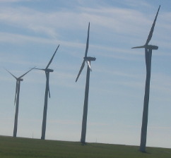
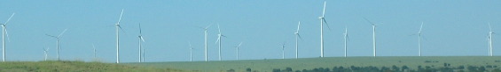
Twenty miles south of Lamar we came upon the Colorado Green Wind Power Project our nation's fifth largest wind farm. The 162 megawat Colorado Green Wind Power Project was developed to help meet Colorado's demand for renewable electricity. Completed in late 2003, the project utilizes 108 GE 1.5 MW wind turbines, the largest assembled in America. the project is owned by PPM Energy, Inc. and Shell WindEnergy Inc. in a 50/50 joint venture.
What better place to harvest the wind than the windy prairies of southeastern Colorado. Dotted over the years by a variety of historic water-pumping windmills used by pioneers when settling in this part off the country. The wind turbines reside on about 11,000 acres used as a working cattle ranch. Less than 2% of the project's land area is used by the actual footprint of the wind turbines, leaving most of the land available for other purposes, including ranching and grazine -- or, as the ranchers tell the story, the space used by the wind turbines translates to one less cow. The project is designed to produce enough wind-generated electricity to serve about 52,000 average Amereican homes.
The Turbine Height from bottom of each tower to the tip of the highest blade is 328 feet---taller than a 32 story building. The wind turbines make one revolution every 2 to 3 seconds. The wind turbines have rotor diameters of 231 feet which is 10% longer than the wingspan of a Bowing 747-400 jumbo jet. Each turbine is the size of a bus weighs aproximately 92-tons (30-40 tons in another source) and is perched on top of the wind tower housed inside the nacelle or housing. Each of the three blades on these wind generators weighs close to 7-tons.
To create electricity the rotor blades of a wind turbine work somewhat like the wings of an airplane. As air passes over the specially-designed blades "lift" is created. This lift, in turn, sends the blades spinning in a circular motion, which drives and electric generator. When winds reach 8-mph, the rotor is engaged and the wind turbine begins producing power.
Did you know that over the last five years wind power has been the world's fastest growing energy source, with an annual average growth rate of over 35.7%? Today, Denmark and many regions of Germany and Spain meet 10% and 25% of their electricity needs from wind energy needs.
South of Springfield Colorado is the Comanche National Grassland. It is easy to see why this place is called a National "Grassland", trees are scarce as hens teeth.
Comanche National Grassland occupies more than 435,000 acres characterized by diverse and often spectacular landscapes, ranging from short and midgrass prairies, to deep canyons and arroyos branching off the Cimarron and Purgatoire River valleys.
A few miles of agricultural land lies south of the Comanche National Grassland in southern Colorado.
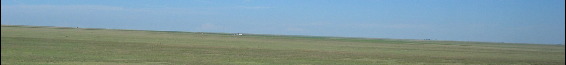
The landscape was sparce as we passed through Oklahoma.
Agriculture was the only thing other than grassland as we traversed the 35-miles across Oklahoma panhandle. We knew it wasn't very far across the Oklahoma panhandle but 35-miles wide is rediculous.
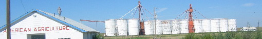
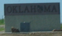
As we dropped out of Oklahome we entered the Texas panhandle and some serious agriculture.
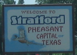
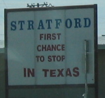
Stratford was the first small town we encountered in Texas. Stratford bills itself as the pheasant Capital of Texas. We thought Stratford's sign advertising the fact that they are the "first chance to stop" in Texas.
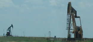
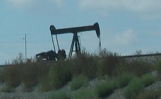
Oil wells are common sights in the Texas panhandle.
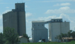
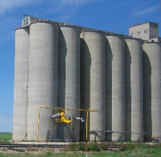
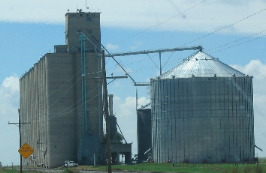
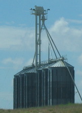
Even more silos can be seen than the ubiquitous oil well.
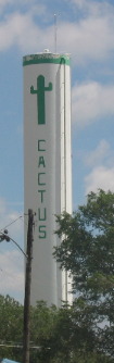
The small farming town of Cactus dressed up their water tower.
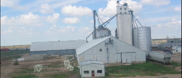
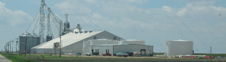
Huge agriculture buildings are the order of the day in the Texas panhandle.
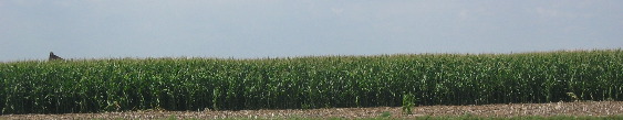
Oil wells, corn and irrigation systems seem to be a winning combination.
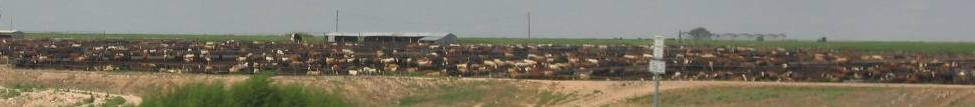
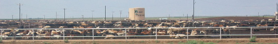
Giant feedlots utilize the corn and other grains grown in the panhandle. The smell from these mega-feed-lots is enough to gag a maggot.
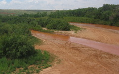
This is the Canadian River that crosses US-87 about 20-miles north of Amarillo.
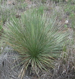
We started seeing this type of yucca, mesquite trees, and prickley pear cactus. We spotted mesquite trees along the Arkansas River in southern Colorado. Then the yucca was next. I don't remember seeing any prickley pear cactus until we were well into Texas.
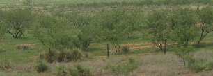
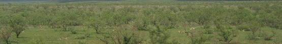
This is a typical scene with mesquite and grass closely cropped by livestock.
By now we have driven south into the Texas Panhandle to very near Amarillo.
Until next time remember how good life is. Mike & Joyce Hendrix
|
| ||

| |||