Places Visited: Idaho: Montpelier, US/SR-36 from Montpelier through Sharon down to Preston; SR-34 from Preston through Cleveland, Thatcher, Niter and Grace; US-30 Soda Springs and Bennington and back to Montpelier. July 22, 23 & 24 2006: Rendezvous RV-Park Montpelier, ID. N42° 19.698' W111° 17.999 $19.20 Full hookups with 50-amps. Gravel interior roads and pads. Nothing fancy, in fact the owner said that new owners had purchased the property with the intent of converting it to a lumber yard. They were just getting a bit of income until the lumber yard was up and running. We had one more scenic drive to take before moving on. This drive consisted of us taking Idaho SR-36 west out of Montpelier to Preston, Idaho. Once in Preston we made a U-turn and headed north on Idaho SR-34 through the small towns of Cleveland, Thatcher, Niter and Grace before turning east on US-30 that took us into Soda Springs and ultimately back to Montpelier.
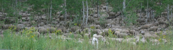
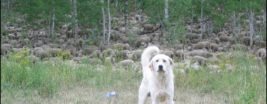
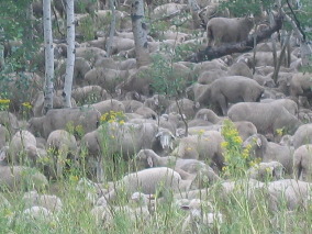
Some 20-miles or so west of Montpelier we find ourselves at the summit of a mountain in the Caribou National Forest. We pulled into a large parking area at the summit and in front of us was this huge flock of sheep and with the sheep were there protectors, these great Pyrenees guard dogs. All we did was pull into the parking area and three of these big dogs came out to let us know that it would be best if we moved on.
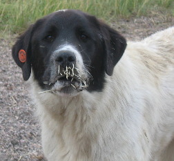
The biggest and baddest of these dogs was this one with the black face that had recently had a face to quill meeting with a porcupine. While cattlemen turn their cattle loose in the National Forest lands during the summer sheep have to be tended with both dogs and an sheepherder.
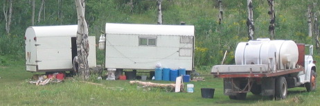
Not far away in a clearing we found the sheepherder's camp. This particular sheepherder had much more of a camp than the ones we are used to seeing. He even had a horse. The truck had a water tank on it and we saw where the sheep had watering tubs so this particular sheepherder was actually bringing water to the sheep. In other operations we have seen the sheepherder walked the sheep to water each day.
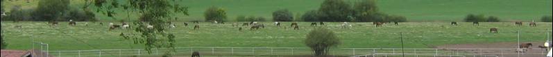
A few miles west we dropped into a valley and this giant horse operation came into view.
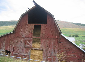
The barn would need to be full of hay to support this many horses during the winter.
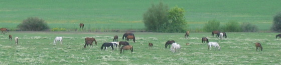
Yet another pasture loaded with horses.
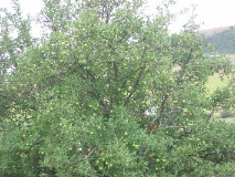
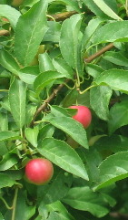
Like any good farm this one had a stand of apple trees.
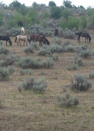
Not far from the horse operation we came upon these horses that were probably escapees from the horse operation. They were "wild" in that they were not fenced in although they probably belonged to someone. I imagine that it would be hard to round these horses up.
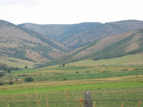
As we move through the valley one bucolic scene after the other appears.
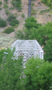
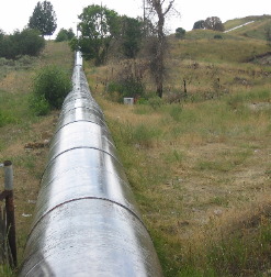
The bridge on the right caught our eye. It was not for automobiles nor was it for walking across the swift flowing creek below. It was for that large pipe you see coming down the hill.
This irrigation pipe looked to be 40 or more inches in diameter and was dropping from the top of this hill/mountain on what looked to be about an 80-degree angle. It was transporting irrigation water from a source high in the mountains.
Just north of Preston we stopped to read an Idaho sign explaining the geological history of the valley we were in. It seems that geologist have determined that the Bear River was diverted into this valley by lava flows where it deposited a huge amount of mostly red clay. The delta formed here where it entered a vast inland sea that covered much of Utah. That inland see was Lake Bonneville. Lake Bonneville has some interesting history that we will be covering next week. But to get you ready for the Lake Bonneville saga let me start by saying that lake Bonneville virtually disappeared 14,500 years ago when a natural dam burst and almost the entire lake (the size of Utah) discharged into the Snake River, then the Columbia River and finally into the Pacific Ocean. The shoreline of the lake along here suddenly went down about 80-feet. From that time on, Lake Bonneville gradually receded to become Salt Lake. But I get ahead of myself. We were talking about this valley and the effect the Bear River had upon it. A change in climate 8,000 years ago caused Lake Bonneville to suddenly receded Bear River had to cut through and erode its old delta, forming steep sides and gullies that we see here today. The change in climate has reduced the historic Lake Bonneville to what is now the Great Salt Lake.
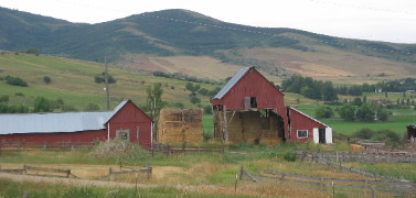
Some farms have cherry trees and apple trees. All have barns with hay.
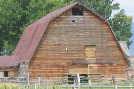
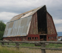
Barns come in all sizes and shapes and make great photography subjects.
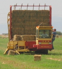
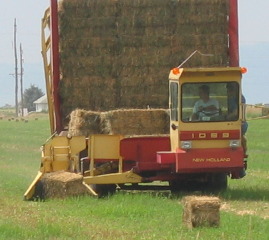
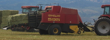
I am always fascinated by farm equipment. These two young men were driving around in a field full of baled hay picking the bales up with the yellow arm assembly that you can see grabbing the bales of hay and stacking the bales behind the cab. This piece of machinery was SLOW compared to a similar operation we watched in southern California near El Centro. That operation was running a fleet of machines like these through the fields at 10 to 20 mph with the machinery handling each bale flawlessly. They are driving this machine one no more than 5-mph and it is mishandling every 3rd or 4th bale. One of the men is riding this machine to jump out and move the bales around so the machine will handle it.
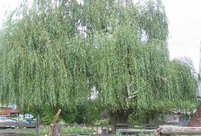
Weeping willow trees grow to enormous size in this area. Isn't this a beautiful tree.
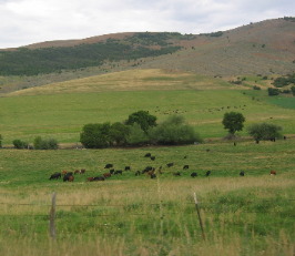
Armed cattle ranchers delayed farm settlement here for six years. It took six years for a permanent farm community to be organized in 1872. This kind of conflict occurred in widely scattered western areas when farm crops displaced rangeland. Families of early farm pioneers still occupy holdings here that are well over a century old, although many of them finally have shifted from planting crops to raising cattle after winning their battle against early stock herders.
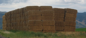
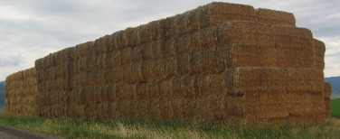
Those that remain may have cattle but they still farm to produce hay for those cattle during the winter.
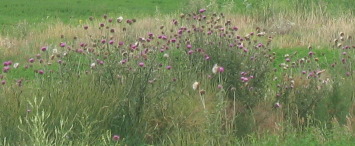
Joyce snapped this picture of blooming thistle on a small patch of ground that was not planted in alfalfa. The piles of hay on each farm boggle our minds. These are enormous stores of hay and it is only July. How much will be here by September?
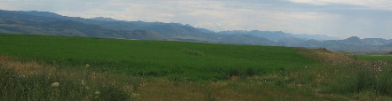
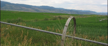
Alfalfa and irrigation systems with mountains in a background, now that is Idaho.
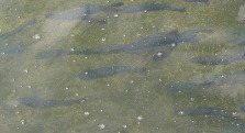
We stopped to see a fish hatchery operation somewhere along the way. The ones on the left are 10-inch fish ready to be released. The ones on the left are much larger and have escaped into a pond on the property. One of the workers told us that they have youth fishing days where they let young people fish in the pond to thin out these escapees. Some of these trout were really big. The large raceways were full of cacheable sized (10-inch) rainbow trout. Each of the 6-raceways can hold around 60,000 cacheable fish. Each raceway has around 9,600 cubic feet of rearing space available for the fish. The amount of water running through each raceway depends on how much water is available and also the number and size of fish in each raceway. Most times fish are fed with a blower feeder pulled by a tractor. I wonder how long it takes these trout to switch to "natural" foods when they are released -------------------- or if they live long enough after being released to actually eat a meal? Something tells me that when these trout are released they only have a day or so of life span remaining.
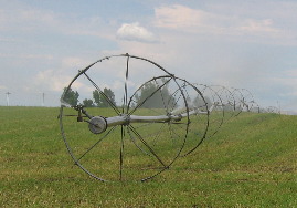
Close-up of an irrigation system. This hay bailer is "delivering" one of those big rectangular bales.
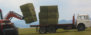
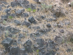
The tractor is loading three bales on the truck. Soil is shallow around here, this is lava rock protruding through the thin soil.
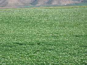
As we travel north we transition to potato fields. Potato crops must be rotated every year to prevent disease. We have been told that fields only produce potatoes every third year.
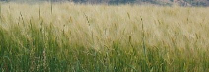
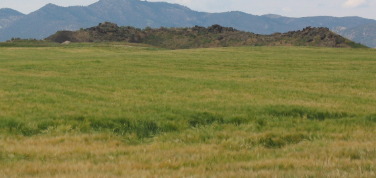
Wheat, barley and alfalfa are crops that are routinely rotated with potatoes. I can't tell if this is wheat or barley can you?
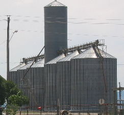
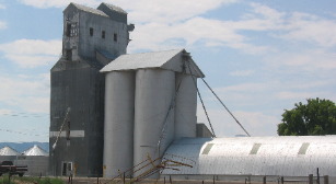
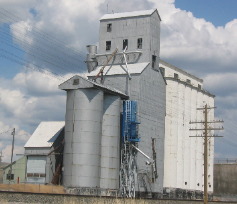
Grain handling facilities are as common as tractors. In addition to grain handling equipment/facilities on each large farm each town has facilities lining the rail road tracks.
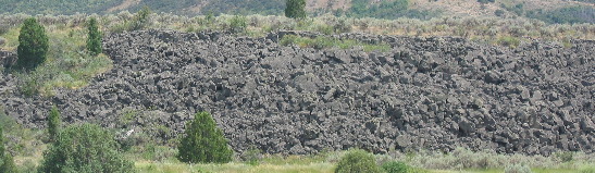
Somewhere along the way we took a side road back to a reservoir that turned out to be a ride through a technological marvel plus a geological event as well.
Not long after we turned off the highway we passed this exposed ancient lava flow.
Then the road to the reservoir turned and started following the river upstream. At this time we are able to see that both banks are lava from an ancient lava flow.
The further we go along that road the banks become steeper and taller. Here the lava walls are 30' or more.
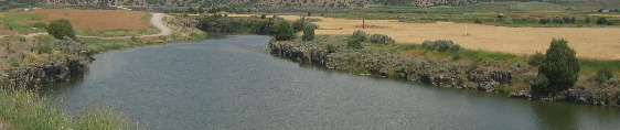
You have now seen the geological the geological matter that got my attention. Now I am going to show you the technological marvel.
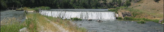
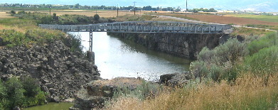
In these pictures you can see the dam and reservoir behind it. Note that the dam is only 8 or 10' high.
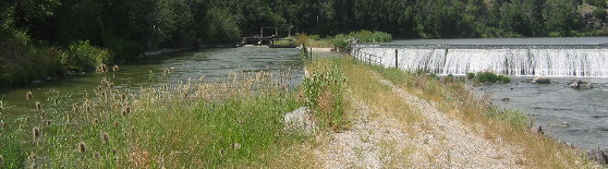
To the extreme left in the pictures is an irrigation ditch. Keep your eyes on that irrigation ditch because it is going to rather quickly traverse several structures that make it unique.
This is a picture of the river downstream of the dam. As you can see it is rapidly losing altitude.
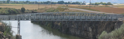
Just around a bend in the river, less than 1/2 mile away is a flume.
A flume is an inclined channel for conveying water and in this case the flume is transporting that irrigation canal across the river from which it was just drawn. In other words the river is flowing over and under itself.
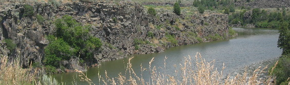
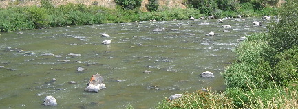
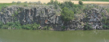
Just after that flume the river stops dropping so rapidly and spreads out a bit between two walls of lava. The river has cut its way through this lava flow.
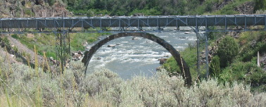
This is a second flume that crosses the river 600-yards or so downstream of the first flume. Note the steep lava banks on both sides of the river. I suspect that the lava flowed down a valley filling the entire valley. After the lava flow ceased I suspect the river continued to flow down the valley but now on top of the lava flow. Over eons as water will do it has cut down into the lava. I am intrigued by both the geologic event that took place and is so easy to see and the technology involved in transporting the river over itself in this series of flumes to be used to irrigate farmland on both sides of the river.
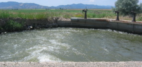
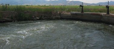
I took these pictures of water exiting the last flume just after it crossed over the river. It emptied into this manifold with a series of valves that open to distribute water to a series of farms being serviced by this water source.
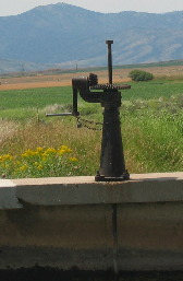
To the right you can better see one of the valves. Note that it has a lock and chain on it.
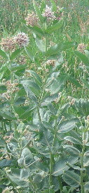
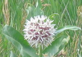
Showy milkweed is common along the roadside. Monarch butterflies that use milkweed as a host plant are no where to be seen.
In 1840, John Bidwell began to assemble emigrants from Missouri to open a road to California. Note that 1840 is EARLY in the western migration. A year later Bidwell set out with a party of 69 "Pacific Coast Pioneers". When they reached this valley on August 12, 1841, half of his group decided to go northwest to Oregon instead. But his California crew turned south down Bear River to try a terrible rout west of Salt Lake. Joseph R. Chiles returned east in 1842 to find a practical California Trail across Idaho through Fort Hall and Granite Pass. Shortcuts were valuable and adventuresome pioneers were always on the lookout for a shortcut. When emigrants left the main trail leading to Fort Hall, heading to California through that Hudspeth's Cutoff would save them considerable time and miles in the race to the gold fields. To their surprise, they were still in Idaho's Raft River drainage when they again encountered the main trail. They had saved about 25 miles, but the route crossed over four mountain ranges and consumed more time than they would have by following the established trail. Even so, the cutoff soon became the route of choice for most emigrants. When the Applegate Route from Humboldt, Nevada to Dalles, Oregon opened in the fall of 1846, Oregon bound emigrants were able to choose an alternative to floating down the Columbia River. A few years later, Hudspeth's Cutoff made this option even more appealing. Finally we arrived in Soda Springs the northern apex of our travels today. Soda Springs was named for a group of springs famous to the Oregon Trail. Travelers, most of whom stopped to try the "acid taste and effervescing gasses" of the waters from these springs. Earlier, fur traders often -- less elegantly -- called the place "Beer Springs" after one spring whose water tasted like Lager Beer --- only flat. Another, Steamboat Spring, made sounds resembling --- a high pressure steam engine. Both springs are now drowned in Alexander Reservoir on the western edge of Soda Springs. Other springs in the area can still be tasted if that is what you are into. Colonel P. E. Conner set up the old town of Soda Springs, now mostly flooded by Alexander Reservoir and an adjacent army post near here in May of 1863. The gold rush to Idaho had greatly increased traffic on the Oregon Trail, and the post was needed to protect travelers from the Indians. Along with his troops, Conner brought 160 settlers from Utah and the town they founded became the County seat from 1864 to 1866. It soon declined, but in 1870 Brigham Young visited here and established the present town site just east of the earlier location. Tourist can stop and sample free, clear sparkling soda water today if they just stop in the city park in Soda Springs. You can't miss the city park, it is located on US-30 in town and town only consists of a few blocks. The water from springs around Soda Springs has been a prime attraction for more than 160-years. It was marketed nationally after rail service reached this area in 1882. W. H. Hooper, Salt Lake City's leading banker and president of Zion's Cooperative Mercantile Institution, had his summer home in Soda Springs. He did much to found and promote Soda Springs and its soda water industry while serving as Utah's delegate to Congress. It is interesting that a Utah Congressman was promoting a product from Idaho.
Like other towns in these parts Soda Springs has the ubiquitous grain elevator next to the rail road tracks.
Until next time remember how good life is. Mike & Joyce Hendrix
|
| ||