|
Ft Pickens National
Seashore & Campground Pensacola, Florida
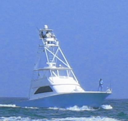
Cobia fishing trip out of Pensacola, Florida offshore of Ft Pickens National Seashore
In 2007 I was fishing on a boat like this off Ft Pickens National Seashore. During the trip we got close enough to Ft Pickens & the National Seashore to get some pictures. For those of you who are familiar with Ft Pickens you will remember that Hurricane Ivan came ashore just west of Pensacola (and Ft Pickens) in September of 2004 completely destroying everything. The large campground (over 200 sites) was completely destroyed. The road to Ft Pickens was destroyed. As of this travel log written in the spring of 2007 the road to Ft Pickens had not been fixed and the campground (what was left of it) was returning to nature. The pictures that follow document what Ft Pickens looks like 3-years later. Ft Pickens National Seashore off Pensacola, Florida
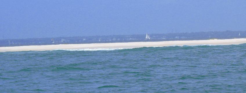
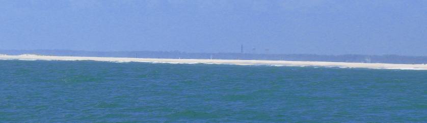
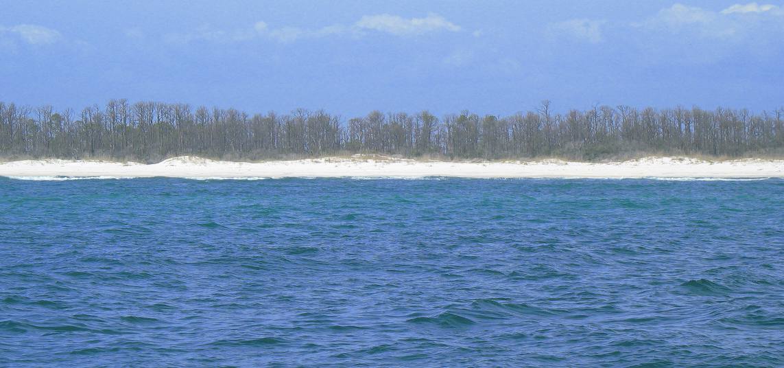
This picture was taken from the Gulf looking north. The sand bar you see is the NARROW strip of land connecting Ft Pickens to Pensacola Beach. That is a 7-mile strip of land, -------- where the road used to be. Now you can see why the road has not been replaced 3-years later. I am taking this picture from the Gulf of Mexico looking north across the National Seashore with Pensacola Bay and Pensacola in the distance. The sailboat is on Pensacola Bay. This is a section of Ft Pickens National Seashore, the spit of land stretching from Pensacola Beach to the western end where the campground at old Ft Pickens used to be. I say used to be because that campground has not been open since September 2004 when hurricane Ivan destroyed it, and may never be opened again. The stretch of beach in this picture was washed away. Boats were able to use the opening to navigate from the gulf to Pensacola Bay a year ago. As you can see sand has filled in the hole.
Ft Pickens National Seashore Pensacola, Florida as viewed from the Gulf of Mexico
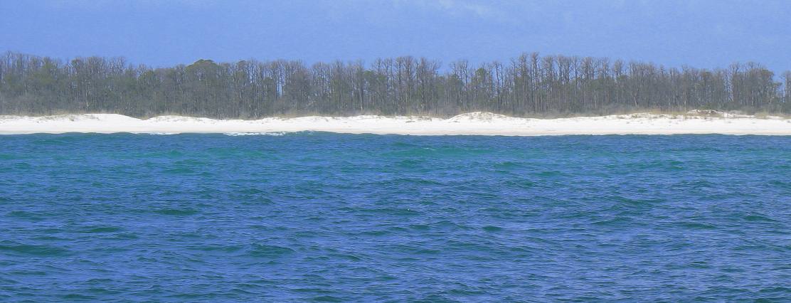
This is another section of that sliver of land connecting Ft Pickens to Pensacola Beach. This is also a section where the road connecting Ft Pickens to Pensacola Beach was washed away. That road no longer exist. People do ride bicycles or walk the 7-miles from Pensacola Beach to the Old Ft Pickens ruins and where the campground used to be.
Ft Pickens National Seashore Pensacola, Florida as viewed from the Gulf of Mexico
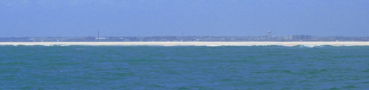
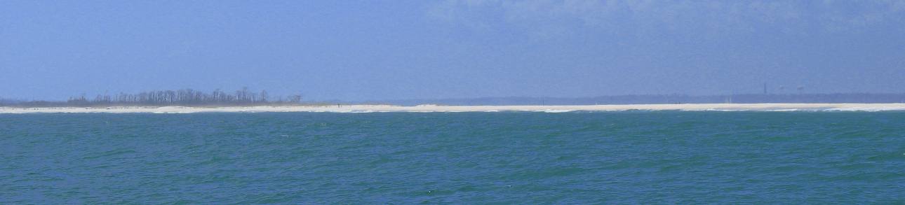
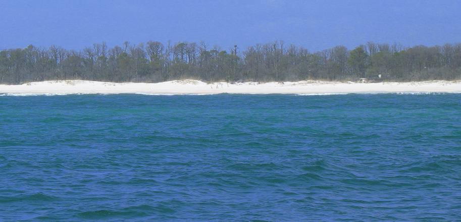
For those of you familiar with Pensacola this picture was taken from the Gulf of Mexico looking north. The strip of white sand beach is the sliver of land connecting Pensacola Beach with Ft Pickens. That sliver of land is 7-miles in length. This is along the section where the road was washed away by Hurricane Ivan in September of 2004. The beach is only 100-yards or so wide with Pensacola Bay on the other side. To the left, across Pensacola Bay is Pensacola Naval Air Station. The big buildings and water tower you see on the right is downtown Pensacola, probably 6-miles away.
Ft Pickens National Seashore Pensacola, Florida as viewed from the Gulf of Mexico
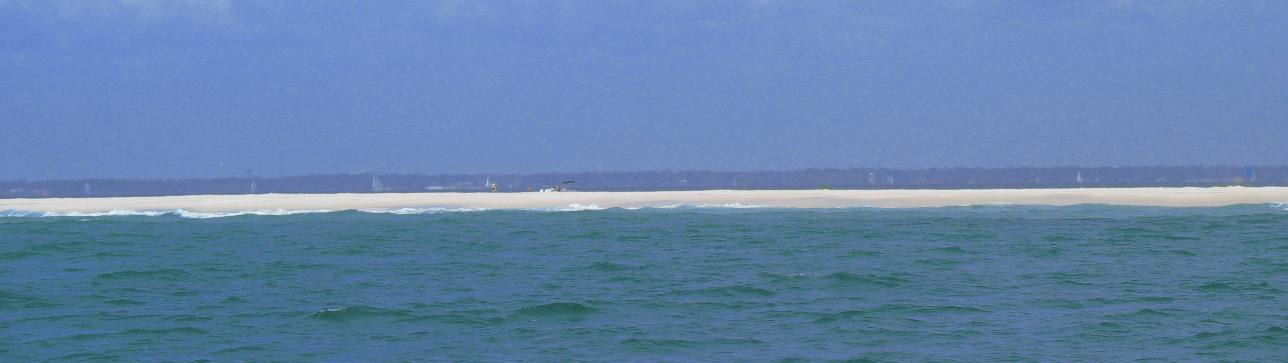
If you look near the center of this picture you can see where a small outboard boat has pulled up to the other side of this small strip of beach. That boat is in Pensacola bay. That boat could navigate from where it is now to the gulf where we are not too long ago. Hurricane Ivan, in September of 2004, washed this beach away then hurricane Dennis followed in July of 2005 creating even more damage to this barrier island. Time is healing the scars. That opening to Pensacola Bay has closed and sand is beginning to accumulate once again. While it is not much more than a sand bar now it is much better than having water flow through an opening. Possibly, one day, we may see another road over this strip of land once again connecting Pensacola Beach with one of best Campgrounds around.
Ft Pickens National Seashore Pensacola, Florida taken from the Gulf of Mexico
Another view of that strip of land where the road connecting Pensacola Beach with Ft Pickens used to be. Nature is healing itself but as you can see there is not nearly enough sand to construct a road. Or at least a road that would survive the summer.
Ft Pickens National Seashore Pensacola, Florida as viewed from the Gulf of Mexico
The sailboat in the middle of this picture is in Pensacola Bay between where we are in the Gulf of Mexico and downtown Pensacola.
Ft Pickens National Seashore Pensacola as viewed from the Gulf of Mexico
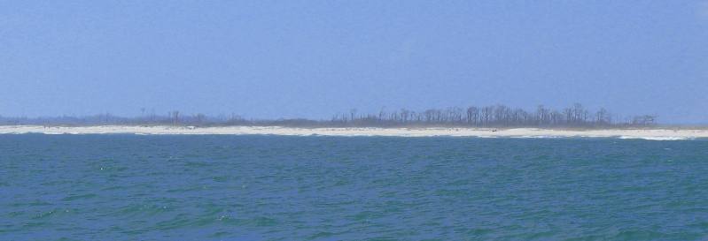
This is the first clump of trees you used to see when approaching Ft Pickens after driving over 6-miles down that strip of white sand beach. A group camping area was located in that patch of pine trees. Note that 95% of those trees were pine trees and they are all dead. Six to twelve feet of salt water washed across the island killing most trees. Ft Pickens National Seashore Pensacola, Florida viewed from the Gulf of Mexico
The dead pine trees are more visible in this picture. The group camping area was in that clump of trees.
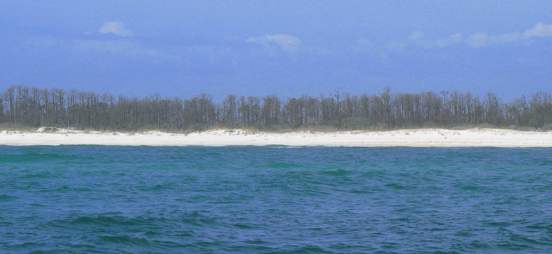
Old Campground at Ft Pickens National Seashore Pensacola, Florida
The campground at Ft Pickens was located in those trees. Note that the majority (if not all) of those trees are dead. Salt water killed them when hurricane Ivan swept across the island in 2004. Ft Pickens National Seashore Campground Pensacola, Florida was in those dead trees
Ft Pickens National Seashore Campground Pensacola, Florida was located in those dead trees
Ft Pickens National Seashore Campground Pensacola, Florida was located in those dead trees
If you look closely at this picture you may be able to see what remains of the campground store located at the entrance to the Old Campground on Ft Pickens. Look closely and you may see a few live trees. Remember this picture is being taken from the gulf looking north. As you can see some of the dune system is beginning to return. Even so there is not much beach remaining. Click here for Florida Panhandle travellogsUntil next time remember how good life is. More Florida AdventuresFlorida Panhandle Adventures ** More 2007 Travel Adventures
Mike & Joyce Hendrix
Mike & Joyce Hendrix who we are We hope you liked this page. If you do you might be interested in some of our other Travel Adventures: Mike & Joyce Hendrix's home page Travel Adventures by Year ** Travel Adventures by State ** Plants ** Marine-Boats ** Geology ** Exciting Drives ** Cute Signs ** RV Subjects ** Miscellaneous Subjects
We would love to hear from you......just put "info" in the place of "FAKE" in this address: FAKE@travellogs.us Until next time remember how good life is.
|
| ||
|
| |||
|
| |||
|
|