Places Visited: Utah: From Blanding to Moab on US-191 and a visit to Arches National Park in Moab. May 21, 2007. There are multiple commercial campgrounds in Moab. All of them appear to be good or at least adequate------no slums anyway. We decided to stay in OK RV-Park & Canyonlands Stables 3310 Spanish Valley Drive 435-259-1400 because it was a PPA park thus 1/2 price. Even at half price it was $15.50 per-night for FHU with 30/30 amps and cable included. Most RV-Parks in the area are going to be around $25 plus a stiff tax. This park had some shade so we picked it but the nice Spanish Trail RV-Park has nice shade as well and both are within a mile of each other. All of the parks in Moab appear to have gravel interior roads and sites.
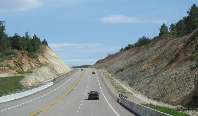
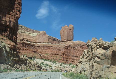
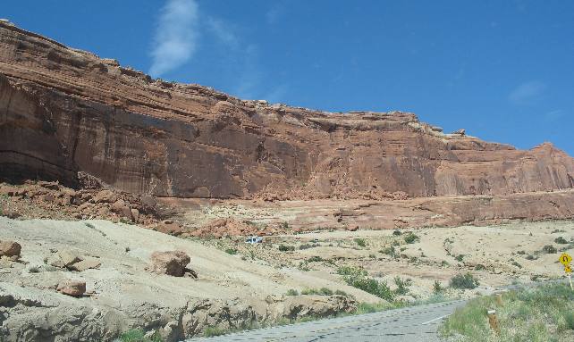
Joyce managed to take a few pictures of our drive between Blanding and Moab on US-191.
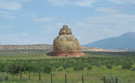
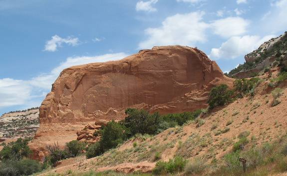
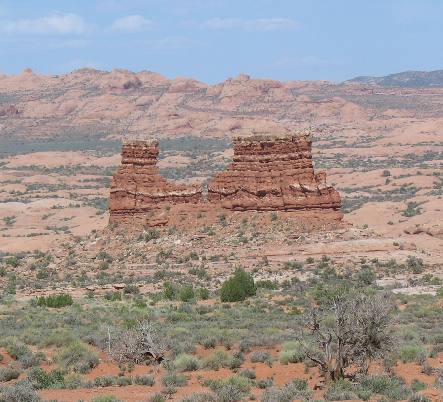
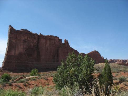
Free standing forms such as this never cease to amaze me. How would you like this monolith in your cow pasture?
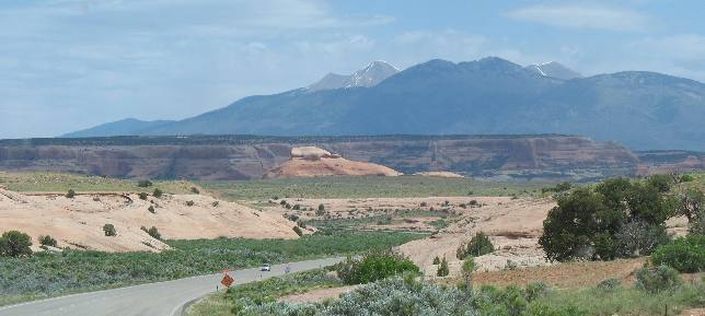
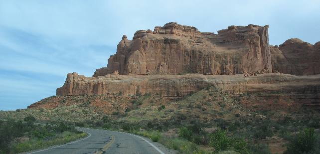
The La Sal Mountains come into view long before we get to Moab. The La Sal Mountains rise to the east of Moab. Note that they have snow on them.
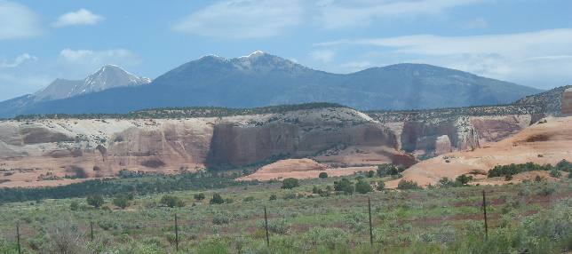
Another view of sandstone cliffs and the La Sal Mountains.
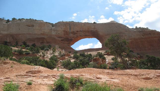
This is Wilson's Arch. We stopped at a pullout on US-191 south of Moab to take this picture. Joe Wilson was a local pioneer who had a cabin nearby. This formation is known as Entrada Sandstone laid down 175-million years ago when this area was covered in huge sand dunes.
This is a fin of that same Entrada Sandstone. This may one day become an arch if by chance a hole develops in the fin.
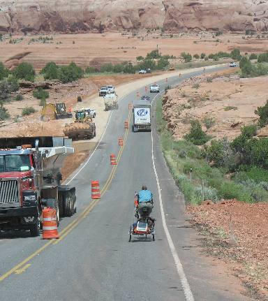
I just had to throw this picture in. This fellow on his bicycle was riding in front of me as we followed the "follow-me" vehicle through this construction. You can see the follow me vehicle in front of the 18-wheeler. There was about 7-miles of this construction where US-191 was limited to one lane. When the "follow-me" truck got to the end he was surprised to realize that the convoy of vehicles that were supposed to be following him were actually stuck in "traffic" behind this dude on his bicycle pulling a two wheel wagon. By the time we got to the end of this construction we were out of sight of the 18-wheeler and that follow me truck. Oh, by the way, it wasn't just me that this fellow was holding up. There was about a mile of traffic backed up behind me. Plus all the vehicles coming in the other direction on US-191 that were waiting for our convoy of vehicles to clear so they could use this side of the road. It is occasions like this that I begin to think that public whippings might be in order. OK, I will get off my soap box.
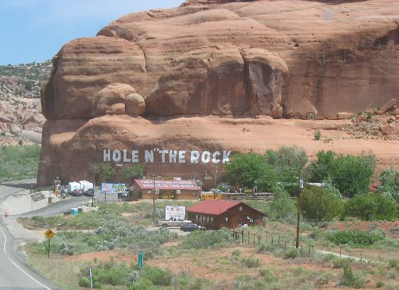
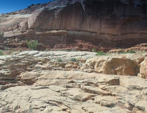
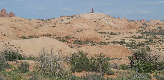
We have been by this attraction on US-191 south of Moab but have never stopped. Someone please let me know if we are missing anything.
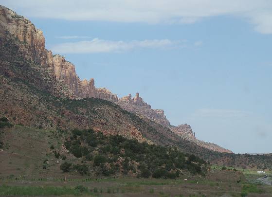
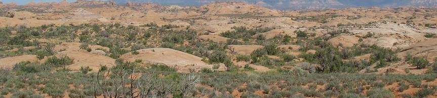
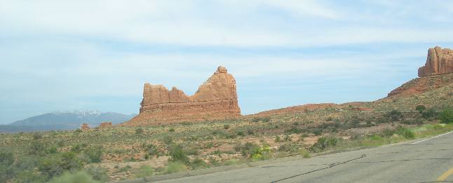
This mesa and valley scene is so typical of southern Utah.
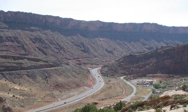
When you see this formation rise on the west side of US-191 you know that you are on the outskirts of Moab. Moab sits on a fault line where this side of the fault has fallen and now makes up the valley. US-191 runs up and down the fault line in the valley.
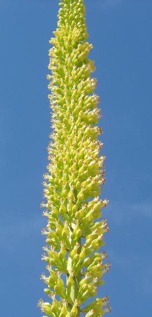
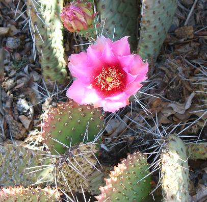
The pink flower is on a cactus while the bright yellow stalk is on a type of yucca that I am not familiar with.
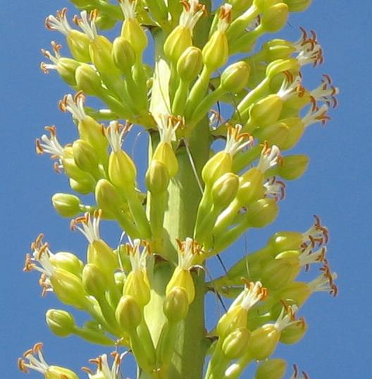
This is a close-up of that beautiful yucca flower stalk. We saw this at the Moab visitor center in downtown Moab.
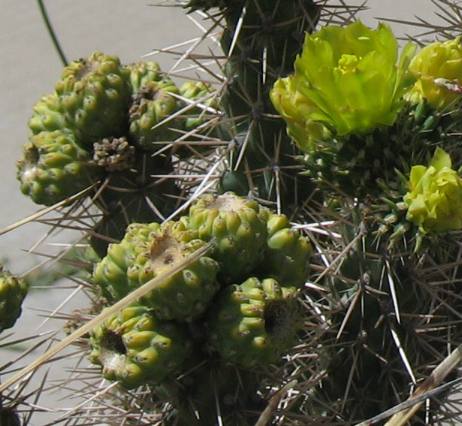
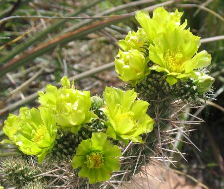
To the left is a cholla bloom while to the right is the fruit. I think these fruits were from last years bloom.
When in Moab one must take at least one drive through Arches National Park. Today is our day for that obligatory drive. Sit back and enjoy it with us.
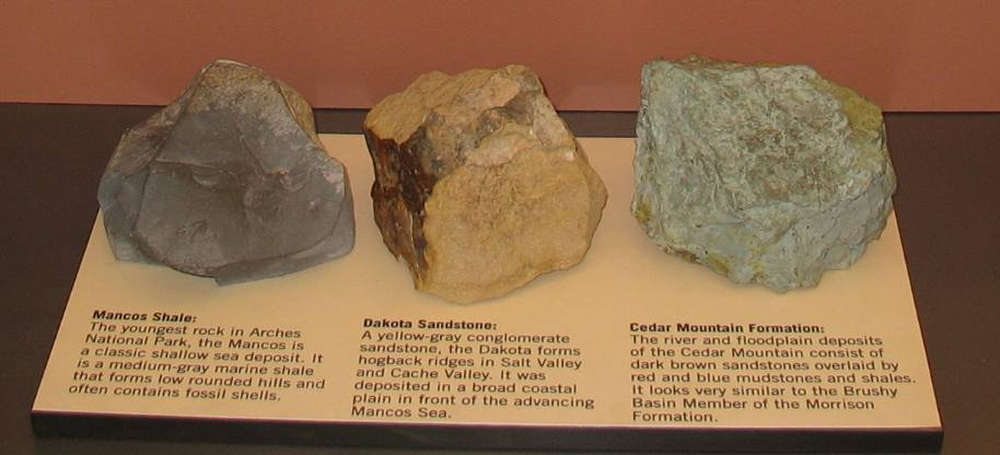
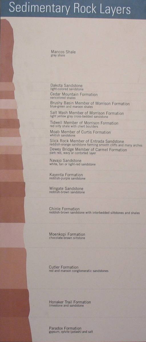
Pay close attention to the information presented above. These are the rock formations that we will be viewing as we drive through Arches National Park today. I hope you remember the Cedar Mountain Formation (when we were in Natural Bridges National Monument they were referring to this formation as Cedar Mesa Formation not Cedar Mountain Formation). Cedar Mountain Formation is what the Natural Bridges were formed in. Remember that Dakota Sandstone and Mancos Shale lay on top of the Cedar Mountain Formation thus are younger rocks by millions of years. These sediments were deposited around 90-million years ago when this area was underwater as one of the greatest seas of all times encroached from the north. The open water of this sea stretched from what is now central Utah to the western Appalachians and from the Arctic to the Gulf of Mexico. To the west, in present-day Nevada, rose great Andean-style mountains.
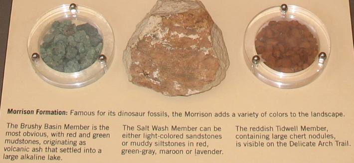
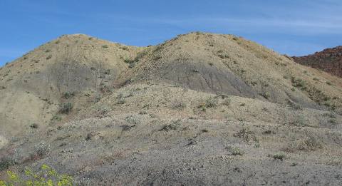
A very large shallow alkaline lake developed in the current-day Four Corners area 150-million years ago. Ash from volcanoes in what is now Nevada fell into the lake to create the blue-green Shales of Brushy Basin Member of the Morrison Formation.
Shifting continental plates created uplands and mountains in present-day Nevada 175-million years ago. Sand dunes bordered the southeast margin of the large sea to the north. These sand dunes eventually became the Entrada Sandstone, the primary layer of rock exposed in Arches National Park today.
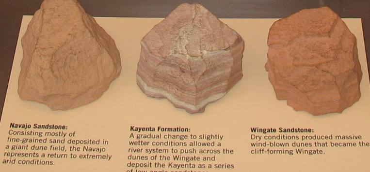
Then the climate became very arid around 200-million years ago. A great Sahara-like desert spread much of the western interior, depositing thick layers of sands that became today's Wingate and Navajo layers
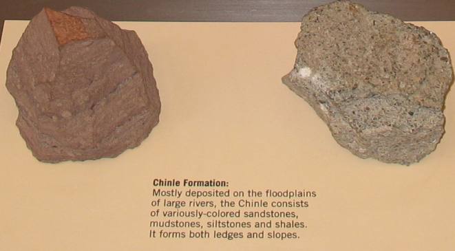
Rivers again flowed across across this area covering much of the western inter around 215-million years ago. These major rivers with extensive floodplains originated in mountains to the south and remnants of the Appalachian Mountains far to the east.
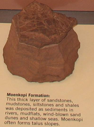
The Ancestral Rockies had eroded to low hills about 240-million years ago. Streams originating in present-day Texas and Mexico carried sediments westward across broad floodplains to coastal mud flats that reached several hundred miles inland from the open sea. The sea eventually retreated to the west.
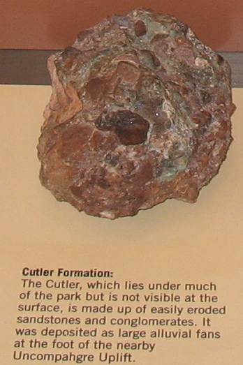
Then 275-million years ago the Uncompahgre Uplift rose rapidly and became the source of sediments that completely filled the adjacent Paradox Basin. Streams deposited coarse material closer to the mountains as alluvial fans; finer materials were transported to the south, covering most of what is now southern Utah and northern Arizona.
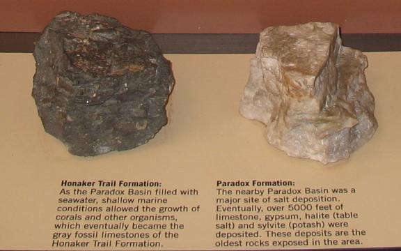
315-million years ago the high Uncompahgre Uplift, part of the Ancestral Rockies, formed just northeast of what is now Arches National Park. A deep trough formed adjacent to the uplift. Known as the Paradox Basin, it was repeatedly flooded by salt water as ocean levels rose and fell.
Now it is time to put all that information into perspective. To the left is a pictorial that puts together all the rock formations we covered above. Remember the youngest rock is on the top while the oldest sediments are on the bottom.
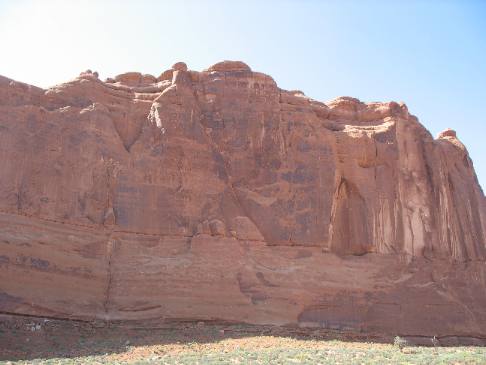
This picture is just inside the entrance to Arches National Park. Can you see the different types of sedimentary rocks and how they sit one on top of the other? Now the much bigger question, can you tell which of the above rock formations are represented here?
This canyon wall has multiple layers of sediments that should be easy to identify.
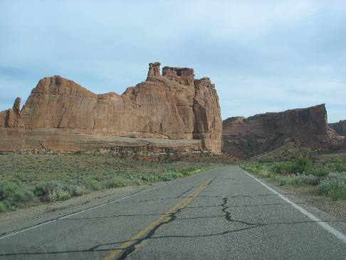
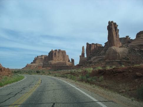
This view is from a mile or so inside Arches National Park looking the to the northwest. That is the visitors center and US-191 heading north along the fault line that created the valley Moab and US-191 are now occupying.
This is Navajo Sandstone. It resembles sand dunes, that is because it is how they originated. Some 200-million years ago, winds carried tons of fine-grained sand into this area, creating an immense desert dune system. Over time these sand dunes were covered by other layers of sediment, compressed, and cemented by quartz and calcite into this Navajo Sandstone. In this exposure erosion has washed away the overlying layers of rock, exposing these "petrified" dunes.
Pay attention to that small piece of Entrada Sandstone perched atop the sand dune in the middle (it is that red piece). There is a bit more Entrada Sandstone visible on the extreme left side of this picture.
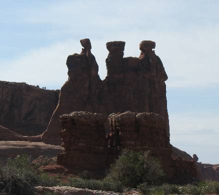
Hoodoos.
Hoodoos carved in Entrada Sandstone.
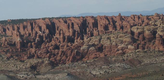
Another look at 175-million year old Entrada Sandstone being shaped into long fins and other objects.
Another look at the 200-million year old Navajo Formation laid down as huge sand dunes.
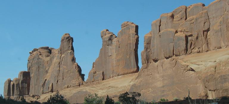
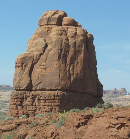
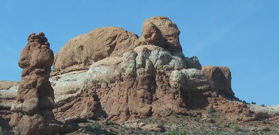
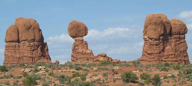
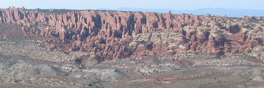
One of my favorite sites in Arches National Park was this view of multiple fins and hoodoos.
On the left is volcanic ash. I suspect this ash is part of the 150-million year old Morrison Formation. Specifically the Brushy Basin Member of the Morrison Formation (famous for dinosaur fossils) because it is visible as greenish mudstones, originating as volcanic ash that settled into a large alkaline lake.
Around every corner in Arches National Park is another amazing geological wonder. This it the backside of a fault. Notice how these sedimentary layers of rock are angled almost vertical. Even for someone who knows almost nothing about geology I can spot this like it has a spotlight on it.
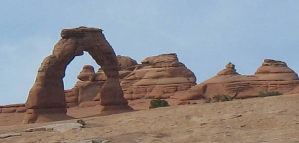
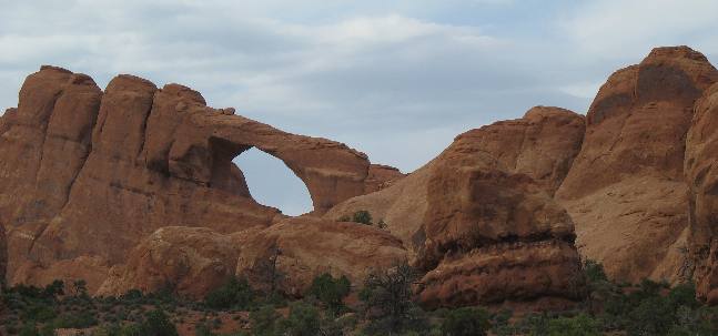
This is Delicate Arch. Carved in Entrada Sandstone. Remember that Entrada Sandstone was deposited as desert sand dunes around 175-million years ago.
Also keep in mind that Arches National Park features rock formations that are millions of years younger and older than this Entrada Sandstone.
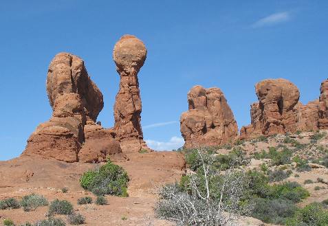
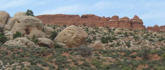
Besides the uniqueness of the rock formations in this picture I think it is fairly easy to determine the formations represented. The light colored rocks are 200-million year old Navajo Sandstone while the red top layer of rock is 175-million year old Entrada Sandstone.
These are hoodoos but I am not sure what rock formations they are carved out of but I would bet it is Entrada Sandstone.
Arches usually form slowly, but quick and dramatic changs do occur. In 1940, a large boulder suddenly fell out of Skyline Arch, roughly doubling the size of this opening. Again this arch has been carved in 175-million year old Entrada Sandstone.
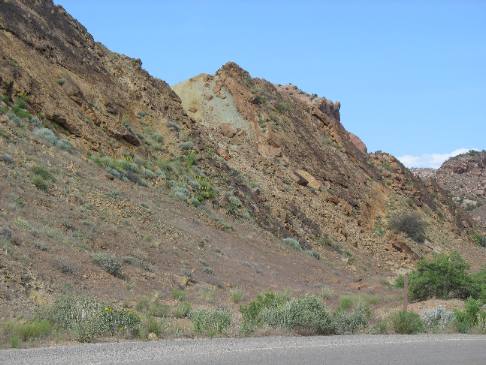
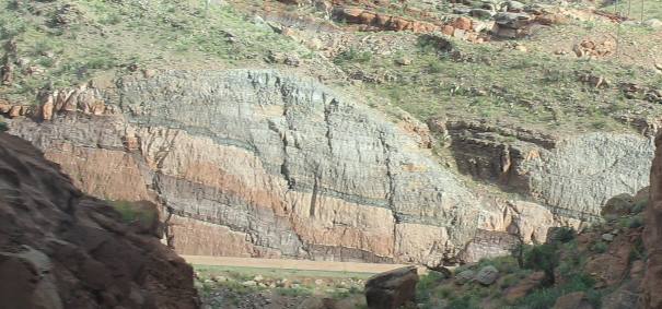
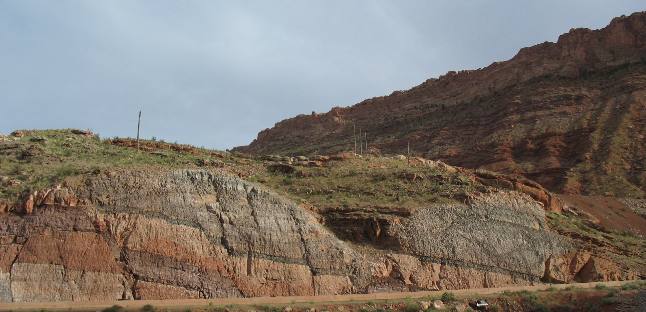
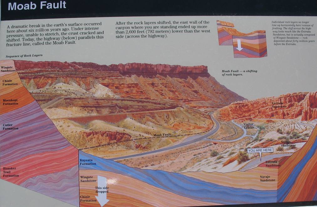
This is the fault that created the valley Moab sits in and US-191 follows through Moab. It is easy to see where sedimentary layers have been broken and faulted. That highway at the bottom of the fault is US-191 as it passes by the entrance to Arches National Park.
Here is that fault line again with US-191 running along the bottom. This time you can see the other side of that fault.
Now look at this explanation of the fault. The two pictures above are along the dotted line in the explanation below.
With this picture we are officially out of Arches National Park. I hope you enjoyed the pictorial journey.
Until next time remember how good life is. Mike & Joyce Hendrix
|
| ||

| |||