|
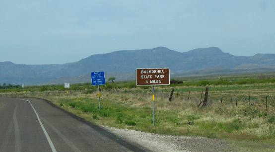
Texas: West Texas, Balmorhea State Park, Fort Davis, Mc Donald Observatory & Davis Mountains April 25 and 26, 2007. We are staying in Balmorhea State Park. Water & 50-amps $14 with cable TV $17 plus $5 each for park entry fee. Located a few miles south of I-10 exit 206 if you are east bound and exit 209 if you are west bound. We like to stay here for the wildlife and birding. Balmorhea Springs boast the worlds largest swimming pool. On Wednesday April 25 we continued our journey west on I-10. Traveling I-10 west from Junction to Balmorhea Springs State Park is a rather lonely drive. There are great expanses of limestone roadcuts punctuated by thousands of acres of cedar. Really, there is a lot of that but as we travel west it is obvious that the landscape is becoming dryer.
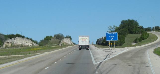
Roadcuts through layers upon layers of limestone punctuate I-10 through the first 100-miles of Texas Hill Country.
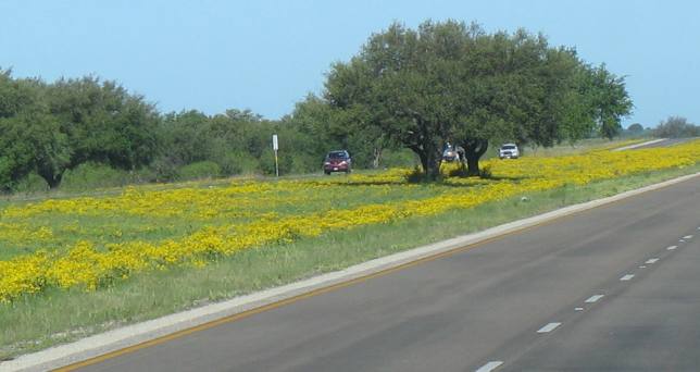
East of Sonora spring rain has encouraged a good crop of wild flowers. Notice that there is enough moisture in this region to support live oak trees.
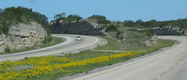
Awesome roadcuts such as this are routine to well west of Sonora.
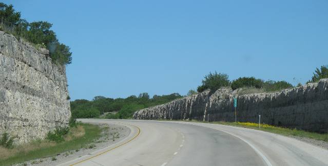
Deep roadcuts through thousands of years of limestone deposits are just part of the landscape traveling I-10.
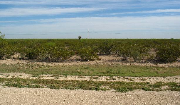
West of Fort Stockton is really dry and flat. Joyce took this picture at a rest stop west of Fort Stockton to emphasize that plants are not growing more than 4 to 5 feet tall. One yucca plant is taller than 5-feet.
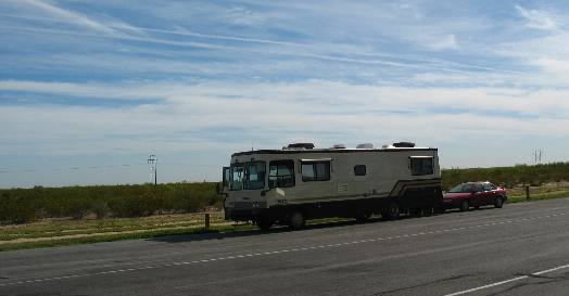
Our motorhome at that rest area. You can see for miles and miles but you aren't going to see any trees, only bushes.
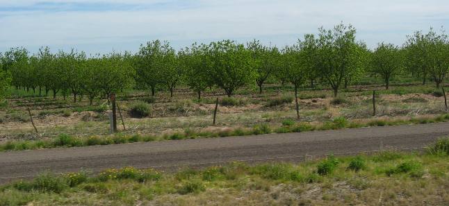
On the outskirts of Balmorhea there is this pecan orchard that looks like it may be around 100 acres. The springs at Balmorhea that feed the swimming pool are providing water to make this orchard possible.
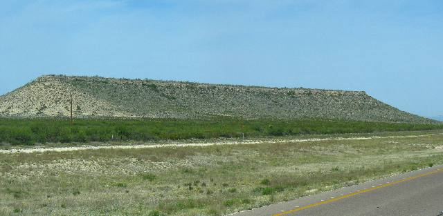
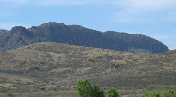
This looks like a butte to me since buttes are isolated, small, flat-topped hills, usually an erosional remnant carved from flat-lying rocks. This looks like it fits that definition.
As we turn off I-10 at exit 209 we can see the Davis Mountains to the south.
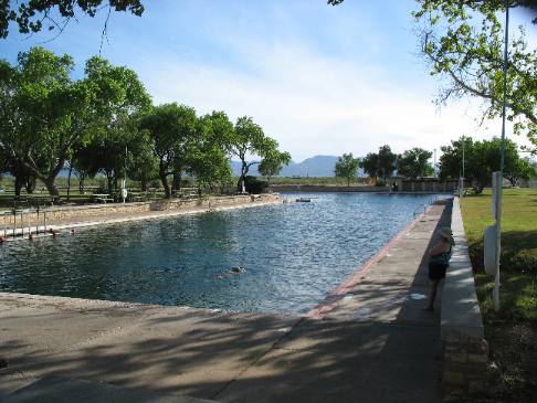
The San Solomon spring at Balmorhea State Park has created a superb desert oasis. These springs in the desert flatlands of West Texas have provided water for Native Americans, and later, for Spanish explorers and soldiers. Today the life sustaining waters from the spring are used to supply irrigation water for 12,900 acres of farming land.
The present name, San Solomon Springs, was given by the first settlers, Mexican farmers who used the water for irrigating crops. Prior to 1849, the springs were called Mescalero Springs, named for the Mescalero Apache Indians who watered their horses along its banks. Then in 1856 soldiers stationed at Fort Davis changed the name to Head Springs.
In 1851, the first canals were built to facilitate large-scale irrigation. The Bureau of Reclamation dredged the springs in 1927 and constructed the main canal which remains in use today. Between 1935 and 1938 the CCC (Civilian Conservation Corps) built the "L" shaped pool which was formed with a 200' circle over the spring, and two 389' tangents, all lined with limestone and bordered with flagstone. Repairs and updating have added cement sidewalks around the pool.
Another view of the "L" shaped pool. It is a deep pool. This end has a high dive and is 20' deep. Scuba divers converge on the spring during the summer and on weekends. The other 389' leg of this pool can be seen going to the left at the far end of this picture. The Davis Mountains can be seen in the distance.
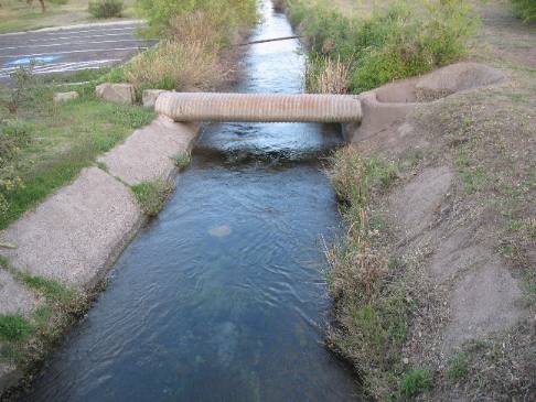
Irrigation canals like this one have been in use since the mid-1800's. Aquinas (Spanish for irrigation canal) in many areas have earthen sides.
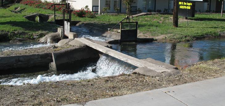
This picture was taken in the small village of Balmorhea. Irrigation water is flowing from the right into the diverter system. It appeared to me that about half the water was flowing into the nearest canal while the water flowing in through that raised gate was being split into two different canals. The village grew because of this water system from the San Solomon Springs. It is the life blood of this small agrarian community.
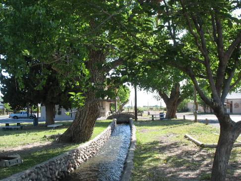
The aquina (irrigation ditch) flowing through downtown Balmorhea with SR-17 on one side and main street on the other. The town has set aside a small strip of property on both sides of the aquina as it flows through town that is used as a city park. Huge cottonwood trees line both sides of the aquina in town.
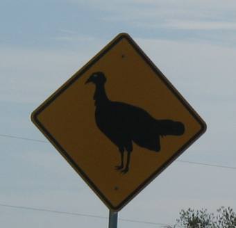
This turkey caution sign is the first I can remember seeing. The village of Balmorhea had one on each end of town. I have never seen a turkey when visiting Balmorhea but they must be there.
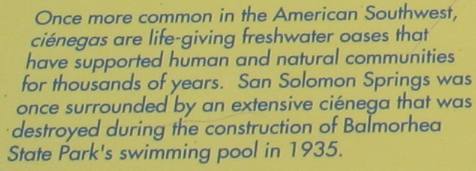
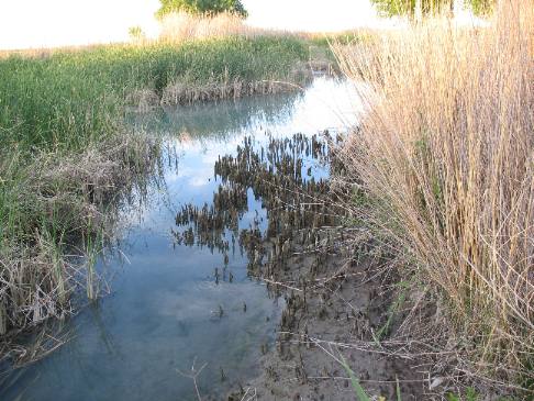
In 1995, construction began on the San Solomon cienega, a 3-acre wetlands restoration which provides a refuge for aquatic life. The revegetation project utilized only plants obtained fom local sources, including native reeds and bullrushes. This "wildlife" oasis is located adjacent to the RV-Park. We always drop by the cienega to look for wildlife that does not visit the large pool. Cienega is Spanish for a desert wetland or swamp.
Balmorhea, the local town, got its name from the local settlers: BALcom, MOore, and RHEA.
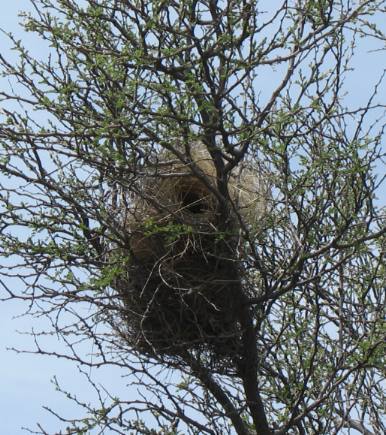
We dropped the motorhome at Balmorhea Springs State Park then headed to the Davis Mountains in our Saturn. Along the way we were spotting cactus wren nests like this one.
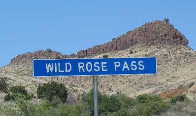
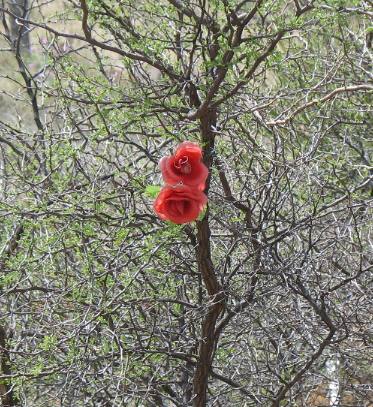
As we climb into the Davis Mountains we start up over Wild Rose Pass where we kept seeing flowers (roses) in the small bushes along the highway. The flowers looked like roses but the plants didn't look like rose bushes. We pulled over to get a better picture before realizing that some prankster had placed artificial roses in the bushes. We got a good kick out of the prank.
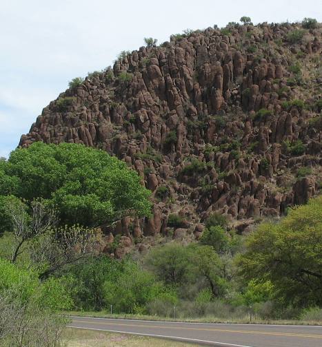
Columnar Jointed Basalt in ancient lava flow
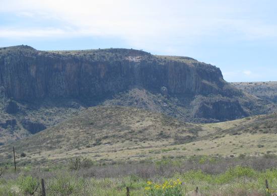
All kinds of volcanic activity are present in the Davis Mountains. Lava flows with columnar joints are common as are thick ash-flow tuffs.
Columnar Jointed Basalt visible in Davis Mountains
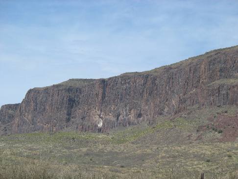
The magma that formed these rocks either flowed out or was blasted out of two main volcanic centers, one south of Ft Davis the other north west of Ft Davis.
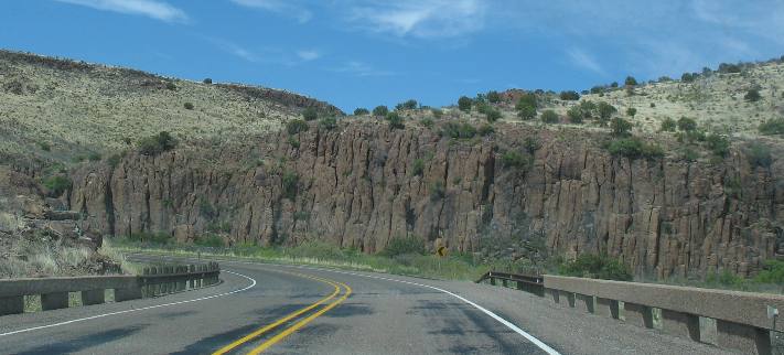
Columnar jointed basalt formed from old lava flow
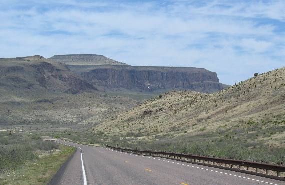
Some of these 37-million year old lava flows are nearly 1,000 feet thick.
Columnar jointed basalt formed from ancient lava flow
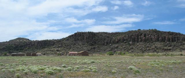
Columnar-jointed lava flow caps mesa between Balmorhea and Ft Davis.
Columnar jointed basalt in ancient lava flow
Close up of columnar-jointing lava flow.
Columnar jointed basalt from old lava flow
More columnar jointed basalt in old lava flow.
Columnar jointed basalt in old lava flow
More lava flow and even the untrained eye can recognize the columnar jointing.
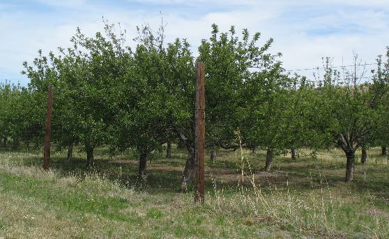
Nearing Fort Davis we pass through a old apple orchard.
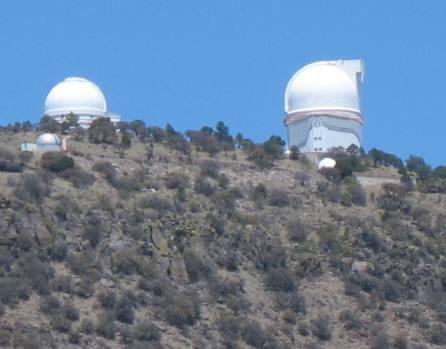
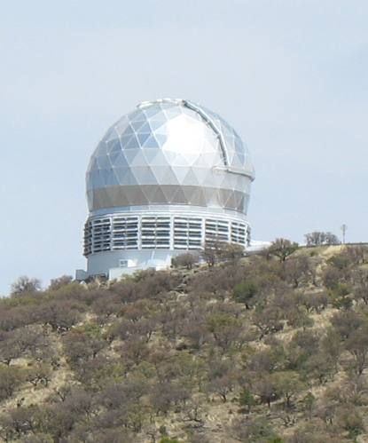
These two telescopes are part of the University of Texas's McDonald Observatory in the Davis Mountains. The large one on the right belongs to NASA.
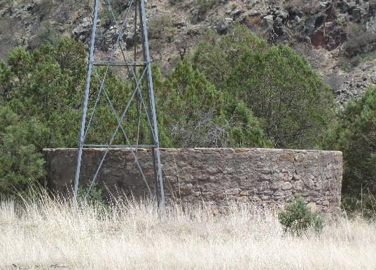
Deep in the mountains we ran across this windmill and stock tank servicing a thriving cattle industry.
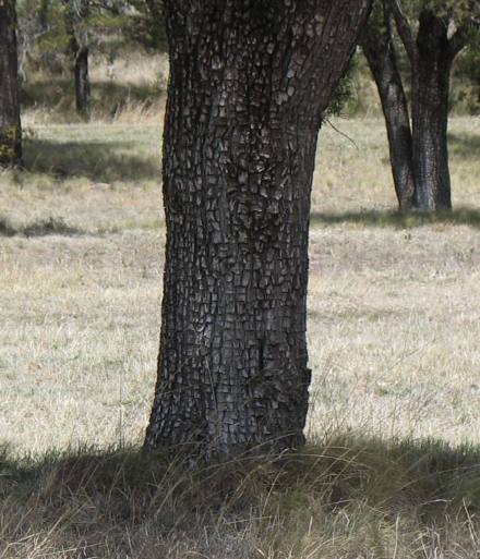
This is an alligator juniper we photographed at a roadside park deep in the Davis Mountains.
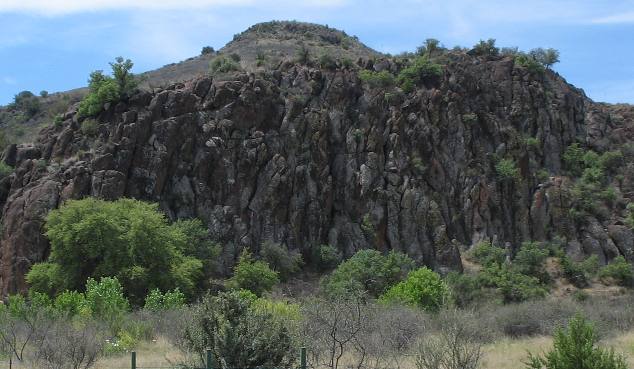
Old Fort Davis flanked by 36-million year old rhyolite ash flow tuff with well-developed columnar jointing. These parallel columns formed as lava contracted as it crystallized.
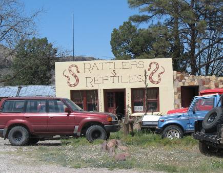
I visited this place one time 6-years ago when we spent a few days in the area. This fellows place is on the north side of Ft Davis and he does have a good collection of reptiles, rattlers in particular.
Until next time
remember how good life is. Mike & Joyce Hendrix
More Texas AdventuresPlants Trees and Flowers ** More 2007 Travel Adventures
Mike & Joyce Hendrix
Mike & Joyce Hendrix who we are We hope you liked this page. If you do you might be interested in some of our other Travel Adventures: Mike & Joyce Hendrix's home page Travel Adventures by Year ** Travel Adventures by State ** Plants ** Marine-Boats ** Geology ** Exciting Drives ** Cute Signs ** RV Subjects ** Miscellaneous Subjects
We would love to hear from you......just put "info" in the place of "FAKE" in this address: FAKE@travellogs.us Until next time remember how good life is.
|
| ||
|
| |||
|
| |||
|
|