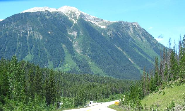
PH 93 from Radium Hot Springs to BanffMt Rundle & traveling PH 93 from Radium Hot Springs to BanffJuly 7, 2007. We are staying in the Tunnel Mountain National Park Campground in Banff, Alberta. Tunnel Mountain Campground offers no hookups, electricity only and full hookups. We are in one of the $29.70 electricity only sites. I do not know what FHU or no hookups cost but they are all in the same area. All sites are paved. View traveling PH 93 from Radium Hot Springs to Banff
We are driving PH 93 from Radium Hot Springs to Banff and starting this travelogue just west of the Continental Divide but looking east into Alberta.
Snow avalanches and rock slides cut a path through trees and other vegetation as they both make their way to the bottom. You can clearly see where rock slides and avalanches have made paths down this mountain.
Traveling PH 93 from Radium Hot Springs to Banff
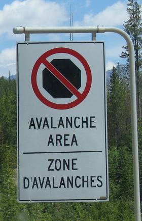
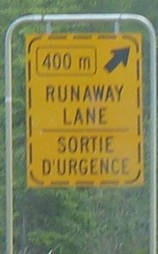
Even without this sign it is fairly easy to see the avalanche area.
View traveling PH 93 from Radium Hot Springs to Banff
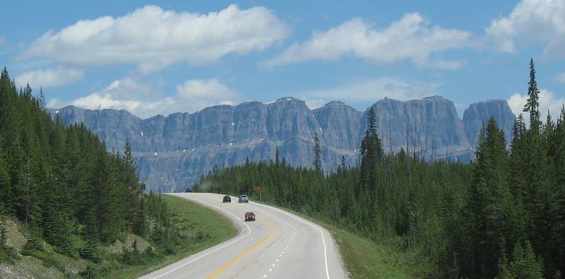
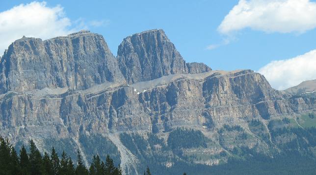
This sheer limestone/shale cliff was carved by ancient glaciers.
Rivers carve V shaped valleys while glaciers carve U shaped valleys. Take note that the sedimentary levels are level. That is normal in the Main Range of the Rocky Mountains. The Front Range will feature highly tilted sedimentary levels.
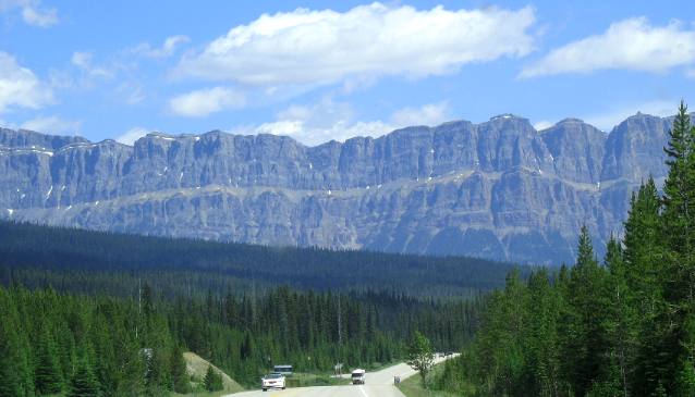
View traveling PH 93 from Radium Hot Springs to Banff
In this section there appears to be only a small amount of tilting. Here the sedimentary rocks appear to be laying almost flat.
Crossing the Continental Divide on PH 93 between Radium Hot Springs & Banff
We are crossing over the Continental Divide and entering Alberta.
Again these sedimentary rocks are laying almost flat.
Traveling PH 93 from Radium Hot Springs to Banff
We can't pay exclusive attention to the scenery, this road demands a little attention also.
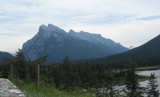
Mt. Rundle north of Banff, Alberta
We stopped just north of Banff to get a picture of this huge tilted landscape. At one time that mountain was on the bottom of a sea floor. Then over hundreds of millions of years two plates within the earth collided, with one plate rising over the other. This is where one of the colliding plates was forced over the other plate until is was almost vertical.
This is what is know as the front range of the Rockies, the particular formation is Mt. Rundle. Front Ranges like this were deformed as older rock layers rode up over younger ones like roof shingles slanting crazily up to the east. The rock layer at the bottom of this formation bear fossil evidence of having had their beginnings in the bottom of an ancient sea between 365 and 320 million years ago. Some of the rocks on the top are only 150 million years old. Beginning about 175 million years ago and continuing for 130 million years, North America drifted westward, colliding with chains of islands moving toward it from the Pacific. The collision caused the horizontal rock layers to slowly crumple into huge, accordion-like folds, and fracture into great slabs that stacked upward and eastward like shingles on a roof. By 60 million years ago the ancient seabed had been thrust into high mountains. This explains why you might find fossils of ancient sea creatures on the top of Mount Rundle! Before all this took place sediments from the mainland and the remains of sea creatures and corals accumulated in massive layers on the seabed and hardened into rock.
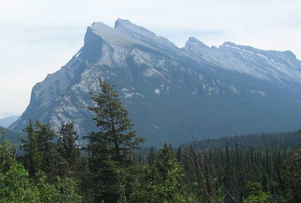
Mt Rundle on the Front Range of the Rockies north of Banff Alberta
From the other side you can clearly see the layers of sediment comprising Mt. Rundle. Layers upon layers of limestone and shale make up the entire mountain. Can you imagine the earth quakes that must have shook this region for 130 million years as tremendous forces caused the earth to crack and move skyward like this.
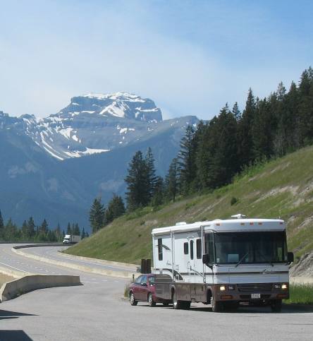
View from pullout north of Banff
This is our motorhome and Saturn in a pull out just north of Banff.
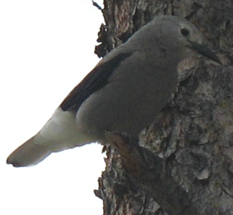
Clarks nut cracker
This is the Clarks Nut Cracker a blue jay sized bird that is named for William Clark of Lewis and Clark fame. Clark described this bird in one of his journals from the famous journey.
Traveling PH 93 from Radium Hot Springs to Banff across the continental divide and past Mt Rundle is one of those bucket list items that everyone should experience.
Click here for more Canada travellogsUntil next time remember how good life is.
More Canada AdventuresPlants Trees and Flowers ** More 2007 Travel Adventures
Mike & Joyce Hendrix
Mike & Joyce Hendrix who we are We hope you liked this page. If you do you might be interested in some of our other Travel Adventures: Mike & Joyce Hendrix's home page Travel Adventures by Year ** Travel Adventures by State ** Plants ** Marine-Boats ** Geology ** Exciting Drives ** Cute Signs ** RV Subjects ** Miscellaneous Subjects
We would love to hear from you......just put "info" in the place of "FAKE" in this address: FAKE@travellogs.us Until next time remember how good life is.
|
| ||
|
| |||
|
| |||
|
|